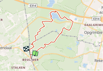
![](/images/other/stat-length.png)
![Tocht Stappen Zutendaal - 2021-10-22_20h10m45_1021 - Photo](https://media.geolcdn.com/t/1900/400/ext.pjpeg?maxdim=2&url=https%3A%2F%2Fstatic1.geolcdn.com%2Fsiteimages%2Fupload%2Ffiles%2F1553511878bg_sport_marche.png)
2021-10-22_20h10m45_1021
mumu.larandonneuse
Gebruiker GUIDE
![Lengte](/images/other/stat-length.png)
![Max. hoogte](https://static1.geolcdn.com/siteimages/upload/files/1508320355ic_sort_altitude_max_24dp.png)
![Positief hoogteverschil](https://static1.geolcdn.com/siteimages/upload/files/1508320355ic_sort_den_pos_24dp.png)
![Km-Effort](/images/other/stat-length.png)
![Min. hoogte](https://static1.geolcdn.com/siteimages/upload/files/1508320355ic_sort_altitude_min_24dp.png)
![Negatief hoogteverschil](https://static1.geolcdn.com/siteimages/upload/files/1508320355ic_sort_den_neg_24dp.png)
![Boucle](https://static1.geolcdn.com/siteimages/upload/files/16400158638029165_repeat_loop_refresh_sync_direction_icon.png)
![Stappen](https://static1.geolcdn.com/sitytour/trail-icons/101.png)
3h46
Moeilijkheid : Gemakkelijk
![Scan deze QR-code om de tocht te openen in de SityTrail-applicatie](https://capi.geolives.com/qq0zvz2zws4bq2lad0pu/sitytour/trails/2978832/qr.png?size=200)
Gratisgps-wandelapplicatie
Over ons
Tocht Stappen van 14,7 km beschikbaar op Vlaanderen, Limburg, Zutendaal. Deze tocht wordt voorgesteld door mumu.larandonneuse.
Beschrijving
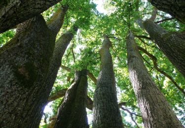
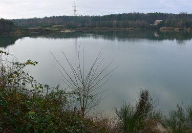
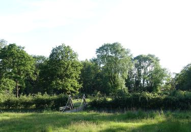
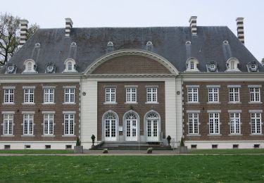
Au cours de cette promenade légèrement vallonnée, vous traversez la forêt et la lande jusqu'à un point de vue avec un banc, d'où vous avez une belle vue sur la lande de Neerharense. Ensuite, vous longez le domaine royal Fridhem Opgrimbie jusqu'à la belle vallée du Kikbeekbron. Ici, vous marchez pendant un certain temps le long d'un beau marais et après 9,3 km, vous arrivez à une aire de pique-nique avec des rochers. Ensuite, vous vous promenez à travers les bois et les landes jusqu'au café avec terrasse où vous pourrez profiter d'une belle récompense.
ℹ www.wandelgidszuidlimburg.com n° 1021.
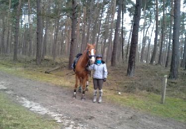
Plaatsbepaling
Opmerkingen
Wandeltochten in de omgeving
![Tocht Paardrijden Lanaken - lanaken ter biessen - Photo](https://media.geolcdn.com/t/375/260/ext.jpg?maxdim=2&url=https%3A%2F%2Fservices.sitytrail.com%2FGeolivesWS%2FDownloadMedia.ashx%3FTrailID%3D390608%26Media%3Dfix__20150227131053.jpg)
![Paardrijden Paardrijden](https://static1.geolcdn.com/sitytour/trail-icons/301.png)
Paardrijden
![](/images/other/stat-length.png)
![](https://static1.geolcdn.com/siteimages/upload/files/16400158638029165_repeat_loop_refresh_sync_direction_icon.png)
![Tocht Stappen Zutendaal - Promenade de Papendaalheide - Photo](https://media.geolcdn.com/t/375/260/4e56217a-c7d6-4b98-8c3a-5cd7f84ac60f.jpg&format=jpg&maxdim=2)
![Stappen Stappen](https://static1.geolcdn.com/sitytour/trail-icons/101.png)
Stappen
![](/images/other/stat-length.png)
![](https://static1.geolcdn.com/siteimages/upload/files/16400158638029165_repeat_loop_refresh_sync_direction_icon.png)
![Tocht Te voet Lanaken - Pietersheim Rode driehoek - Photo](https://media.geolcdn.com/t/375/260/9816eec6-c3b6-47ed-b64d-04ff8da432ee.jpeg&format=jpg&maxdim=2)
![Te voet Te voet](https://static1.geolcdn.com/sitytour/trail-icons/100.png)
Te voet
![](/images/other/stat-length.png)
![](https://static1.geolcdn.com/siteimages/upload/files/16400158638029165_repeat_loop_refresh_sync_direction_icon.png)
![Tocht Te voet Lanaken - La Butte aux Bois Paarse trapezium - Photo](https://media.geolcdn.com/t/375/260/008f39de-a80a-4e12-81c2-a391e947623e.jpeg&format=jpg&maxdim=2)
![Te voet Te voet](https://static1.geolcdn.com/sitytour/trail-icons/100.png)
Te voet
![](/images/other/stat-length.png)
![](https://static1.geolcdn.com/siteimages/upload/files/16400158638029165_repeat_loop_refresh_sync_direction_icon.png)
![Tocht Te voet Lanaken - Pietersheim Blauwe ruit - Photo](https://media.geolcdn.com/t/375/260/9816eec6-c3b6-47ed-b64d-04ff8da432ee.jpeg&format=jpg&maxdim=2)
![Te voet Te voet](https://static1.geolcdn.com/sitytour/trail-icons/100.png)
Te voet
![](/images/other/stat-length.png)
![](https://static1.geolcdn.com/siteimages/upload/files/16400158638029165_repeat_loop_refresh_sync_direction_icon.png)
![Tocht Te voet Zutendaal - Papendaalheide Groene rechthoek - Photo](https://media.geolcdn.com/t/375/260/61aba794-7888-4dc3-bb68-e186310dacfe.jpeg&format=jpg&maxdim=2)
![Te voet Te voet](https://static1.geolcdn.com/sitytour/trail-icons/100.png)
Te voet
![](/images/other/stat-length.png)
![](https://static1.geolcdn.com/siteimages/upload/files/16400158638029165_repeat_loop_refresh_sync_direction_icon.png)
![Tocht Te voet Zutendaal - Lieteberg - Papendaalheide Rode driehoek - Photo](https://media.geolcdn.com/t/375/260/4351c275-94e5-4a21-8486-701fab6129e8.jpeg&format=jpg&maxdim=2)
![Te voet Te voet](https://static1.geolcdn.com/sitytour/trail-icons/100.png)
Te voet
![](/images/other/stat-length.png)
![](https://static1.geolcdn.com/siteimages/upload/files/16400158638029165_repeat_loop_refresh_sync_direction_icon.png)
![Tocht Te voet Lanaken - Pietersheim Groene rechthoek - Photo](https://media.geolcdn.com/t/375/260/423127ca-2680-47e9-b06e-390ba56df230.jpeg&format=jpg&maxdim=2)
![Te voet Te voet](https://static1.geolcdn.com/sitytour/trail-icons/100.png)
Te voet
![](/images/other/stat-length.png)
![](https://static1.geolcdn.com/siteimages/upload/files/16400158638029165_repeat_loop_refresh_sync_direction_icon.png)
![Tocht Te voet Bilzen - Hoefaert Rode driehoek - Photo](https://media.geolcdn.com/t/375/260/5b2ce394-fffe-4e26-87f6-f3ba328634d3.jpeg&format=jpg&maxdim=2)
![Te voet Te voet](https://static1.geolcdn.com/sitytour/trail-icons/100.png)
Te voet
![](/images/other/stat-length.png)
![](https://static1.geolcdn.com/siteimages/upload/files/16400158638029165_repeat_loop_refresh_sync_direction_icon.png)
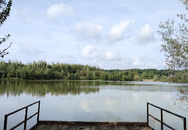
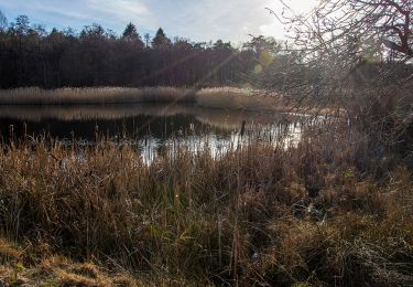
Superbe parcours 100% nature.