


13,1 km | 18,6 km-effort

Gebruiker


Gratisgps-wandelapplicatie
 SityTrail
IGN / Geografische instituten
SityTrail World
De wereld gaat voor u open
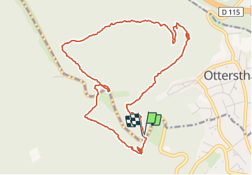
Tocht Stappen van 5,7 km beschikbaar op Grand Est, Bas-Rhin, Ottersthal. Deze tocht wordt voorgesteld door helmut68.
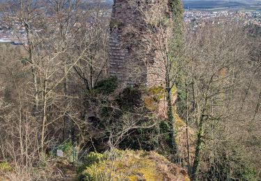
Courte mais riche , cette balade permet de découvrir quelques grottes et rochers remarquables, comme celui du saut du Prince-Charles qui abritait un sanctuaire au Moyen Âge et du sommet duquel le prince sauta pour échapper à ses poursuivants ...
Départ du parking du jardin botanique , prenez le chemin balisé " anneau bleu " et rejoignez la chapelle St Barbe ou une belle vue de Saverne et Monswiller vous attend. Ensuite reprenez le balisage " anneau bleu " ( derrière la chapelle)
pour passer devant le rocher Gustave Orth , le conturner par la gauche et grimper vers le plateau sans cesser de suivre " l'anneau bleu " afin de déboucher sur un large chemin menant à l'ancienne auberge du saut du Prince Charles. Puis sur votre droite empruntez le balisage " disque jaune " jusqu'à la fontaine d' Alsace . Ensuite traversez la RD1004 pour s'engager sur la route forestière des Pandours . Après environ 300 m suivez , sur votre gauche , le balisage " rectangle rouge " du GR 53 qui vous mènera jusqu'au rocher et grotte du Prince-Charles. A gauche du rocher un escalier vous mènera sur une plateforme avec un beau point de vue. Ensuite un sentier vous reconduira à votre point de départ en passant devant l'entrée du jardin botanique.
Alors à vous chaussures !


Mountainbike
Stappen
Te voet
Te voet

Te voet
Te voet
Te voet
Te voet
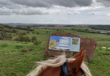
Paardrijden