11,3 km | 26 km-effort
ma
olivierGPS
Gebruiker
Lengte
10,6 km
Max. hoogte
1525 m
Positief hoogteverschil
1655 m
Km-Effort
33 km
Min. hoogte
449 m
Negatief hoogteverschil
1662 m
Boucle
Ja
Datum van aanmaak :
2021-10-11 05:51:32.289
Laatste wijziging :
2021-10-11 10:16:04.949
4h24
Moeilijkheid : Zeer moeilijk
Gratisgps-wandelapplicatie
Over ons
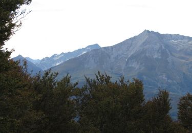
Tocht Stappen van 10,6 km beschikbaar op Nieuw-Aquitanië, Pyrénées-Atlantiques, Arthez-d'Asson. Deze tocht wordt voorgesteld door olivierGPS.
Plaatsbepaling
Land:
France
Regio :
Nieuw-Aquitanië
Departement/Provincie :
Pyrénées-Atlantiques
Gemeente :
Arthez-d'Asson
Locatie:
Unknown
Vertrek:(Dec)
Vertrek:(UTM)
722831 ; 4771943 (30T) N.
Opmerkingen
Wandeltochten in de omgeving
Le Pic du Monbula - Arthez d'Asson
Stappen
Moeilijk
Asson,
Nieuw-Aquitanië,
Pyrénées-Atlantiques,
France
6h 30min
Ja
Pic du Pas de Broc (1371m) et pic du Merdanson (1540m)
Stappen
Zeer moeilijk
Louvie-Juzon,
Nieuw-Aquitanië,
Pyrénées-Atlantiques,
France
13,6 km | 28 km-effort
6h 16min
Ja
Les toupiettes cabanne d’Isarce
Stappen
Moeilijk
Asson,
Nieuw-Aquitanië,
Pyrénées-Atlantiques,
France
12,5 km | 25 km-effort
3h 59min
Ja
ASSON Cabane de l'isarce G2A -857D+ 459/1313m
Stappen
Moeilijk
Asson,
Nieuw-Aquitanië,
Pyrénées-Atlantiques,
France
10,4 km | 22 km-effort
3h 45min
Ja
Plateau de l'Isarce
Stappen
Moeilijk
Asson,
Nieuw-Aquitanië,
Pyrénées-Atlantiques,
France
9,9 km | 21 km-effort
6h 6min
Ja
Trace Arthez Isou G3 Guy
sport
Heel gemakkelijk
Arthez-d'Asson,
Nieuw-Aquitanië,
Pyrénées-Atlantiques,
France
10,5 km | 17,7 km-effort
Onbekend
Neen
Col nana ils
sport
Heel gemakkelijk
Asson,
Nieuw-Aquitanië,
Pyrénées-Atlantiques,
France
10,5 km | 19,9 km-effort
Onbekend
Ja
MERDANSON DURBAN 11 AVRIL 2024
Stappen
Zeer moeilijk
Louvie-Juzon,
Nieuw-Aquitanië,
Pyrénées-Atlantiques,
France
15,7 km | 34 km-effort
8h 15min
Ja
Trace Isarce Toupiettes
Stappen
Asson,
Nieuw-Aquitanië,
Pyrénées-Atlantiques,
France
11,8 km | 24 km-effort
4h 13min
Ja