![](/images/other/stat-length.png)
![Tocht Stappen Miravet - Miravet alentours et Château - Photo](https://media.geolcdn.com/t/1900/400/570c2b69-2fca-4714-941b-767dcfac1f79.jpg&format=pjpeg&maxdim=2)
Miravet alentours et Château
jll7513
Gebruiker
![Lengte](/images/other/stat-length.png)
![Max. hoogte](https://static1.geolcdn.com/siteimages/upload/files/1508320355ic_sort_altitude_max_24dp.png)
![Positief hoogteverschil](https://static1.geolcdn.com/siteimages/upload/files/1508320355ic_sort_den_pos_24dp.png)
![Km-Effort](/images/other/stat-length.png)
![Min. hoogte](https://static1.geolcdn.com/siteimages/upload/files/1508320355ic_sort_altitude_min_24dp.png)
![Negatief hoogteverschil](https://static1.geolcdn.com/siteimages/upload/files/1508320355ic_sort_den_neg_24dp.png)
![Boucle](https://static1.geolcdn.com/siteimages/upload/files/16400158638029165_repeat_loop_refresh_sync_direction_icon.png)
![Stappen](https://static1.geolcdn.com/sitytour/trail-icons/101.png)
2h34
Moeilijkheid : Gemakkelijk
![Scan deze QR-code om de tocht te openen in de SityTrail-applicatie](https://capi.geolives.com/qq0zvz2zws4bq2lad0pu/sitytour/trails/2960302/qr.png?size=200)
Gratisgps-wandelapplicatie
Over ons
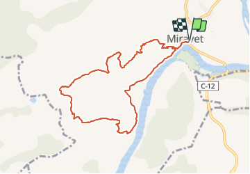
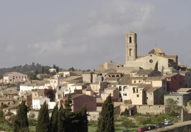
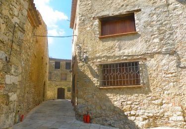
Tocht Stappen van 10,4 km beschikbaar op Catalonië, Tarragona, Miravet. Deze tocht wordt voorgesteld door jll7513.
Beschrijving
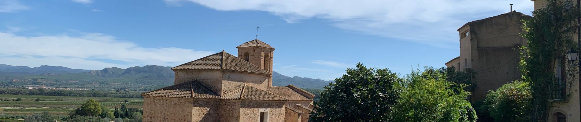
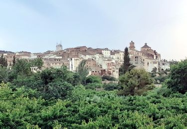
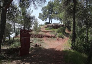
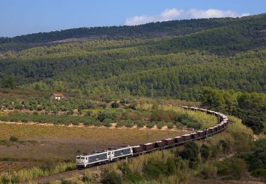
Déjà pour accéder au village de Miravet il y a possibilité de traverser l'Ebre avec un petit bac qui ne contient qu'une voiture. Quand on a un peu de temps vraiment à faire. Le début de la randonnée est très belle avec le cheminement sur les bords de l'Ebre. Ensuite monter assez sérieuse mais relativement ombragée, on est dans une petite forêt. La partie centrale de la randonnée est assez particulière, puisque l'on se trouve au milieu d'exploitations agricoles (olives) et sur des chemins qui ont été soit bétonnés soit goudronnés. Très belle vue à la descente sur la plaine de l'Ebre et le château de Miravet. En profiter pour le visiter, c'est intéressant puisqu'il s'agit de la commanderie des Templiers pour tout le bassin méditerranéen.
Plaatsbepaling
Opmerkingen
Wandeltochten in de omgeving
![Tocht Te voet Tivissa - Jardí conreat. Tivissa - Photo](https://media.geolcdn.com/t/375/260/e5563592-0a82-4ce7-9b36-03333e6003cc.jpeg&format=jpg&maxdim=2)
![Te voet Te voet](https://static1.geolcdn.com/sitytour/trail-icons/100.png)
Te voet
![](/images/other/stat-length.png)
![](https://static1.geolcdn.com/siteimages/upload/files/16400158638029165_repeat_loop_refresh_sync_direction_icon.png)
![Tocht Te voet Tivissa - El morral de les Moles - Photo](https://media.geolcdn.com/t/375/260/11bbe290-5485-41dd-8209-c35ec00b30f7.jpeg&format=jpg&maxdim=2)
![Te voet Te voet](https://static1.geolcdn.com/sitytour/trail-icons/100.png)
Te voet
![](/images/other/stat-length.png)
![](https://static1.geolcdn.com/siteimages/upload/files/16400158638029165_repeat_loop_refresh_sync_direction_icon.png)
![Tocht Te voet Capçanes - Capçanes. Ruta de la Pedra seca - Photo](https://media.geolcdn.com/t/375/260/af2ca7a0-e075-4cbc-9b7f-40e1410e2c6a.jpeg&format=jpg&maxdim=2)
![Te voet Te voet](https://static1.geolcdn.com/sitytour/trail-icons/100.png)
Te voet
![](/images/other/stat-length.png)
![](https://static1.geolcdn.com/siteimages/upload/files/16400158638029165_repeat_loop_refresh_sync_direction_icon.png)
![Tocht Te voet el Masroig - Rere la petjada d'antics pobladors - Photo](https://media.geolcdn.com/t/375/260/98703c27-c17b-4b5e-a2c0-20e420221964.jpeg&format=jpg&maxdim=2)
![Te voet Te voet](https://static1.geolcdn.com/sitytour/trail-icons/100.png)
Te voet
![](/images/other/stat-length.png)
![](https://static1.geolcdn.com/siteimages/upload/files/16400158638029165_repeat_loop_refresh_sync_direction_icon.png)
![Tocht Te voet Marçà - Carrerada de les Taules. Marçà - Photo](https://media.geolcdn.com/t/375/260/2ef24d68-a21f-4e78-ac2f-5d2db647d0ad.jpeg&format=jpg&maxdim=2)
![Te voet Te voet](https://static1.geolcdn.com/sitytour/trail-icons/100.png)
Te voet
![](/images/other/stat-length.png)
![](https://static1.geolcdn.com/siteimages/upload/files/16400158638029165_repeat_loop_refresh_sync_direction_icon.png)
![Tocht Te voet Marçà - Marçà-Capçanes-Marcà. Dos mon en un de sol - Photo](https://media.geolcdn.com/t/375/260/1a0e5b8c-31cf-42dd-aa1b-191bb3369d15.jpeg&format=jpg&maxdim=2)
![Te voet Te voet](https://static1.geolcdn.com/sitytour/trail-icons/100.png)
Te voet
![](/images/other/stat-length.png)
![](https://static1.geolcdn.com/siteimages/upload/files/16400158638029165_repeat_loop_refresh_sync_direction_icon.png)
![Tocht Te voet la Figuera - La Figuera - Photo](https://media.geolcdn.com/t/375/260/45075f1c-30a7-43d9-b0f9-10f1a60b0fb8.jpeg&format=jpg&maxdim=2)
![Te voet Te voet](https://static1.geolcdn.com/sitytour/trail-icons/100.png)
Te voet
![](/images/other/stat-length.png)
![](https://static1.geolcdn.com/siteimages/upload/files/16400158638029165_repeat_loop_refresh_sync_direction_icon.png)
![Tocht Te voet Capçanes - Capçanes. Seguint els passos del guerrillers Carrasclet - Photo](https://media.geolcdn.com/t/375/260/c4ebbfbd-122d-4245-94c8-5731b07c321a.jpeg&format=jpg&maxdim=2)
![Te voet Te voet](https://static1.geolcdn.com/sitytour/trail-icons/100.png)
Te voet
![](/images/other/stat-length.png)
![](https://static1.geolcdn.com/siteimages/upload/files/16400158638029165_repeat_loop_refresh_sync_direction_icon.png)
![Tocht Te voet Falset - Falset. Els batecs del vi - Photo](https://media.geolcdn.com/t/375/260/2f1f71d2-8915-49c5-8ea6-1e49761326a7.jpeg&format=jpg&maxdim=2)
![Te voet Te voet](https://static1.geolcdn.com/sitytour/trail-icons/100.png)
Te voet
![](/images/other/stat-length.png)
![](https://static1.geolcdn.com/siteimages/upload/files/16400158638029165_repeat_loop_refresh_sync_direction_icon.png)