


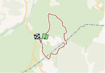

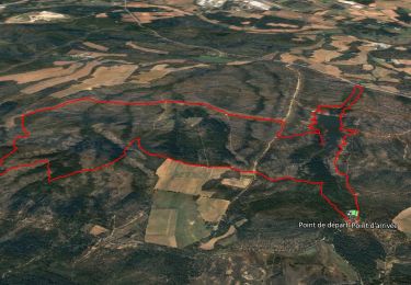
8,3 km | 9,3 km-effort

Gebruiker


Gratisgps-wandelapplicatie
 SityTrail
IGN / Geografische instituten
SityTrail World
De wereld gaat voor u open
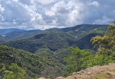
Tocht Stappen van 6,5 km beschikbaar op Provence-Alpes-Côte d'Azur, Var, Vidauban. Deze tocht wordt voorgesteld door Chantheys.
Départ à déplacer. Arriver par la D48 et emprunter le Chemin de la Moure et se garer presque aussitôt, juste après l'enclos des poubelles.


Stappen

Stappen
Stappen
Stappen
Stappen

Stappen
Wegfiets

Stappen
Stappen