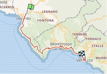
![](/images/other/stat-length.png)
![Tocht Te voet Levanto - sejour-cinque-terre-journee-2-levanto-vernazza - Photo](https://media.geolcdn.com/t/1900/400/3f2e0a3d-9aaf-4a9d-8677-4481d4ba0aac.jpg&format=pjpeg&maxdim=2)
sejour-cinque-terre-journee-2-levanto-vernazza
chessyca
Gebruiker GUIDE
![Lengte](/images/other/stat-length.png)
![Max. hoogte](https://static1.geolcdn.com/siteimages/upload/files/1508320355ic_sort_altitude_max_24dp.png)
![Positief hoogteverschil](https://static1.geolcdn.com/siteimages/upload/files/1508320355ic_sort_den_pos_24dp.png)
![Km-Effort](/images/other/stat-length.png)
![Min. hoogte](https://static1.geolcdn.com/siteimages/upload/files/1508320355ic_sort_altitude_min_24dp.png)
![Negatief hoogteverschil](https://static1.geolcdn.com/siteimages/upload/files/1508320355ic_sort_den_neg_24dp.png)
![Boucle](https://static1.geolcdn.com/siteimages/upload/files/16400158638029165_repeat_loop_refresh_sync_direction_icon.png)
![Te voet](https://static1.geolcdn.com/sitytour/trail-icons/100.png)
--
Moeilijkheid : Medium
![Scan deze QR-code om de tocht te openen in de SityTrail-applicatie](https://capi.geolives.com/qq0zvz2zws4bq2lad0pu/sitytour/trails/2951876/qr.png?size=200)
Gratisgps-wandelapplicatie
Over ons
Tocht Te voet van 27 km beschikbaar op Ligurië, La Spezia, Levanto. Deze tocht wordt voorgesteld door chessyca.
Beschrijving
Les cinque terre et le golf des poètes par Chemins du sud
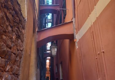
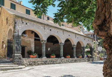
Deuxième jour du séjour cinque terre avec la découverte des deux premiers villages : Montessoro et Vernazza.
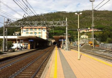
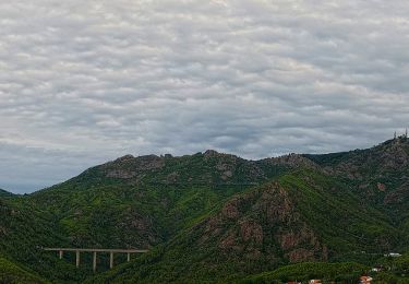
Train de Moneglia à Levanto
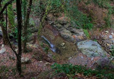
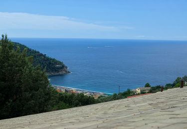
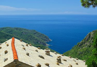
Une partie de la rando payante (dans le parc des cinq terres ) mais incontournable
Pas de difficultés majeures à signaler -
Plaatsbepaling
Opmerkingen
Wandeltochten in de omgeving
![Tocht Stappen Levanto - Levanto - Vernazza 6.5.23 - Photo](https://media.geolcdn.com/t/375/260/0287dcd3-7795-4c8b-8f35-962c00e797c3.jpg&format=jpg&maxdim=2)
![Stappen Stappen](https://static1.geolcdn.com/sitytour/trail-icons/101.png)
Stappen
![](/images/other/stat-length.png)
![](https://static1.geolcdn.com/siteimages/upload/files/16400158638029165_repeat_loop_refresh_sync_direction_icon.png)
![Tocht Te voet Levanto - Alta Via delle 5 Terre: Foce di Dosso - Monte San Nicolao - Passo del Biscia - Photo](https://media.geolcdn.com/t/375/260/b0c8ac09-74d2-479f-a320-56bfabb8d7cd.jpeg&format=jpg&maxdim=2)
![Te voet Te voet](https://static1.geolcdn.com/sitytour/trail-icons/100.png)
Te voet
![](/images/other/stat-length.png)
![](https://static1.geolcdn.com/siteimages/upload/files/16400158638029165_repeat_loop_refresh_sync_direction_icon.png)
![Tocht Te voet Levanto - Vallesanta - Monte delle Streghe - Colletto - Photo](https://media.geolcdn.com/t/375/260/efa63fd2-8e4e-4cf6-bbf2-2f4e4541a575.jpeg&format=jpg&maxdim=2)
![Te voet Te voet](https://static1.geolcdn.com/sitytour/trail-icons/100.png)
Te voet
![](/images/other/stat-length.png)
![](https://static1.geolcdn.com/siteimages/upload/files/16400158638029165_repeat_loop_refresh_sync_direction_icon.png)
![Tocht Te voet Bonassola - Reggimonti - Monte Gaggi - S.P. 64 - Monte Grumo - Photo](https://media.geolcdn.com/t/375/260/53b7c24f-114d-496d-8324-7d9132d796d3.jpeg&format=jpg&maxdim=2)
![Te voet Te voet](https://static1.geolcdn.com/sitytour/trail-icons/100.png)
Te voet
![](/images/other/stat-length.png)
![](https://static1.geolcdn.com/siteimages/upload/files/16400158638029165_repeat_loop_refresh_sync_direction_icon.png)
![Tocht Te voet Bonassola - Bonassola - Salto della Lepre - Pastorelli - Montaretto - Photo](https://media.geolcdn.com/t/375/260/a7cea6e7-bc07-4258-9020-ad0c6abe0784.jpeg&format=jpg&maxdim=2)
![Te voet Te voet](https://static1.geolcdn.com/sitytour/trail-icons/100.png)
Te voet
![](/images/other/stat-length.png)
![](https://static1.geolcdn.com/siteimages/upload/files/16400158638029165_repeat_loop_refresh_sync_direction_icon.png)
![Tocht Te voet Framura - Vandarecca - Montaretto - Reggimonti – Bivio AV5T - Photo](https://media.geolcdn.com/t/375/260/433b5181-ce40-4552-b8f8-d309475f0ca2.jpeg&format=jpg&maxdim=2)
![Te voet Te voet](https://static1.geolcdn.com/sitytour/trail-icons/100.png)
Te voet
![](/images/other/stat-length.png)
![](https://static1.geolcdn.com/siteimages/upload/files/16400158638029165_repeat_loop_refresh_sync_direction_icon.png)
![Tocht Te voet Framura - Framura (Setta) - Costa - Rovereto - Castagnola - Monte Sant'Agata - Photo](https://media.geolcdn.com/t/375/260/f566bb7c-3946-4951-b36b-20a42e298c78.jpeg&format=jpg&maxdim=2)
![Te voet Te voet](https://static1.geolcdn.com/sitytour/trail-icons/100.png)
Te voet
![](/images/other/stat-length.png)
![](https://static1.geolcdn.com/siteimages/upload/files/16400158638029165_repeat_loop_refresh_sync_direction_icon.png)
![Tocht Te voet Levanto - Il Termine – Mad.di Soviore – Colla di Gritta – S.Antonio al Mesco - Photo](https://media.geolcdn.com/t/375/260/7d93da1b-0b41-4fef-acc9-26fc84562262.jpeg&format=jpg&maxdim=2)
![Te voet Te voet](https://static1.geolcdn.com/sitytour/trail-icons/100.png)
Te voet
![](/images/other/stat-length.png)
![](https://static1.geolcdn.com/siteimages/upload/files/16400158638029165_repeat_loop_refresh_sync_direction_icon.png)
![Tocht Te voet Levanto - Levanto - Montale - Foce di Montale - Valle Carbonetta - Photo](https://media.geolcdn.com/t/375/260/f14c232d-65b5-4ec2-b169-eb236882792a.jpeg&format=jpg&maxdim=2)
![Te voet Te voet](https://static1.geolcdn.com/sitytour/trail-icons/100.png)
Te voet
![](/images/other/stat-length.png)
![](https://static1.geolcdn.com/siteimages/upload/files/16400158638029165_repeat_loop_refresh_sync_direction_icon.png)