Tocht Stappen Ax-les-Thermes - Le chemin de la Ramille - Photo

Le chemin de la Ramille

 c.chehere
c.chehere

Gebruiker

© OpenStreetMap contributors
Lengte
Lengte
8,2 km
Max. hoogte
Max. hoogte
960 m
Positief hoogteverschil
294 m
Km-Effort
Km-Effort  
12,2 km
Min. hoogte
Min. hoogte
717 m
Negatief hoogteverschil
294 m
Boucle
Boucle
Ja
Datum van aanmaak :
2021-09-22 05:57:04.231
Laatste wijziging :
2021-09-22 09:20:27.927

(0 Bericht)

Stappen
Stappen
3h02
Moeilijkheid : Gemakkelijk

Scan deze QR-code om de tocht te openen in de SityTrail-applicatie

Gratisgps-wandelapplicatie

Logo SityTrail SityTrail

IGN / Geografische instituten

SityTrail uit de App Store downloaden SityTrail uit Google Play downloaden

Logo SityTrail SityTrail World

De wereld gaat voor u open

SityTrail uit de App Store downloaden SityTrail uit Google Play downloaden SityTrail op Huawei AppGallery downloaden

Over ons

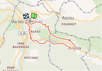
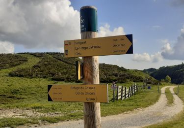
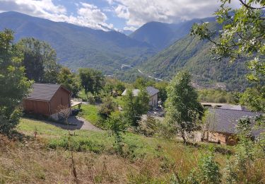
Tocht Stappen van 8,2 km beschikbaar op Occitanië, Ariège, Ax-les-Thermes. Deze tocht wordt voorgesteld door c.chehere.

Beschrijving

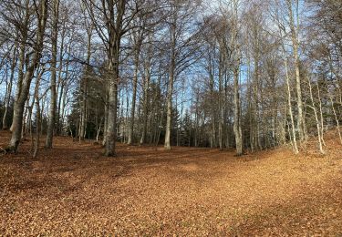
Très belle balade en partie balisée

Hoogteprofiel

Foto's

Plaatsbepaling

Land:
France
Regio :
Occitanië
Departement/Provincie :
Ariège
Gemeente :
Ax-les-Thermes
Locatie:
Unknown
Vertrek:(UTM)
405000 ; 4730259 (31T) N.

Wandeltochten in de omgeving

Tocht Stappen Perles-et-Castelet - cabane de Bistort Teoula et Mouscadou - Photo
Stappen
chrisgps

Stappen

Medium
(1)
Perles-et-Castelet, Occitanië, Ariège, France
12,3 km | 26 km-effort
6h 15min
Neen
Tocht Stappen Sorgeat - Chemin des Bonhommes - Sorgeat Merens - Photo
Stappen
tracegps

Stappen

Zeer moeilijk
(1)
Sorgeat, Occitanië, Ariège, France
21 km | 36 km-effort
8h 0min
Neen
Tocht Mountainbike Orlu - Orlu  Parking Aygue Longue - Photo
Mountainbike
GUIDE
harydh

Mountainbike

Medium
Orlu, Occitanië, Ariège, France
16,1 km | 24 km-effort
2h 51min
Ja
Tocht Stappen Ax-les-Thermes - Lac de Campauleil - Orgeix - Photo
Stappen
Oupia82

Stappen

Heel gemakkelijk
(1)
Ax-les-Thermes, Occitanië, Ariège, France
8,6 km | 11,2 km-effort
3h 3min
Ja
Tocht Stappen Ignaux - Chioula d - Photo
Stappen
GUIDE
antignacs

Stappen

Heel gemakkelijk
Ignaux, Occitanië, Ariège, France
15,1 km | 21 km-effort
3h 50min
Ja
Tocht Stappen Orlu - Le Fanguil - Photo
Stappen
c.chehere

Stappen

Medium
Orlu, Occitanië, Ariège, France
16,8 km | 23 km-effort
6h 59min
Ja
Tocht Stappen Prades - La Chioula Orlu GR107 le chemins des Bonshommes - Photo
Stappen
tercla

Stappen

Moeilijk
Prades, Occitanië, Ariège, France
18,7 km | 25 km-effort
6h 17min
Neen
Tocht Stappen Ax-les-Thermes - balade bleue au dessus d'Ax - Photo
Stappen
c.chehere

Stappen

Gemakkelijk
Ax-les-Thermes, Occitanië, Ariège, France
3,8 km | 6,1 km-effort
1h 22min
Ja
Tocht Stappen Ax-les-Thermes - Orgeix _ Ignaux - Photo
Stappen
c.chehere

Stappen

Medium
Ax-les-Thermes, Occitanië, Ariège, France
12,8 km | 19,1 km-effort
4h 12min
Ja


Sluiten
Mijn abonnementen