![](/images/other/stat-length.png)
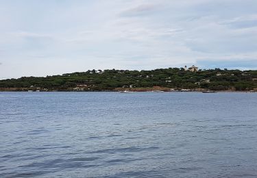
![Tocht Motorboot Saint-Tropez - Nalade St Tropez bateau - Photo](https://media.geolcdn.com/t/1900/400/254f135f-2379-4ae8-9362-6a2064aa074d.jpg&format=pjpeg&maxdim=2)
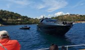
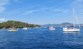
Nalade St Tropez bateau
Alain Lampertz
Gebruiker
![Lengte](/images/other/stat-length.png)
Lengte
18,2 km
![Max. hoogte](https://static1.geolcdn.com/siteimages/upload/files/1508320355ic_sort_altitude_max_24dp.png)
Max. hoogte
4 m
![Positief hoogteverschil](https://static1.geolcdn.com/siteimages/upload/files/1508320355ic_sort_den_pos_24dp.png)
Positief hoogteverschil
3 m
![Km-Effort](/images/other/stat-length.png)
Km-Effort
18,3 km
![Min. hoogte](https://static1.geolcdn.com/siteimages/upload/files/1508320355ic_sort_altitude_min_24dp.png)
Min. hoogte
0 m
![Negatief hoogteverschil](https://static1.geolcdn.com/siteimages/upload/files/1508320355ic_sort_den_neg_24dp.png)
Negatief hoogteverschil
3 m
![Boucle](https://static1.geolcdn.com/siteimages/upload/files/16400158638029165_repeat_loop_refresh_sync_direction_icon.png)
Boucle
Ja
Datum van aanmaak :
2021-09-12 09:39:25.595
Laatste wijziging :
2021-09-12 10:47:16.443
![Motorboot](https://static1.geolcdn.com/sitytour/trail-icons/701.png)
1h07
Moeilijkheid : Heel gemakkelijk
![Scan deze QR-code om de tocht te openen in de SityTrail-applicatie](https://capi.geolives.com/qq0zvz2zws4bq2lad0pu/sitytour/trails/2933761/qr.png?size=200)
Gratisgps-wandelapplicatie
Over ons
Tocht Motorboot van 18,2 km beschikbaar op Provence-Alpes-Côte d'Azur, Var, Saint-Tropez. Deze tocht wordt voorgesteld door Alain Lampertz.
Beschrijving
Bateau
Plaatsbepaling
Land:
France
Regio :
Provence-Alpes-Côte d'Azur
Departement/Provincie :
Var
Gemeente :
Saint-Tropez
Locatie:
Unknown
Vertrek:(Dec)
Vertrek:(UTM)
308348 ; 4793681 (32T) N.
Opmerkingen
Wandeltochten in de omgeving
![Tocht Stappen Saint-Tropez - PRESQU'ÎLE DE SAINT TROPEZ - Photo](https://media.geolcdn.com/t/375/260/8e598ed1-ea67-4611-be57-9e4f5043f112.jpg&format=jpg&maxdim=2)
![Stappen Stappen](https://static1.geolcdn.com/sitytour/trail-icons/101.png)
PRESQU'ÎLE DE SAINT TROPEZ
Stappen
Medium
(3)
Saint-Tropez,
Provence-Alpes-Côte d'Azur,
Var,
France
![](/images/other/stat-length.png)
12,2 km | 14,7 km-effort
5h 19min
![](https://static1.geolcdn.com/siteimages/upload/files/16400158638029165_repeat_loop_refresh_sync_direction_icon.png)
Ja
![Tocht Stappen Saint-Tropez - Saint Tropez - Photo](https://media.geolcdn.com/t/375/260/ext.jpg?maxdim=2&url=https%3A%2F%2Fservices.sitytrail.com%2FGeolivesWS%2FDownloadMedia.ashx%3FTrailID%3D636110%26Media%3Dfix__20160925112927.jpg)
![Stappen Stappen](https://static1.geolcdn.com/sitytour/trail-icons/101.png)
Saint Tropez
Stappen
Gemakkelijk
(1)
Saint-Tropez,
Provence-Alpes-Côte d'Azur,
Var,
France
![](/images/other/stat-length.png)
11,7 km | 13,7 km-effort
4h 19min
![](https://static1.geolcdn.com/siteimages/upload/files/16400158638029165_repeat_loop_refresh_sync_direction_icon.png)
Neen
![Tocht Stappen Ramatuelle - chemin du littoral : Pampelone St Tropez - Photo](https://media.geolcdn.com/t/375/260/ext.jpg?maxdim=2&url=https%3A%2F%2Fservices.sitytrail.com%2FGeolivesWS%2FDownloadMedia.ashx%3FTrailID%3D200480%26Media%3D20130625091922.jpeg)
![Stappen Stappen](https://static1.geolcdn.com/sitytour/trail-icons/101.png)
chemin du littoral : Pampelone St Tropez
Stappen
Gemakkelijk
(3)
Ramatuelle,
Provence-Alpes-Côte d'Azur,
Var,
France
![](/images/other/stat-length.png)
13,2 km | 15,6 km-effort
3h 20min
![](https://static1.geolcdn.com/siteimages/upload/files/16400158638029165_repeat_loop_refresh_sync_direction_icon.png)
Neen
![Tocht Stappen Saint-Tropez - Golfe de St Tropez - Photo](https://media.geolcdn.com/t/375/260/ext.jpg?maxdim=2&url=https%3A%2F%2Fservices.sitytrail.com%2FGeolivesWS%2FDownloadMedia.ashx%3FTrailID%3D107154%26Media%3D11997_5.jpg)
![Stappen Stappen](https://static1.geolcdn.com/sitytour/trail-icons/101.png)
Golfe de St Tropez
Stappen
Moeilijk
(2)
Saint-Tropez,
Provence-Alpes-Côte d'Azur,
Var,
France
![](/images/other/stat-length.png)
15,1 km | 17,6 km-effort
4h 30min
![](https://static1.geolcdn.com/siteimages/upload/files/16400158638029165_repeat_loop_refresh_sync_direction_icon.png)
Ja
![Tocht Stappen Saint-Tropez - St tropez calanque - Photo](https://media.geolcdn.com/t/375/260/3af67e6c-107d-484e-b13a-cf0edd584740.jpg&format=jpg&maxdim=2)
![Stappen Stappen](https://static1.geolcdn.com/sitytour/trail-icons/101.png)
St tropez calanque
Stappen
Medium
(1)
Saint-Tropez,
Provence-Alpes-Côte d'Azur,
Var,
France
![](/images/other/stat-length.png)
9,9 km | 11,4 km-effort
3h 52min
![](https://static1.geolcdn.com/siteimages/upload/files/16400158638029165_repeat_loop_refresh_sync_direction_icon.png)
Ja
![Tocht Mountainbike Ramatuelle - SityTrail - Ramatuelle - Ballade dans et autour de Ramatuelle - Moulin de Paillas - La roulliere - Photo](https://media.geolcdn.com/t/375/260/ext.jpg?maxdim=2&url=https%3A%2F%2Fstatic1.geolcdn.com%2Fsiteimages%2Fupload%2Ffiles%2F1524743154velo.jpg)
![Mountainbike Mountainbike](https://static1.geolcdn.com/sitytour/trail-icons/202.png)
SityTrail - Ramatuelle - Ballade dans et autour de Ramatuelle - Moulin de Pai...
Mountainbike
Medium
(1)
Ramatuelle,
Provence-Alpes-Côte d'Azur,
Var,
France
![](/images/other/stat-length.png)
23 km | 30 km-effort
2h 3min
![](https://static1.geolcdn.com/siteimages/upload/files/16400158638029165_repeat_loop_refresh_sync_direction_icon.png)
Ja
![Tocht Mountainbike Grimaud - VTT de Port -Grimaud - Photo](https://media.geolcdn.com/t/375/260/ext.jpg?maxdim=2&url=https%3A%2F%2Fservices.sitytrail.com%2FGeolivesWS%2FDownloadMedia.ashx%3FTrailID%3D795928%26Media%3Dd1a4096c-7e26-4780-acbc-fe0cf30ee0df.JPG)
![Mountainbike Mountainbike](https://static1.geolcdn.com/sitytour/trail-icons/202.png)
VTT de Port -Grimaud
Mountainbike
Medium
Grimaud,
Provence-Alpes-Côte d'Azur,
Var,
France
![](/images/other/stat-length.png)
21 km | 26 km-effort
1h 45min
![](https://static1.geolcdn.com/siteimages/upload/files/16400158638029165_repeat_loop_refresh_sync_direction_icon.png)
Ja
![Tocht Mountainbike Grimaud - VTT du Plan de la Tour - Photo](https://media.geolcdn.com/t/375/260/ext.jpg?maxdim=2&url=https%3A%2F%2Fservices.sitytrail.com%2FGeolivesWS%2FDownloadMedia.ashx%3FTrailID%3D787323%26Media%3D86ee6b79-1220-4d35-8e8c-b77bb4ae8c68.JPG)
![Mountainbike Mountainbike](https://static1.geolcdn.com/sitytour/trail-icons/202.png)
VTT du Plan de la Tour
Mountainbike
Moeilijk
(1)
Grimaud,
Provence-Alpes-Côte d'Azur,
Var,
France
![](/images/other/stat-length.png)
35 km | 46 km-effort
2h 59min
![](https://static1.geolcdn.com/siteimages/upload/files/16400158638029165_repeat_loop_refresh_sync_direction_icon.png)
Ja
![Tocht Mountainbike Gassin - La Nartelle- depart Bourrian - Photo](https://media.geolcdn.com/t/375/260/ext.jpg?maxdim=2&url=https%3A%2F%2Fstatic1.geolcdn.com%2Fsiteimages%2Fupload%2Ffiles%2F1524743154velo.jpg)
![Mountainbike Mountainbike](https://static1.geolcdn.com/sitytour/trail-icons/202.png)
La Nartelle- depart Bourrian
Mountainbike
Medium
(1)
Gassin,
Provence-Alpes-Côte d'Azur,
Var,
France
![](/images/other/stat-length.png)
24 km | 31 km-effort
3h 11min
![](https://static1.geolcdn.com/siteimages/upload/files/16400158638029165_repeat_loop_refresh_sync_direction_icon.png)
Ja