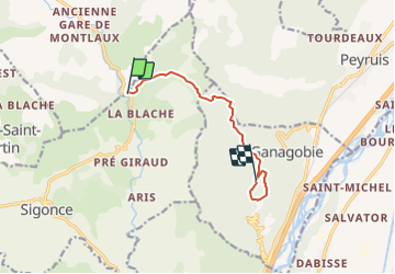
![](/images/other/stat-length.png)
![Tocht Stappen Sigonce - Sigonce-la Blondine au Prieuré de Ganagobie - Photo](https://media.geolcdn.com/t/1900/400/ext.pjpeg?maxdim=2&url=https%3A%2F%2Fstatic1.geolcdn.com%2Fsiteimages%2Fupload%2Ffiles%2F1553511878bg_sport_marche.png)
Sigonce-la Blondine au Prieuré de Ganagobie
JPJ38
Gebruiker
![Lengte](/images/other/stat-length.png)
![Max. hoogte](https://static1.geolcdn.com/siteimages/upload/files/1508320355ic_sort_altitude_max_24dp.png)
![Positief hoogteverschil](https://static1.geolcdn.com/siteimages/upload/files/1508320355ic_sort_den_pos_24dp.png)
![Km-Effort](/images/other/stat-length.png)
![Min. hoogte](https://static1.geolcdn.com/siteimages/upload/files/1508320355ic_sort_altitude_min_24dp.png)
![Negatief hoogteverschil](https://static1.geolcdn.com/siteimages/upload/files/1508320355ic_sort_den_neg_24dp.png)
![Boucle](https://static1.geolcdn.com/siteimages/upload/files/16400158638029165_repeat_loop_refresh_sync_direction_icon.png)
![Stappen](https://static1.geolcdn.com/sitytour/trail-icons/101.png)
2h37
Moeilijkheid : Medium
![Scan deze QR-code om de tocht te openen in de SityTrail-applicatie](https://capi.geolives.com/qq0zvz2zws4bq2lad0pu/sitytour/trails/2922442/qr.png?size=200)
Gratisgps-wandelapplicatie
Over ons
Tocht Stappen van 7,7 km beschikbaar op Provence-Alpes-Côte d'Azur, Alpes-de-Haute-Provence, Sigonce. Deze tocht wordt voorgesteld door JPJ38.
Beschrijving
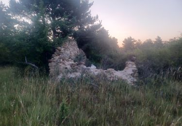
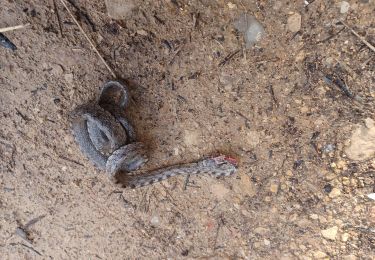
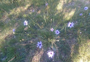
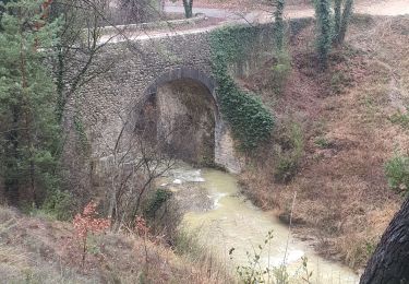
A l'arrivée sur le plateau de Ganagobie aller jusqu'au prieuré puis longer l'autre bord du plateau pour passer par les ruines de la vieille ville puis terminer la boucle au point culminant de l'aller et retour par le même parcours par l'aller. distance totale 14km
Plaatsbepaling
Opmerkingen
Wandeltochten in de omgeving
![Tocht Stappen Ganagobie - GANAGOBIE . Tour par le bas . Visite Ganagobie o m s - Photo](https://media.geolcdn.com/t/375/260/f43abf33-22fe-4846-8dac-9d35176e3e78.jpg&format=jpg&maxdim=2)
![Stappen Stappen](https://static1.geolcdn.com/sitytour/trail-icons/101.png)
Stappen
![](/images/other/stat-length.png)
![](https://static1.geolcdn.com/siteimages/upload/files/16400158638029165_repeat_loop_refresh_sync_direction_icon.png)
![Tocht Stappen Ganagobie - Plateau de Ganagobie - Photo](https://media.geolcdn.com/t/375/260/ext.jpg?maxdim=2&url=https%3A%2F%2Fservices.sitytrail.com%2FGeolivesWS%2FDownloadMedia.ashx%3FTrailID%3D107037%26Media%3D11842_5.jpg)
![Stappen Stappen](https://static1.geolcdn.com/sitytour/trail-icons/101.png)
Stappen
![](/images/other/stat-length.png)
![](https://static1.geolcdn.com/siteimages/upload/files/16400158638029165_repeat_loop_refresh_sync_direction_icon.png)
![Tocht Stappen Cruis - CRUIS . L ESPINASSE . DEFEND DES BOEUF . JAS ROCHE . O S L - Photo](https://media.geolcdn.com/t/375/260/a0cf8023-8ba0-4cae-8b97-e7a5d91b64cb.jpg&format=jpg&maxdim=2)
![Stappen Stappen](https://static1.geolcdn.com/sitytour/trail-icons/101.png)
Stappen
![](/images/other/stat-length.png)
![](https://static1.geolcdn.com/siteimages/upload/files/16400158638029165_repeat_loop_refresh_sync_direction_icon.png)
![Stappen Stappen](https://static1.geolcdn.com/sitytour/trail-icons/101.png)
Stappen
![](/images/other/stat-length.png)
![](https://static1.geolcdn.com/siteimages/upload/files/16400158638029165_repeat_loop_refresh_sync_direction_icon.png)
![Tocht Stappen Mallefougasse-Augès - MALEFOUGASSE La Ronde des Jas , Jas Figuiere , Aubert , L Ami , Calais , Trou Redon etc o - Photo](https://media.geolcdn.com/t/375/260/47ed88f5-ec00-4e57-8360-d9ab842bcc9a.jpg&format=jpg&maxdim=2)
![Stappen Stappen](https://static1.geolcdn.com/sitytour/trail-icons/101.png)
Stappen
![](/images/other/stat-length.png)
![](https://static1.geolcdn.com/siteimages/upload/files/16400158638029165_repeat_loop_refresh_sync_direction_icon.png)
![Tocht Stappen Ganagobie - GANAGOBIE. LE TOUR DU PRIEURE. LES GROTTES O L - Photo](https://media.geolcdn.com/t/375/260/52cfdfc9-4f86-4088-870f-757d56a0ef4f.jpg&format=jpg&maxdim=2)
![Stappen Stappen](https://static1.geolcdn.com/sitytour/trail-icons/101.png)
Stappen
![](/images/other/stat-length.png)
![](https://static1.geolcdn.com/siteimages/upload/files/16400158638029165_repeat_loop_refresh_sync_direction_icon.png)
![Tocht Stappen Montlaux - MONTLAUX. LES SOURCES DU LAUZON .O L M - Photo](https://media.geolcdn.com/t/375/260/f4854e53-edc8-45e8-9b45-a70e3872e836.jpg&format=jpg&maxdim=2)
![Stappen Stappen](https://static1.geolcdn.com/sitytour/trail-icons/101.png)
Stappen
![](/images/other/stat-length.png)
![](https://static1.geolcdn.com/siteimages/upload/files/16400158638029165_repeat_loop_refresh_sync_direction_icon.png)
![Tocht Stappen Montlaux - montlaux.lablache - Photo](https://media.geolcdn.com/t/375/260/3a7d5a76-fb65-413e-bf4d-fa5f9a5f7e1b.jpg&format=jpg&maxdim=2)
![Stappen Stappen](https://static1.geolcdn.com/sitytour/trail-icons/101.png)
Stappen
![](/images/other/stat-length.png)
![](https://static1.geolcdn.com/siteimages/upload/files/16400158638029165_repeat_loop_refresh_sync_direction_icon.png)
![Tocht Stappen Ganagobie - 2024-02-27 Ganagobie - Photo](https://media.geolcdn.com/t/375/260/39331507-485d-4d04-8063-2a27329bc715.jpg&format=jpg&maxdim=2)
![Stappen Stappen](https://static1.geolcdn.com/sitytour/trail-icons/101.png)
Stappen
![](/images/other/stat-length.png)
![](https://static1.geolcdn.com/siteimages/upload/files/16400158638029165_repeat_loop_refresh_sync_direction_icon.png)