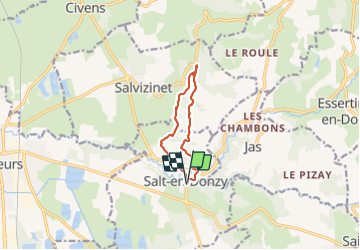
![](/images/other/stat-length.png)
![Tocht Stappen Salt-en-Donzy - Salt-en-Donzy, petite montagne - Photo](https://media.geolcdn.com/t/1900/400/252d959a-2962-4e4a-bcee-20640b08fc82.jpg&format=pjpeg&maxdim=2)
Salt-en-Donzy, petite montagne
mimi69670
Gebruiker
![Lengte](/images/other/stat-length.png)
![Max. hoogte](https://static1.geolcdn.com/siteimages/upload/files/1508320355ic_sort_altitude_max_24dp.png)
![Positief hoogteverschil](https://static1.geolcdn.com/siteimages/upload/files/1508320355ic_sort_den_pos_24dp.png)
![Km-Effort](/images/other/stat-length.png)
![Min. hoogte](https://static1.geolcdn.com/siteimages/upload/files/1508320355ic_sort_altitude_min_24dp.png)
![Negatief hoogteverschil](https://static1.geolcdn.com/siteimages/upload/files/1508320355ic_sort_den_neg_24dp.png)
![Boucle](https://static1.geolcdn.com/siteimages/upload/files/16400158638029165_repeat_loop_refresh_sync_direction_icon.png)
![Stappen](https://static1.geolcdn.com/sitytour/trail-icons/101.png)
2h32
Moeilijkheid : Gemakkelijk
![Scan deze QR-code om de tocht te openen in de SityTrail-applicatie](https://capi.geolives.com/qq0zvz2zws4bq2lad0pu/sitytour/trails/2909195/qr.png?size=200)
Gratisgps-wandelapplicatie
Over ons
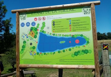
Tocht Stappen van 9 km beschikbaar op Auvergne-Rhône-Alpes, Loire, Salt-en-Donzy. Deze tocht wordt voorgesteld door mimi69670.
Beschrijving
Départ de la mairie.
Salt en Donzy possède un antique et riche passé.. Depuis les temps préhistoriques, où l'homme habite les collines et y laisse ses traces:hachette, silex, jusqu'à la grande époque gal'o romaine ou une intense activité se développe autour des thermes romains du "Gour Chaud".
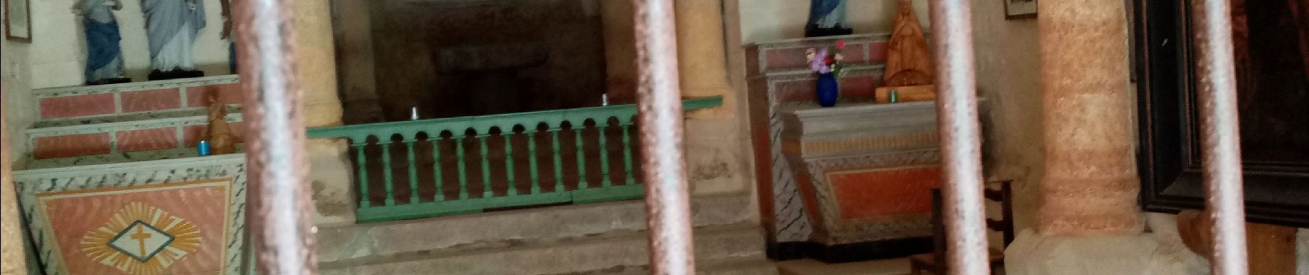
L'église du village est une église prieurale du 12 ème siècle, avec une allure extérieure ramassée dans le style roman Forezien.
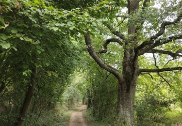
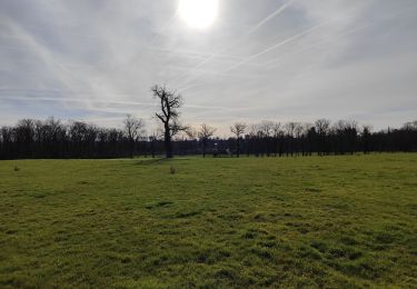
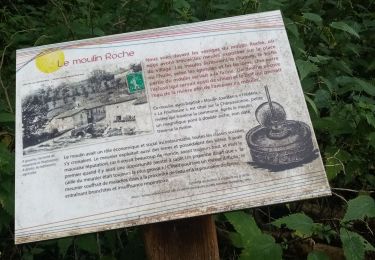
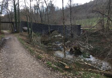
Rando sur Donzy, chemi' du monorail. Il faut longer un bon moment la rivière "La Charpassonne", chemin du site médiéval. Le site médiéval de Donzy garde quelques vestiges.
Continuer pour aller à la chapelle de La Valette, style roman du 11ème siècle.
Retour sur Salt en Donzy par des sentiers
Plaatsbepaling
Opmerkingen
Wandeltochten in de omgeving
![Tocht Stappen Essertines-en-Donzy - Essertines en Donzy - Photo](https://media.geolcdn.com/t/375/260/846e66e1-3e4e-46d4-8aff-bf6bfe8bdd34.jpg&format=jpg&maxdim=2)
![Stappen Stappen](https://static1.geolcdn.com/sitytour/trail-icons/101.png)
Stappen
![](/images/other/stat-length.png)
![](https://static1.geolcdn.com/siteimages/upload/files/16400158638029165_repeat_loop_refresh_sync_direction_icon.png)
![Tocht Stappen Salt-en-Donzy - Salt en Donzy - Photo](https://media.geolcdn.com/t/375/260/92e0799b-7397-4a83-951d-7d8dab5181d4.jpg&format=jpg&maxdim=2)
![Stappen Stappen](https://static1.geolcdn.com/sitytour/trail-icons/101.png)
Stappen
![](/images/other/stat-length.png)
![](https://static1.geolcdn.com/siteimages/upload/files/16400158638029165_repeat_loop_refresh_sync_direction_icon.png)
![Tocht Stappen Feurs - Randonnée au dessus de Feurs - Photo](https://media.geolcdn.com/t/375/260/d2c52346-f2e5-4497-8257-48fbc24ee939.jpg&format=jpg&maxdim=2)
![Stappen Stappen](https://static1.geolcdn.com/sitytour/trail-icons/101.png)
Stappen
![](/images/other/stat-length.png)
![](https://static1.geolcdn.com/siteimages/upload/files/16400158638029165_repeat_loop_refresh_sync_direction_icon.png)
![Tocht Stappen Valeille - Randonnée de Valeille - Photo](https://media.geolcdn.com/t/375/260/ff2b86da-5b69-4dbf-81f1-c6c051c235e0.jpg&format=jpg&maxdim=2)
![Stappen Stappen](https://static1.geolcdn.com/sitytour/trail-icons/101.png)
Stappen
![](/images/other/stat-length.png)
![](https://static1.geolcdn.com/siteimages/upload/files/16400158638029165_repeat_loop_refresh_sync_direction_icon.png)
![Tocht Stappen Essertines-en-Donzy - rando à partir de l'étang de la tuilerie - Photo](https://media.geolcdn.com/t/375/260/03d3503b-ae63-4901-b6b1-fb14fd833326.jpg&format=jpg&maxdim=2)
![Stappen Stappen](https://static1.geolcdn.com/sitytour/trail-icons/101.png)
Stappen
![](/images/other/stat-length.png)
![](https://static1.geolcdn.com/siteimages/upload/files/16400158638029165_repeat_loop_refresh_sync_direction_icon.png)
![Tocht Stappen Salt-en-Donzy - rando au départ de Salt en Douzy, les 3 Chapelles - Photo](https://media.geolcdn.com/t/375/260/1d587284-1cc2-4d83-a606-db22cec9330d.jpg&format=jpg&maxdim=2)
![Stappen Stappen](https://static1.geolcdn.com/sitytour/trail-icons/101.png)
Stappen
![](/images/other/stat-length.png)
![](https://static1.geolcdn.com/siteimages/upload/files/16400158638029165_repeat_loop_refresh_sync_direction_icon.png)
![Tocht Stappen Salvizinet - Salvizinet, les ponts - Photo](https://media.geolcdn.com/t/375/260/c69d1521-2db8-470f-b0c0-5530cf9080dd.jpg&format=jpg&maxdim=2)
![Stappen Stappen](https://static1.geolcdn.com/sitytour/trail-icons/101.png)
Stappen
![](/images/other/stat-length.png)
![](https://static1.geolcdn.com/siteimages/upload/files/16400158638029165_repeat_loop_refresh_sync_direction_icon.png)
![Tocht Stappen Salt-en-Donzy - rando à Salt en Douzy, boucle autour du chemin de monorail - Photo](https://media.geolcdn.com/t/375/260/ee316358-f7a5-4d9c-844b-66185530b4f7.jpg&format=jpg&maxdim=2)
![Stappen Stappen](https://static1.geolcdn.com/sitytour/trail-icons/101.png)
Stappen
![](/images/other/stat-length.png)
![](https://static1.geolcdn.com/siteimages/upload/files/16400158638029165_repeat_loop_refresh_sync_direction_icon.png)
![Tocht Stappen Salvizinet - Salvizinet et vers monorail - Photo](https://media.geolcdn.com/t/375/260/5a0a9506-2bc1-45db-9a49-992d649dcc32.jpg&format=jpg&maxdim=2)
![Stappen Stappen](https://static1.geolcdn.com/sitytour/trail-icons/101.png)
Stappen
![](/images/other/stat-length.png)
![](https://static1.geolcdn.com/siteimages/upload/files/16400158638029165_repeat_loop_refresh_sync_direction_icon.png)