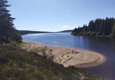
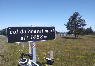
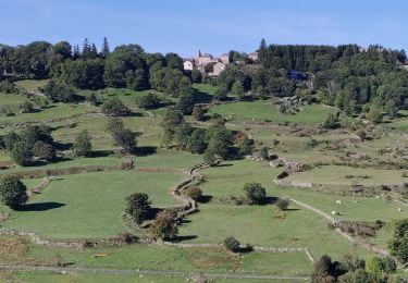
Tocht Paard Châteauneuf-de-Randon - Boucle De Margeride à Mont Lozère (Boucle Michel Wicker) - Photo

Boucle De Margeride à Mont Lozère (Boucle Michel Wicker)

 Lozère Cheval
Lozère Cheval

Gebruiker

© OpenStreetMap contributors
Lengte
Lengte
156 km
Max. hoogte
Max. hoogte
1480 m
Positief hoogteverschil
3980 m
Km-Effort
Km-Effort  
209 km
Min. hoogte
Min. hoogte
901 m
Negatief hoogteverschil
3981 m
Boucle
Boucle
Ja
Datum van aanmaak :
2021-08-19 18:11:59.726
Laatste wijziging :
2021-12-01 15:49:50.985

(0 Bericht)

Paard
Paard
--
Moeilijkheid : Heel gemakkelijk

Scan deze QR-code om de tocht te openen in de SityTrail-applicatie

Gratisgps-wandelapplicatie

Logo SityTrail SityTrail

IGN / Geografische instituten

SityTrail uit de App Store downloaden SityTrail uit Google Play downloaden

Logo SityTrail SityTrail World

De wereld gaat voor u open

SityTrail uit de App Store downloaden SityTrail uit Google Play downloaden SityTrail op Huawei AppGallery downloaden

Over ons

Tocht Paard van 156 km beschikbaar op Occitanië, Lozère, Châteauneuf-de-Randon. Deze tocht wordt voorgesteld door Lozère Cheval.

Hoogteprofiel

POI's

POI Mont Lozère et Goulet - Hôtel les Sources Chasserades - Photo
Lozère Cheval
MONT LOZÈRE ET GOULET 
POI Mont Lozère et Goulet - Hôtel le Refuge - Photo
Lozère Cheval
MONT LOZÈRE ET GOULET 
POI Laubert - La Pontière - Photo
Lozère Cheval
LAUBERT 
POI Arzenc-de-Randon - Le Giraldès  chez Valy - Photo
Lozère Cheval
ARZENC-DE-RANDON 
POI Grandrieu - Mazimbert - Photo
Lozère Cheval
GRANDRIEU 
POI Arzenc-de-Randon - Hôtel de la Poste - Photo
Lozère Cheval
ARZENC-DE-RANDON 
POI Mont Lozère et Goulet - Gite de l'Escoutal - Photo
Lozère Cheval
MONT LOZÈRE ET GOULET 
POI Grandrieu - Gite de la Chapelle (non adhérent) - Photo
Lozère Cheval
POI Grandrieu - Moulin gite des Deux Rieu - Photo
Lozère Cheval

Plaatsbepaling

Land:
France
Regio :
Occitanië
Departement/Provincie :
Lozère
Gemeente :
Châteauneuf-de-Randon
Locatie:
Unknown
Vertrek:(UTM)
553615 ; 4942525 (31T) N.

Wandeltochten in de omgeving

Tocht Wegfiets Arzenc-de-Randon - lac de Charpal - Photo
Wegfiets
GUIDE
nadd73

Wegfiets

Gemakkelijk
Arzenc-de-Randon, Occitanië, Lozère, France
38 km | 47 km-effort
3h 12min
Ja
Tocht Wegfiets Châteauneuf-de-Randon - col du cheval mort - Photo
Wegfiets
GUIDE
nadd73

Wegfiets

Medium
Châteauneuf-de-Randon, Occitanië, Lozère, France
52 km | 63 km-effort
2h 36min
Ja
Tocht Elektrische fiets Arzenc-de-Randon - AUBRAC  3dle étape  - Photo
Elektrische fiets
chris13370

Elektrische fiets

Medium
Arzenc-de-Randon, Occitanië, Lozère, France
74 km | 89 km-effort
8h 5min
Neen
Tocht Paardrijden Châteauneuf-de-Randon - 2022-09-18 Rando CVA Lozere Chateauneuf de Randon vers Chasserades - Photo
Paardrijden
GUIDE
holtzv

Paardrijden

Medium
Châteauneuf-de-Randon, Occitanië, Lozère, France
31 km | 42 km-effort
5h 20min
Neen
Tocht Stappen Arzenc-de-Randon - Arzenc de Rendon - Photo
Stappen
FLORENSAC

Stappen

Gemakkelijk
Arzenc-de-Randon, Occitanië, Lozère, France
10,6 km | 14,5 km-effort
3h 9min
Ja
Tocht Stappen Châteauneuf-de-Randon - CHATEAUNEUF DE RANDON  vers LE PIC DE FORTUNIO - Photo
Stappen
FLORENSAC

Stappen

Moeilijk
Châteauneuf-de-Randon, Occitanië, Lozère, France
17,6 km | 25 km-effort
6h 38min
Neen
Tocht Paardrijden Châteauneuf-de-Randon - Etoile  Etoile du Château Hotel de la Poste - Photo
Paardrijden
Lozère Cheval

Paardrijden

Gemakkelijk
Châteauneuf-de-Randon, Occitanië, Lozère, France
32 km | 41 km-effort
2h 28min
Ja
Tocht Elektrische fiets Châteauneuf-de-Randon - Tour du Fortunio  - Photo
Elektrische fiets
ZITO12

Elektrische fiets

Medium
Châteauneuf-de-Randon, Occitanië, Lozère, France
48 km | 59 km-effort
3h 43min
Ja
Tocht Campingcar Laubert - larzalier - Photo
Campingcar
dijojuguy

Campingcar

Heel gemakkelijk
Laubert, Occitanië, Lozère, France
9,5 km | 11,1 km-effort
12min
Neen


Sluiten
Mijn abonnementen