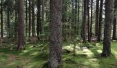

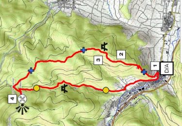
Fréland - Blancrupt

duchaine.nicolas
Gebruiker

Lengte
39 km

Max. hoogte
1189 m

Positief hoogteverschil
1244 m

Km-Effort
55 km

Min. hoogte
357 m

Negatief hoogteverschil
1239 m
Boucle
Ja
Datum van aanmaak :
2021-07-17 13:45:36.696
Laatste wijziging :
2021-07-18 07:48:19.546
4h15
Moeilijkheid : Gemakkelijk
4h15
Moeilijkheid : Gemakkelijk

Gratisgps-wandelapplicatie
Over ons
Tocht Mountainbike van 39 km beschikbaar op Grand Est, Haut-Rhin, Fréland. Deze tocht wordt voorgesteld door duchaine.nicolas.
Beschrijving
Via Lapoutroie, Col de Bermont, Surcenord, Cimetière Duchesne
Retour Bocheney, Roche du Pin, La Chaume, Les Machielles, Pairis, Orbey
Plaatsbepaling
Land:
France
Regio :
Grand Est
Departement/Provincie :
Haut-Rhin
Gemeente :
Fréland
Locatie:
Unknown
Vertrek:(Dec)
Vertrek:(UTM)
365797 ; 5337177 (32U) N.
Opmerkingen
Wandeltochten in de omgeving

2012-06-16 Marche aux Alisiers Orbey


Stappen
Gemakkelijk
(2)
Lapoutroie,
Grand Est,
Haut-Rhin,
France

11,1 km | 16,6 km-effort
2h 49min
Ja
Du ⛺️ aux 4 villages


Stappen
Medium
Kaysersberg-Vignoble,
Grand Est,
Haut-Rhin,
France

12,9 km | 15,1 km-effort
3h 30min
Ja
2021-05-30 Marche Kaysersberg Ursprung St Alexis


Stappen
Zeer moeilijk
Kaysersberg-Vignoble,
Grand Est,
Haut-Rhin,
France

17,1 km | 26 km-effort
4h 46min
Ja
2019-11-03 WE Aubure Taennchel


Paardrijden
Heel gemakkelijk
Aubure,
Grand Est,
Haut-Rhin,
France

27 km | 41 km-effort
7h 45min
Ja
2019-11-02 WE Aubure Brezouard


Paardrijden
Heel gemakkelijk
Aubure,
Grand Est,
Haut-Rhin,
France

25 km | 39 km-effort
5h 57min
Ja
2019-10-26 CDTE67 Tournage Video Promotion TE


Paardrijden
Gemakkelijk
Kaysersberg-Vignoble,
Grand Est,
Haut-Rhin,
France

24 km | 29 km-effort
24min
Neen
Le tour de Kysersberg


Stappen
Medium
(1)
Kaysersberg-Vignoble,
Grand Est,
Haut-Rhin,
France

7,9 km | 11,7 km-effort
2h 34min
Ja
2024-07-24_18h02m57_230112363


Stappen
Moeilijk
Lapoutroie,
Grand Est,
Haut-Rhin,
France

10,3 km | 17,2 km-effort
3h 54min
Ja
De Kaysersberg à l'auberge St Alexis


Stappen
Moeilijk
Kaysersberg-Vignoble,
Grand Est,
Haut-Rhin,
France

11,9 km | 18,8 km-effort
4h 15min
Ja


 SityTrail


