![](/images/other/stat-length.png)
![Tocht Stappen Praye - PRAYE - LA COLLINE DE SION-VAUDEMONT - Photo](https://media.geolcdn.com/t/1900/400/f6dfea2b-18d4-4541-a670-282ca29a8c57.jpg&format=pjpeg&maxdim=2)
PRAYE - LA COLLINE DE SION-VAUDEMONT
jean-marie.parachini
Gebruiker
![Lengte](/images/other/stat-length.png)
Lengte
16,6 km
![Max. hoogte](https://static1.geolcdn.com/siteimages/upload/files/1508320355ic_sort_altitude_max_24dp.png)
Max. hoogte
532 m
![Positief hoogteverschil](https://static1.geolcdn.com/siteimages/upload/files/1508320355ic_sort_den_pos_24dp.png)
Positief hoogteverschil
380 m
![Km-Effort](/images/other/stat-length.png)
Km-Effort
22 km
![Min. hoogte](https://static1.geolcdn.com/siteimages/upload/files/1508320355ic_sort_altitude_min_24dp.png)
Min. hoogte
307 m
![Negatief hoogteverschil](https://static1.geolcdn.com/siteimages/upload/files/1508320355ic_sort_den_neg_24dp.png)
Negatief hoogteverschil
380 m
![Boucle](https://static1.geolcdn.com/siteimages/upload/files/16400158638029165_repeat_loop_refresh_sync_direction_icon.png)
Boucle
Ja
Datum van aanmaak :
2021-07-08 07:35:15.218
Laatste wijziging :
2021-07-08 17:12:30.223
![Stappen](https://static1.geolcdn.com/sitytour/trail-icons/101.png)
8h52
Moeilijkheid : Gemakkelijk
![Scan deze QR-code om de tocht te openen in de SityTrail-applicatie](https://capi.geolives.com/qq0zvz2zws4bq2lad0pu/sitytour/trails/2854220/qr.png?size=200)
Gratisgps-wandelapplicatie
Over ons
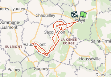
Tocht Stappen van 16,6 km beschikbaar op Grand Est, Meurthe-et-Moselle, Praye. Deze tocht wordt voorgesteld door jean-marie.parachini.
Beschrijving
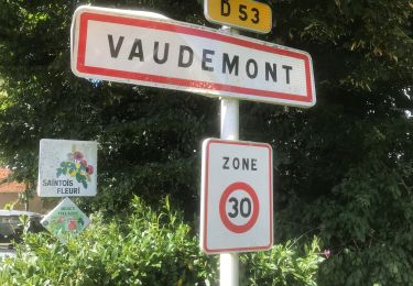
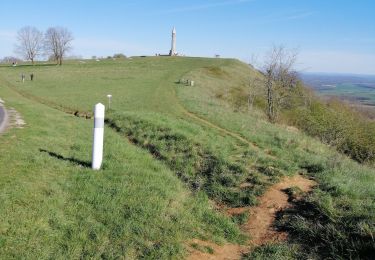
autour de la colline inspirée avec la basilique de Sion et le monument de Barres.
Des points de vue sur le sud de la Meurthe et Moselle jusqu'aux contreforts des Vosges.
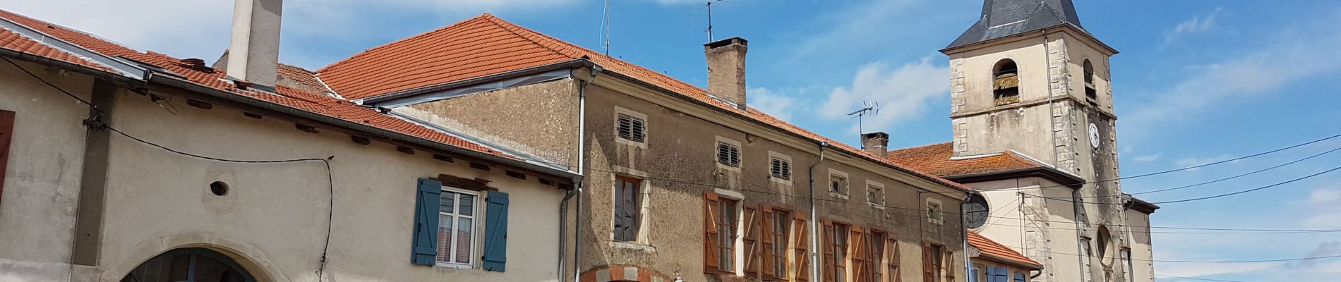
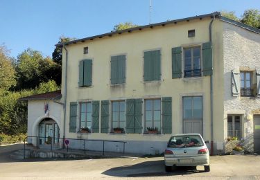
Plaatsbepaling
Land:
France
Regio :
Grand Est
Departement/Provincie :
Meurthe-et-Moselle
Gemeente :
Praye
Locatie:
Unknown
Vertrek:(Dec)
Vertrek:(UTM)
285930 ; 5368590 (32U) N.
Opmerkingen
Wandeltochten in de omgeving
![Tocht Te voet Vaudémont - Circuit Barrès - Brunehaut - Photo](https://media.geolcdn.com/t/375/260/4379cc40-7f33-4534-895d-40998ea52ef9.jpeg&format=jpg&maxdim=2)
![Te voet Te voet](https://static1.geolcdn.com/sitytour/trail-icons/100.png)
Circuit Barrès - Brunehaut
Te voet
Gemakkelijk
Vaudémont,
Grand Est,
Meurthe-et-Moselle,
France
![](/images/other/stat-length.png)
8,4 km | 10,7 km-effort
2h 26min
![](https://static1.geolcdn.com/siteimages/upload/files/16400158638029165_repeat_loop_refresh_sync_direction_icon.png)
Ja
![Tocht Stappen Saxon-Sion - Sion - Photo](https://media.geolcdn.com/t/375/260/ext.jpg?maxdim=2&url=https%3A%2F%2Fstatic1.geolcdn.com%2Fsiteimages%2Fupload%2Ffiles%2F1553511878bg_sport_marche.png)
![Stappen Stappen](https://static1.geolcdn.com/sitytour/trail-icons/101.png)
Sion
Stappen
Heel gemakkelijk
(1)
Saxon-Sion,
Grand Est,
Meurthe-et-Moselle,
France
![](/images/other/stat-length.png)
12,5 km | 16,2 km-effort
4h 40min
![](https://static1.geolcdn.com/siteimages/upload/files/16400158638029165_repeat_loop_refresh_sync_direction_icon.png)
Ja
![Tocht sport Vaudémont - Vaudemont - Photo](https://media.geolcdn.com/t/375/260/3e0597da-804d-40ff-aac7-534e403227a8.jpg&format=jpg&maxdim=2)
Vaudemont
sport
Heel gemakkelijk
Vaudémont,
Grand Est,
Meurthe-et-Moselle,
France
![](/images/other/stat-length.png)
5 km | 6,4 km-effort
Onbekend
![](https://static1.geolcdn.com/siteimages/upload/files/16400158638029165_repeat_loop_refresh_sync_direction_icon.png)
Ja
![Tocht Stappen Saxon-Sion - sion - Photo](https://media.geolcdn.com/t/375/260/9578318c-4e9b-48e6-b13f-618e356491c1.jpg&format=jpg&maxdim=2)
![Stappen Stappen](https://static1.geolcdn.com/sitytour/trail-icons/101.png)
sion
Stappen
Medium
Saxon-Sion,
Grand Est,
Meurthe-et-Moselle,
France
![](/images/other/stat-length.png)
12,2 km | 16 km-effort
4h 36min
![](https://static1.geolcdn.com/siteimages/upload/files/16400158638029165_repeat_loop_refresh_sync_direction_icon.png)
Ja
![Tocht Stappen Praye - tour de Sion 54 - Photo](https://media.geolcdn.com/t/375/260/efd9d13b-96a3-4b6c-aa74-e6fa88929e0e.jpg&format=jpg&maxdim=2)
![Stappen Stappen](https://static1.geolcdn.com/sitytour/trail-icons/101.png)
tour de Sion 54
Stappen
Medium
Praye,
Grand Est,
Meurthe-et-Moselle,
France
![](/images/other/stat-length.png)
18,3 km | 25 km-effort
5h 8min
![](https://static1.geolcdn.com/siteimages/upload/files/16400158638029165_repeat_loop_refresh_sync_direction_icon.png)
Ja
![Tocht Stappen Vaudémont - 2012-01-15 18h02m24 - Photo](https://media.geolcdn.com/t/375/260/ext.jpg?maxdim=2&url=https%3A%2F%2Fservices.sitytrail.com%2FGeolivesWS%2FDownloadMedia.ashx%3FTrailID%3D98704%26Media%3D20120115165929.jpeg)
![Stappen Stappen](https://static1.geolcdn.com/sitytour/trail-icons/101.png)
2012-01-15 18h02m24
Stappen
Gemakkelijk
Vaudémont,
Grand Est,
Meurthe-et-Moselle,
France
![](/images/other/stat-length.png)
4 km | 4,8 km-effort
1h 4min
![](https://static1.geolcdn.com/siteimages/upload/files/16400158638029165_repeat_loop_refresh_sync_direction_icon.png)
Ja
![Tocht Stappen Vaudémont - Randoguide - Photo](https://media.geolcdn.com/t/375/260/ext.jpg?maxdim=2&url=https%3A%2F%2Fservices.sitytrail.com%2FGeolivesWS%2FDownloadMedia.ashx%3FTrailID%3D90656%26Media%3D20111106174526.jpeg)
![Stappen Stappen](https://static1.geolcdn.com/sitytour/trail-icons/101.png)
Randoguide
Stappen
Medium
Vaudémont,
Grand Est,
Meurthe-et-Moselle,
France
![](/images/other/stat-length.png)
9,9 km | 12,9 km-effort
2h 45min
![](https://static1.geolcdn.com/siteimages/upload/files/16400158638029165_repeat_loop_refresh_sync_direction_icon.png)
Ja
![Tocht Stappen Saxon-Sion - Sion - Photo](https://media.geolcdn.com/t/375/260/ext.jpg?maxdim=2&url=https%3A%2F%2Fstatic1.geolcdn.com%2Fsiteimages%2Fupload%2Ffiles%2F1553511878bg_sport_marche.png)
![Stappen Stappen](https://static1.geolcdn.com/sitytour/trail-icons/101.png)
![Tocht Stappen Vaudémont - Saxon-Sion 12 300m + 282m (théorique) - Photo](https://media.geolcdn.com/t/375/260/ext.jpg?maxdim=2&url=https%3A%2F%2Fstatic1.geolcdn.com%2Fsiteimages%2Fupload%2Ffiles%2F1553511878bg_sport_marche.png)
![Stappen Stappen](https://static1.geolcdn.com/sitytour/trail-icons/101.png)
Saxon-Sion 12 300m + 282m (théorique)
Stappen
Moeilijk
Vaudémont,
Grand Est,
Meurthe-et-Moselle,
France
![](/images/other/stat-length.png)
12,2 km | 16 km-effort
3h 38min
![](https://static1.geolcdn.com/siteimages/upload/files/16400158638029165_repeat_loop_refresh_sync_direction_icon.png)
Ja
Très beau parcours, avec un aspect culturel sympathique et des paysages très variés. A conseiller.