Tocht Stappen Thiers - Le Chemin de Sainte-Agathe - Photo

Le Chemin de Sainte-Agathe

 arleol63
arleol63

Gebruiker

© OpenStreetMap contributors
Lengte
Lengte
94 km
Max. hoogte
Max. hoogte
1104 m
Positief hoogteverschil
3222 m
Km-Effort
Km-Effort  
137 km
Min. hoogte
Min. hoogte
310 m
Negatief hoogteverschil
3226 m
Boucle
Boucle
Ja
Datum van aanmaak :
2021-07-05 10:42:46.888
Laatste wijziging :
2021-07-05 10:44:32.263

(0 Bericht)

Stappen
Stappen
31h05
Moeilijkheid : Zeer moeilijk

Scan deze QR-code om de tocht te openen in de SityTrail-applicatie

Gratisgps-wandelapplicatie

Logo SityTrail SityTrail

IGN / Geografische instituten

SityTrail uit de App Store downloaden SityTrail uit Google Play downloaden

Logo SityTrail SityTrail World

De wereld gaat voor u open

SityTrail uit de App Store downloaden SityTrail uit Google Play downloaden SityTrail op Huawei AppGallery downloaden

Over ons

Tocht Stappen van 94 km beschikbaar op Auvergne-Rhône-Alpes, Puy-de-Dôme, Thiers. Deze tocht wordt voorgesteld door arleol63.

Beschrijving

Ballade agréable dans le Forez. Il faut aimer la nature, les forets et les montagnes à vache.

Hoogteprofiel

POI's

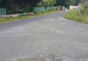
POI Thiers - Orangerie - Photo
arleol63
THIERS 
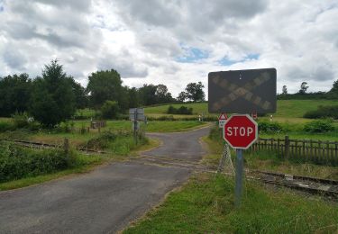
POI Thiers - Croisement en T - Photo
arleol63
POI Escoutoux - Prendre le chemin à gauche - Photo
arleol63
POI Escoutoux - Busset, prendre à gauche - Photo
arleol63
POI Escoutoux - D58 - Photo
arleol63
ESCOUTOUX 
POI Vollore-Ville - Croisement en T, prendre en face - Photo
arleol63
POI Vollore-Ville - Le Rouet, carrefour, prendre à gauche - Photo
arleol63
POI Vollore-Ville - Vollore-Ville, tourner à gauche - Photo
arleol63
POI Vollore-Ville - Carrefour de routes, à droite - Photo
arleol63
POI Vollore-Ville - Cote 484 - Photo
arleol63
VOLLORE-VILLE 
POI Aubusson-d'Auvergne - Les Thioulards - Photo
arleol63
AUBUSSON-D'AUVERGNE 
POI Aubusson-d'Auvergne - Gîte des 4 Vents - Photo
arleol63
AUBUSSON-D'AUVERGNE 
POI Courpière - Gîte des Quatre Vents - Photo
arleol63
POI Aubusson-d'Auvergne - Route de la Souche, prendre à gauche - Photo
arleol63
AUBUSSON-D'AUVERGNE 
POI Aubusson-d'Auvergne - Lac d'Aubusson - Photo
arleol63
AUBUSSON-D'AUVERGNE 
POI Augerolles - Augerolles - Photo
arleol63
AUGEROLLES 
POI Augerolles - Scierie, bifurquer à gauche - Photo
arleol63
POI Augerolles - Moulin du Clos - Photo
arleol63
AUGEROLLES 
POI Olmet - Croix de Chamaly - Photo
arleol63
POI Olliergues - Passerelle cote 512 - Photo
arleol63
POI Olliergues - Carrefour en T - Photo
arleol63
OLLIERGUES 
POI Olliergues - Prendre chemin à droite - Photo
arleol63
POI Olliergues - Olliergues - Photo
arleol63
OLLIERGUES 
POI Marat - Passerelle - Photo
arleol63
MARAT 
POI Saint-Pierre-la-Bourlhonne - Bauchaud - Photo
arleol63
SAINT-PIERRE-LA-BOURLHONNE 
POI La Renaudie - Le Clef, prendre à gauche - Photo
arleol63
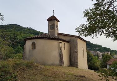
POI La Renaudie - Croix de Sainte-Agathe - Photo
arleol63
POI La Renaudie - La Renaudie - Photo
arleol63
LA RENAUDIE 
POI La Renaudie - Gîte communal de la Renaudie - Photo
arleol63
POI La Renaudie - La Coudairie - Photo
arleol63
LA RENAUDIE 
POI Vollore-Montagne - D317 - Photo
arleol63
VOLLORE-MONTAGNE 
POI Vollore-Montagne - Rossias, scierie, prendre sentier à droite - Photo
arleol63
POI Vollore-Montagne - Montchoisy, bifurquer à droite - Photo
arleol63
POI Vollore-Montagne - Bellevue - Photo
arleol63
VOLLORE-MONTAGNE 
POI Vollore-Montagne - Croix de Sainte-Agathe - Photo
arleol63
VOLLORE-MONTAGNE 
POI Vollore-Montagne - Croix des Tuiles - Photo
arleol63
VOLLORE-MONTAGNE 
POI Vollore-Ville - Croisement en triangle, prendre à droite - Photo
arleol63
POI Vollore-Ville - Croisée de chemins - Photo
arleol63
VOLLORE-VILLE 
POI Sainte-Agathe - Rochemulet - Photo
arleol63
SAINTE-AGATHE 
POI Sainte-Agathe - Raffy, prendre chemin à gauche - Photo
arleol63
POI Sainte-Agathe - D7 - Photo
arleol63
SAINTE-AGATHE 
POI Sainte-Agathe - Sainte Agathe - Photo
arleol63
SAINTE-AGATHE 
POI Sainte-Agathe - Sainte-Agathe - Photo
arleol63
SAINTE-AGATHE 
POI Sainte-Agathe - Carrefour de sentiers, prendre à droite - Photo
arleol63
POI Sainte-Agathe - Route d'accès à Vaulx, prendre à gauche - Photo
arleol63
POI Sainte-Agathe - Croix des Quatre Chemins - Photo
arleol63
POI Celles-sur-Durolle - Croix de fer, continuer en face - Photo
arleol63
CELLES-SUR-DUROLLE 
POI Celles-sur-Durolle - Ruisseau du Bouchet - Photo
arleol63
CELLES-SUR-DUROLLE 
POI Thiers - Membrun - Photo
arleol63
THIERS 
POI Thiers - Passerelle - Photo
arleol63
THIERS 
POI Thiers - Passerelle - Photo
arleol63
THIERS 
POI Thiers - Conduite forcée - Photo
arleol63
POI Thiers - Eglise Saint-Jean - Photo
arleol63
POI Thiers - Orangerie - Photo
arleol63
THIERS 

Plaatsbepaling

Land:
France
Regio :
Auvergne-Rhône-Alpes
Departement/Provincie :
Puy-de-Dôme
Gemeente :
Thiers
Locatie:
Unknown
Vertrek:(UTM)
542278 ; 5077625 (31T) N.

Wandeltochten in de omgeving

Tocht Stappen Thiers - Thiers_Enfer_Rouets - Photo
Stappen
GUIDE
jagarnier

Stappen

Medium
(1)
Thiers, Auvergne-Rhône-Alpes, Puy-de-Dôme, France
11,4 km | 18,3 km-effort
3h 30min
Ja
Tocht Stappen Thiers - Thiers_Horts - Photo
Stappen
GUIDE
jagarnier

Stappen

Medium
(1)
Thiers, Auvergne-Rhône-Alpes, Puy-de-Dôme, France
11 km | 16,1 km-effort
3h 15min
Ja
Tocht Stappen Saint-Rémy-sur-Durolle - 2016-1-26- Chabrol  - Photo
Stappen
claudef

Stappen

Medium
(2)
Saint-Rémy-sur-Durolle, Auvergne-Rhône-Alpes, Puy-de-Dôme, France
8,6 km | 12 km-effort
2h 32min
Ja
Tocht Te voet Thiers - Thiers - Château de Vaulx - Photo
Te voet
GUIDE+

Te voet

Medium
Thiers, Auvergne-Rhône-Alpes, Puy-de-Dôme, France
16 km | 25 km-effort
5h 37min
Neen
Tocht Te voet Thiers - Château de Vaulx - Thiers - Photo
Te voet
GUIDE+

Te voet

Medium
Thiers, Auvergne-Rhône-Alpes, Puy-de-Dôme, France
12,6 km | 20 km-effort
4h 39min
Neen
Tocht Te voet Dorat - Le sentier de Néron - Photo
Te voet
GUIDE+

Te voet

Gemakkelijk
Dorat, Auvergne-Rhône-Alpes, Puy-de-Dôme, France
5,9 km | 7,6 km-effort
1h 42min
Ja
Tocht Te voet Thiers - De l'Enfer aux Rouets - Photo
Te voet
GUIDE+

Te voet

Gemakkelijk
Thiers, Auvergne-Rhône-Alpes, Puy-de-Dôme, France
7,6 km | 12,2 km-effort
2h 46min
Ja
Tocht Te voet Escoutoux - Les Terrasses de la Dore - Photo
Te voet
GUIDE+

Te voet

Gemakkelijk
(1)
Escoutoux, Auvergne-Rhône-Alpes, Puy-de-Dôme, France
13,3 km | 16,1 km-effort
3h 39min
Ja
Tocht Stappen Thiers - Ballet des rouets  - Photo
Stappen
joelinou

Stappen

Moeilijk
Thiers, Auvergne-Rhône-Alpes, Puy-de-Dôme, France
13,2 km | 20 km-effort
5h 21min
Ja


Sluiten
Mijn abonnementen