![](/images/other/stat-length.png)
![Tocht Stappen Nonac - Nonac 01/07/21 - Photo](https://media.geolcdn.com/t/1900/400/090b3d85-e419-4275-a803-cfa4ddd971de.jpg&format=pjpeg&maxdim=2)
Nonac 01/07/21
dorcier
Gebruiker
![Lengte](/images/other/stat-length.png)
Lengte
10 km
![Max. hoogte](https://static1.geolcdn.com/siteimages/upload/files/1508320355ic_sort_altitude_max_24dp.png)
Max. hoogte
154 m
![Positief hoogteverschil](https://static1.geolcdn.com/siteimages/upload/files/1508320355ic_sort_den_pos_24dp.png)
Positief hoogteverschil
179 m
![Km-Effort](/images/other/stat-length.png)
Km-Effort
12,4 km
![Min. hoogte](https://static1.geolcdn.com/siteimages/upload/files/1508320355ic_sort_altitude_min_24dp.png)
Min. hoogte
88 m
![Negatief hoogteverschil](https://static1.geolcdn.com/siteimages/upload/files/1508320355ic_sort_den_neg_24dp.png)
Negatief hoogteverschil
178 m
![Boucle](https://static1.geolcdn.com/siteimages/upload/files/16400158638029165_repeat_loop_refresh_sync_direction_icon.png)
Boucle
Ja
Datum van aanmaak :
2021-07-01 07:38:40.0
Laatste wijziging :
2021-07-06 09:08:42.824
![Stappen](https://static1.geolcdn.com/sitytour/trail-icons/101.png)
2h31
Moeilijkheid : Medium
![Scan deze QR-code om de tocht te openen in de SityTrail-applicatie](https://capi.geolives.com/qq0zvz2zws4bq2lad0pu/sitytour/trails/2845720/qr.png?size=200)
Gratisgps-wandelapplicatie
Over ons
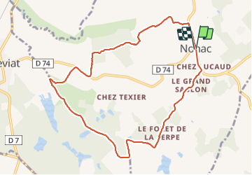
Tocht Stappen van 10 km beschikbaar op Nieuw-Aquitanië, Charente, Nonac. Deze tocht wordt voorgesteld door dorcier.
Beschrijving
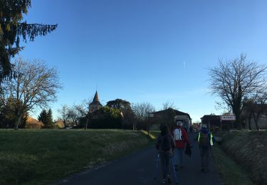
Au départ de la place du 19 mars (face au restaurant)
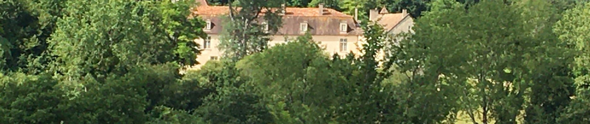
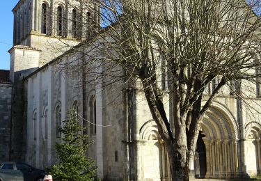
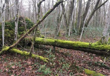
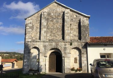
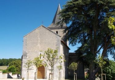
Cette balade vous conduit au bois de la Serpe. Vue sur le château de la Faye, l'église de Deviat.
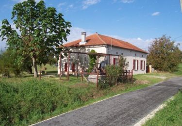
Parcours en grande partie ombragé.
Plaatsbepaling
Land:
France
Regio :
Nieuw-Aquitanië
Departement/Provincie :
Charente
Gemeente :
Nonac
Locatie:
Unknown
Vertrek:(Dec)
Vertrek:(UTM)
269719 ; 5033814 (31T) N.
Opmerkingen
Wandeltochten in de omgeving
![Te voet Te voet](https://static1.geolcdn.com/sitytour/trail-icons/100.png)
St Laurent/ StAmant
Te voet
Medium
Montmoreau,
Nieuw-Aquitanië,
Charente,
France
![](/images/other/stat-length.png)
8,4 km | 10,7 km-effort
2h 20min
![](https://static1.geolcdn.com/siteimages/upload/files/16400158638029165_repeat_loop_refresh_sync_direction_icon.png)
Ja
![Tocht Stappen Nonac - Nonac les 3 maires - Photo](https://media.geolcdn.com/t/375/260/6923342d-cfba-456b-b58a-956901e2cd09.jpg&format=jpg&maxdim=2)
![Stappen Stappen](https://static1.geolcdn.com/sitytour/trail-icons/101.png)
Nonac les 3 maires
Stappen
Medium
Nonac,
Nieuw-Aquitanië,
Charente,
France
![](/images/other/stat-length.png)
8,9 km | 11,2 km-effort
2h 22min
![](https://static1.geolcdn.com/siteimages/upload/files/16400158638029165_repeat_loop_refresh_sync_direction_icon.png)
Ja
![Tocht Stappen Nonac - Nonac 16/12/21 - Photo](https://media.geolcdn.com/t/375/260/b54d8e3d-4e77-48aa-a379-9dfa6adab961.jpg&format=jpg&maxdim=2)
![Stappen Stappen](https://static1.geolcdn.com/sitytour/trail-icons/101.png)
Nonac 16/12/21
Stappen
Medium
Nonac,
Nieuw-Aquitanië,
Charente,
France
![](/images/other/stat-length.png)
8,8 km | 11,5 km-effort
2h 20min
![](https://static1.geolcdn.com/siteimages/upload/files/16400158638029165_repeat_loop_refresh_sync_direction_icon.png)
Ja
![Tocht Stappen Coteaux-du-Blanzacais - cressac - Photo](https://media.geolcdn.com/t/375/260/ext.jpg?maxdim=2&url=https%3A%2F%2Fservices.sitytrail.com%2FGeolivesWS%2FDownloadMedia.ashx%3FTrailID%3D848732%26Media%3D20171019160922.jpg)
![Stappen Stappen](https://static1.geolcdn.com/sitytour/trail-icons/101.png)
cressac
Stappen
Gemakkelijk
Coteaux-du-Blanzacais,
Nieuw-Aquitanië,
Charente,
France
![](/images/other/stat-length.png)
7,4 km | 9,4 km-effort
2h 6min
![](https://static1.geolcdn.com/siteimages/upload/files/16400158638029165_repeat_loop_refresh_sync_direction_icon.png)
Ja
![Tocht Mountainbike Nonac - VTT autour de Nonac - Photo](https://media.geolcdn.com/t/375/260/ext.jpg?maxdim=2&url=https%3A%2F%2Fservices.sitytrail.com%2FGeolivesWS%2FDownloadMedia.ashx%3FTrailID%3D173249%26Media%3D14862_1.jpg)
![Mountainbike Mountainbike](https://static1.geolcdn.com/sitytour/trail-icons/202.png)
VTT autour de Nonac
Mountainbike
Medium
Nonac,
Nieuw-Aquitanië,
Charente,
France
![](/images/other/stat-length.png)
19,1 km | 24 km-effort
1h 30min
![](https://static1.geolcdn.com/siteimages/upload/files/16400158638029165_repeat_loop_refresh_sync_direction_icon.png)
Ja
![Tocht Mountainbike Nonac - Balade VTT autour de Nonac - Photo](https://media.geolcdn.com/t/375/260/ext.jpg?maxdim=2&url=https%3A%2F%2Fservices.sitytrail.com%2FGeolivesWS%2FDownloadMedia.ashx%3FTrailID%3D173248%26Media%3D14860_1.jpg)
![Mountainbike Mountainbike](https://static1.geolcdn.com/sitytour/trail-icons/202.png)
Balade VTT autour de Nonac
Mountainbike
Moeilijk
Nonac,
Nieuw-Aquitanië,
Charente,
France
![](/images/other/stat-length.png)
11,5 km | 14,6 km-effort
1h 30min
![](https://static1.geolcdn.com/siteimages/upload/files/16400158638029165_repeat_loop_refresh_sync_direction_icon.png)
Ja
![Tocht Mountainbike Nonac - Randonnée à Nonac - Photo](https://media.geolcdn.com/t/375/260/ext.jpg?maxdim=2&url=https%3A%2F%2Fservices.sitytrail.com%2FGeolivesWS%2FDownloadMedia.ashx%3FTrailID%3D173213%26Media%3D14811_1.jpg)
![Mountainbike Mountainbike](https://static1.geolcdn.com/sitytour/trail-icons/202.png)
Randonnée à Nonac
Mountainbike
Medium
Nonac,
Nieuw-Aquitanië,
Charente,
France
![](/images/other/stat-length.png)
8,8 km | 10,9 km-effort
1h 0min
![](https://static1.geolcdn.com/siteimages/upload/files/16400158638029165_repeat_loop_refresh_sync_direction_icon.png)
Ja
![Tocht Stappen Nonac - Randonnée à Nonac - Photo](https://media.geolcdn.com/t/375/260/ext.jpg?maxdim=2&url=https%3A%2F%2Fservices.sitytrail.com%2FGeolivesWS%2FDownloadMedia.ashx%3FTrailID%3D173212%26Media%3D14811_1.jpg)
![Stappen Stappen](https://static1.geolcdn.com/sitytour/trail-icons/101.png)
Randonnée à Nonac
Stappen
Medium
(1)
Nonac,
Nieuw-Aquitanië,
Charente,
France
![](/images/other/stat-length.png)
8,8 km | 10,9 km-effort
2h 30min
![](https://static1.geolcdn.com/siteimages/upload/files/16400158638029165_repeat_loop_refresh_sync_direction_icon.png)
Ja
![Tocht Stappen Saint-Martial - Saint Martial](https://media.geolcdn.com/t/375/260/ext.jpg?maxdim=2&url=https%3A%2F%2Fstatic1.geolcdn.com%2Fsiteimages%2Fupload%2Ffiles%2F1553511878bg_sport_marche.png)
![Stappen Stappen](https://static1.geolcdn.com/sitytour/trail-icons/101.png)
Saint Martial "Chez Deslandes"
Stappen
Gemakkelijk
Saint-Martial,
Nieuw-Aquitanië,
Charente,
France
![](/images/other/stat-length.png)
4,5 km | 5,5 km-effort
1h 21min
![](https://static1.geolcdn.com/siteimages/upload/files/16400158638029165_repeat_loop_refresh_sync_direction_icon.png)
Ja