


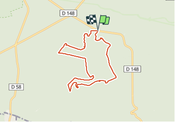

18 km | 22 km-effort

Gebruiker


Gratisgps-wandelapplicatie
 SityTrail
IGN / Geografische instituten
SityTrail World
De wereld gaat voor u open
Tocht Stappen van 7,9 km beschikbaar op Île-de-France, Seine-et-Marne, Fontainebleau. Deze tocht wordt voorgesteld door guydu41.
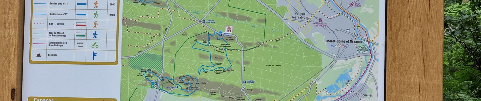
Petite randonnée sur le circuit Denecourt 17.
Départ depuis le parking au Carrefour du Rocher des Princes, 77920 Fontainebleau.
Traversée de deux chaos rocheux puis randonnée sur de longs chemins rectilignes avec une montée assez raide.


Stappen

Te voet

Stappen

Stappen
Stappen
Stappen

Stappen

Stappen

Stappen