![](/images/other/stat-length.png)
![Tocht Mountainbike Virton - Le Bévaux et Saint-Pancré - Balade_VTT_34kms - Photo](https://media.geolcdn.com/t/1900/400/38f8812b-470e-4e52-9786-1768789d1a70.jpg&format=pjpeg&maxdim=2)
Le Bévaux et Saint-Pancré - Balade_VTT_34kms
Pascal L
Gebruiker
![Lengte](/images/other/stat-length.png)
![Max. hoogte](https://static1.geolcdn.com/siteimages/upload/files/1508320355ic_sort_altitude_max_24dp.png)
![Positief hoogteverschil](https://static1.geolcdn.com/siteimages/upload/files/1508320355ic_sort_den_pos_24dp.png)
![Km-Effort](/images/other/stat-length.png)
![Min. hoogte](https://static1.geolcdn.com/siteimages/upload/files/1508320355ic_sort_altitude_min_24dp.png)
![Negatief hoogteverschil](https://static1.geolcdn.com/siteimages/upload/files/1508320355ic_sort_den_neg_24dp.png)
![Boucle](https://static1.geolcdn.com/siteimages/upload/files/16400158638029165_repeat_loop_refresh_sync_direction_icon.png)
![Mountainbike](https://static1.geolcdn.com/sitytour/trail-icons/202.png)
4h00
Moeilijkheid : Moeilijk
![Scan deze QR-code om de tocht te openen in de SityTrail-applicatie](https://capi.geolives.com/qq0zvz2zws4bq2lad0pu/sitytour/trails/2838906/qr.png?size=200)
Gratisgps-wandelapplicatie
Over ons
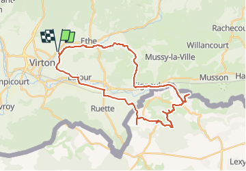
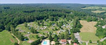
Tocht Mountainbike van 34 km beschikbaar op Wallonië, Luxemburg, Virton. Deze tocht wordt voorgesteld door Pascal L.
Beschrijving
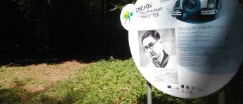
Cette jolie balade passe sur une portion du "Sentier Transfrontalier des Mines de Fer" (au coeur de la cuesta bajocienne) et traverse les villages de Gorcy, Houdlémont et Saint-Pancré.
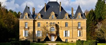
Départ/Retour: Virton (Pierrard)
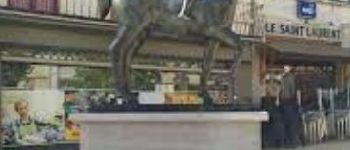
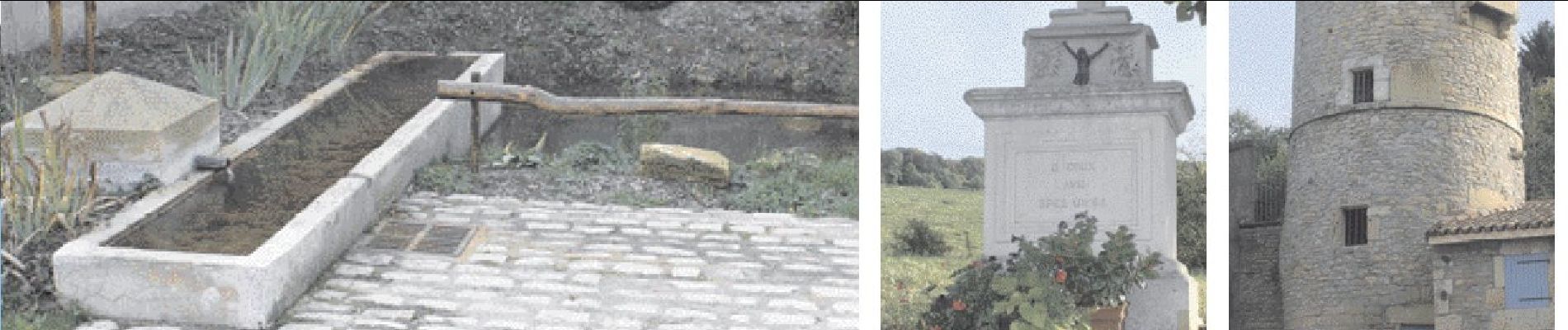
Endroits de passage : Pierrard, Ravel (ligne 155), Ethe, Gévimont, Bleid (Méronvau), Ruisseau du Corbé et du Magenot, Signeulx, chemin de liaison entre Signeulx et Baranzy (belle voie lente de 2,5 kms pour piétons et cyclistes, elle relie les villages de Musson, Baranzy, Signeulx et Gorcy), Marais de la Cussigniere, Gorcy (Cussigny), Houdlémont (Bellevue, Bois de la Dame), Eglise Saint-Denis (Bois de la Ville-Houdlémont), lieu dit «Bévaux» et son ruisseau (Bois de la Cure), la Renardière, Saint-Pancré et son église, Buré-la-Ville, panorama sur la Farinelle et la Bourguinette, Saint-Rémy, Etangs de Latour, Latour, Chenois.
Vidéo: TODO ???
Ref.
1. https://www.musson.be/loisirs/tourisme/gaume-sentier-transfrontalier-des-mines-de-fer.pdf
2. https://www.sitytrail.com/fr/trails/3267723-virton--chemin-transfrontalier-des-mines-de-fer--x--balade_vtt_51kms/
3. https://fr.wikiloc.com/itineraires-randonnee/halanzy-sur-le-sentier-des-mines-de-fer-5119434
4. https://www.sitytrail.com/fr/trails/216976-aubange--halanzy-sentier-des-mines-de-fer/
5. https://www.exxplore.fr/pages/Halanzy.php
6. https://rail.lu/minehalanzy.html
(2021.06.25)
Plaatsbepaling
Opmerkingen
Wandeltochten in de omgeving
![Tocht Stappen Virton - RB-Lu-17_Ethe_via-var-1-et-2-et-3 - Photo](https://media.geolcdn.com/t/375/260/ext.jpg?maxdim=2&url=https%3A%2F%2Fservices.sitytrail.com%2FGeolivesWS%2FDownloadMedia.ashx%3FTrailID%3D541328%26Media%3Df1aeb673-5eb3-40d2-9e3e-9751bd16961f.jpg)
![Stappen Stappen](https://static1.geolcdn.com/sitytour/trail-icons/101.png)
Stappen
![](/images/other/stat-length.png)
![](https://static1.geolcdn.com/siteimages/upload/files/16400158638029165_repeat_loop_refresh_sync_direction_icon.png)
![Tocht Mountainbike Virton - T2019-06-16-16-47 - Photo](https://media.geolcdn.com/t/375/260/7f02a860-4654-49bb-aa49-fc1e5df64440.jpg&format=jpg&maxdim=2)
![Mountainbike Mountainbike](https://static1.geolcdn.com/sitytour/trail-icons/202.png)
Mountainbike
![](/images/other/stat-length.png)
![](https://static1.geolcdn.com/siteimages/upload/files/16400158638029165_repeat_loop_refresh_sync_direction_icon.png)
![Tocht Stappen Virton - GAUME Balade naturelle et historique - Photo](https://media.geolcdn.com/t/375/260/ext.jpg?maxdim=2&url=https%3A%2F%2Fservices.sitytrail.com%2FGeolivesWS%2FDownloadMedia.ashx%3FTrailID%3D164521%26Media%3D20121125163840.jpeg)
![Stappen Stappen](https://static1.geolcdn.com/sitytour/trail-icons/101.png)
Stappen
![](/images/other/stat-length.png)
![](https://static1.geolcdn.com/siteimages/upload/files/16400158638029165_repeat_loop_refresh_sync_direction_icon.png)
![Tocht Te voet Virton - La Bajocienne - Photo](https://media.geolcdn.com/t/375/260/ext.jpg?maxdim=2&url=https%3A%2F%2Fpivotmedia.tourismewallonie.be%2FOTH-A0-006F-3DH1%2FOTH-A0-006F-3DH1.jpg)
![Te voet Te voet](https://static1.geolcdn.com/sitytour/trail-icons/100.png)
Te voet
![](/images/other/stat-length.png)
![](https://static1.geolcdn.com/siteimages/upload/files/16400158638029165_repeat_loop_refresh_sync_direction_icon.png)
![Tocht Stappen Virton - RB-Lu-17_Ethe_via-racc - Photo](https://media.geolcdn.com/t/375/260/ext.jpg?maxdim=2&url=https%3A%2F%2Fservices.sitytrail.com%2FGeolivesWS%2FDownloadMedia.ashx%3FTrailID%3D541324%26Media%3Df9f14959-9764-4ab9-b216-8ff20ce6d698.jpg)
![Stappen Stappen](https://static1.geolcdn.com/sitytour/trail-icons/101.png)
Stappen
![](/images/other/stat-length.png)
![](https://static1.geolcdn.com/siteimages/upload/files/16400158638029165_repeat_loop_refresh_sync_direction_icon.png)
![Tocht Stappen Virton - RB-Lu-17_Ethe - Photo](https://media.geolcdn.com/t/375/260/ext.jpg?maxdim=2&url=https%3A%2F%2Fservices.sitytrail.com%2FGeolivesWS%2FDownloadMedia.ashx%3FTrailID%3D541324%26Media%3D8965deff-6975-4e3c-a1d0-87e46c5ff193.jpg)
![Stappen Stappen](https://static1.geolcdn.com/sitytour/trail-icons/101.png)
Stappen
![](/images/other/stat-length.png)
![](https://static1.geolcdn.com/siteimages/upload/files/16400158638029165_repeat_loop_refresh_sync_direction_icon.png)
![Tocht Mountainbike Virton - Autour de Tintigny - Balade_VTT_54Kms - Photo](https://media.geolcdn.com/t/375/260/f2991960-98bf-4ded-84b3-f3460299ceba.jpg&format=jpg&maxdim=2)
![Mountainbike Mountainbike](https://static1.geolcdn.com/sitytour/trail-icons/202.png)
Mountainbike
![](/images/other/stat-length.png)
![](https://static1.geolcdn.com/siteimages/upload/files/16400158638029165_repeat_loop_refresh_sync_direction_icon.png)
![Tocht Mountainbike Virton - Monquintin - Balade_VTT_22Kms - Photo](https://media.geolcdn.com/t/375/260/136209b8-b776-4094-a6b1-d92770fe7c94.jpg&format=jpg&maxdim=2)
![Mountainbike Mountainbike](https://static1.geolcdn.com/sitytour/trail-icons/202.png)
Mountainbike
![](/images/other/stat-length.png)
![](https://static1.geolcdn.com/siteimages/upload/files/16400158638029165_repeat_loop_refresh_sync_direction_icon.png)
![Tocht Mountainbike Virton - Orval - Balade_VTT_50Kms - Photo](https://media.geolcdn.com/t/375/260/1aeac739-ad2c-44a6-9d1f-617a984d021d.jpg&format=jpg&maxdim=2)
![Mountainbike Mountainbike](https://static1.geolcdn.com/sitytour/trail-icons/202.png)
Mountainbike
![](/images/other/stat-length.png)
![](https://static1.geolcdn.com/siteimages/upload/files/16400158638029165_repeat_loop_refresh_sync_direction_icon.png)