Tocht Stappen Sankt Vith - Planetenweg - Photo
 Mudry
Mudry

Gebruiker

© OpenStreetMap contributors
Lengte
Lengte
3,2 km
Max. hoogte
Max. hoogte
492 m
Positief hoogteverschil
22 m
Km-Effort
Km-Effort  
3,7 km
Min. hoogte
Min. hoogte
419 m
Negatief hoogteverschil
74 m
Boucle
Boucle
Neen
Datum van aanmaak :
2021-06-23 16:15:06.182
Laatste wijziging :
2021-06-23 16:16:53.467

(0 Bericht)

Stappen
Stappen
50m
Moeilijkheid : Gemakkelijk

Scan deze QR-code om de tocht te openen in de SityTrail-applicatie

Gratisgps-wandelapplicatie

Logo SityTrail SityTrail

IGN / Geografische instituten

SityTrail uit de App Store downloaden SityTrail uit Google Play downloaden

Logo SityTrail SityTrail World

De wereld gaat voor u open

SityTrail uit de App Store downloaden SityTrail uit Google Play downloaden SityTrail op Huawei AppGallery downloaden

Over ons

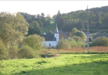
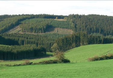
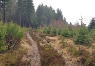
Tocht Stappen van 3,2 km beschikbaar op Wallonië, Luik, Sankt Vith. Deze tocht wordt voorgesteld door Mudry.

Beschrijving

Le Sentier des Planètes est une représentation du système solaire à l’échelle humaine, pour que chacun puisse visualiser facilement les tailles et distances surprenantes. Le Soleil et chaque planète y sont représentés sur des panneaux, avec respect de l’échelle des distances et des tailles. Ils permettent de découvrir les particularités de chacune des planètes, et de visualiser leur distance et leur taille par rapport au Soleil.

Pour cette raison, on a choisi deux échelles: Echelle des distances: 1 m = 2 millions de km dans l‘univers.
Echelle des dimensions des corps célestes et du soleil: 1 cm = 1.000 km de diamètre
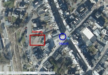
Départ : viaduc «Klosterstraße», arrivée : 2e pont à Galhausen, distance: 3 km (6 km aller-retour).

Hoogteprofiel

POI's

POI Sankt Vith - Chapelle St-Barthélemy - Photo
Mudry
POI Sankt Vith - Camping Wiesenbach - Photo
Mudry
SANKT VITH 

Plaatsbepaling

Land:
Belgium
Regio :
Wallonië
Departement/Provincie :
Luik
Gemeente :
Sankt Vith
Locatie:
Unknown
Vertrek:(UTM)
295399 ; 5572840 (32U) N.

Wandeltochten in de omgeving

Tocht Stappen Sankt Vith - 2022-01-18_14h03m12_st-vith---rodt - Photo
Stappen
GUIDE
mumu.larandonneuse

Stappen

Gemakkelijk
(1)
Sankt Vith, Wallonië, Luik, Belgium
16,1 km | 19,5 km-effort
4h 26min
Ja
Tocht Stappen Sankt Vith - RB-Lg-08 - Raccourci - Photo
Stappen
PRO

Stappen

Zeer moeilijk
(2)
Sankt Vith, Wallonië, Luik, Belgium
16,3 km | 22 km-effort
4h 55min
Ja
Tocht Stappen Sankt Vith - RB-Lg-08 - Dans le décor quasi-alpestre de la vallée de l’Our et de la région des Trois Frontières - Photo
Stappen
PRO

Stappen

Zeer moeilijk
(3)
Sankt Vith, Wallonië, Luik, Belgium
21 km | 28 km-effort
6h 18min
Ja
Tocht Stappen Sankt Vith - Rodt - Chiens de traineau  - Photo
Stappen
GUIDE
mumu.larandonneuse

Stappen

Medium
Sankt Vith, Wallonië, Luik, Belgium
8,4 km | 10,6 km-effort
1h 52min
Ja
Tocht Stappen Sankt Vith - 20230103 - TOTEMUS Saint-Vith - 6.7 Km - Photo
Stappen
GUIDE
pierreh01

Stappen

Medium
(1)
Sankt Vith, Wallonië, Luik, Belgium
6,7 km | 8,9 km-effort
2h 7min
Ja
Tocht Stappen Sankt Vith - 20220904 - Rodt 4.7 Km - Photo
Stappen
GUIDE
pierreh01

Stappen

Gemakkelijk
Sankt Vith, Wallonië, Luik, Belgium
4,7 km | 5,9 km-effort
1h 20min
Ja
Tocht Stappen Sankt Vith - 2022-01-18_13h53m42_st-vith - Photo
Stappen
GUIDE
mumu.larandonneuse

Stappen

Gemakkelijk
(1)
Sankt Vith, Wallonië, Luik, Belgium
15,9 km | 20 km-effort
4h 34min
Ja
Tocht Stappen Sankt Vith - Saint-Vith 🎅🎄✨️ - Photo
Stappen

Stappen

Medium
Sankt Vith, Wallonië, Luik, Belgium
10,7 km | 13,4 km-effort
2h 29min
Ja
Tocht Elektrische fiets Sankt Vith - Pn Rodt  49 Km - Photo
Elektrische fiets
Efr

Elektrische fiets

Heel gemakkelijk
Sankt Vith, Wallonië, Luik, Belgium
49 km | 61 km-effort
Onbekend
Ja


Sluiten
Mijn abonnementen