![](/images/other/stat-length.png)
![Tocht Te voet Gesves - SityTrail - SENTIERS D'ART - 141 km - Ciney, Gesves, Hamois, Havelange, Ohey et Somme-Leuze - Photo](https://media.geolcdn.com/t/1900/400/ext.pjpeg?maxdim=2&url=https%3A%2F%2Fstatic1.geolcdn.com%2Fsiteimages%2Fupload%2Ffiles%2F1545311037marcheuse_200dpi.jpg)
SityTrail - SENTIERS D'ART - 141 km - Ciney, Gesves, Hamois, Havelange, Ohey et Somme-Leuze
PikaRudy
Gebruiker
![Lengte](/images/other/stat-length.png)
![Max. hoogte](https://static1.geolcdn.com/siteimages/upload/files/1508320355ic_sort_altitude_max_24dp.png)
![Positief hoogteverschil](https://static1.geolcdn.com/siteimages/upload/files/1508320355ic_sort_den_pos_24dp.png)
![Km-Effort](/images/other/stat-length.png)
![Min. hoogte](https://static1.geolcdn.com/siteimages/upload/files/1508320355ic_sort_altitude_min_24dp.png)
![Negatief hoogteverschil](https://static1.geolcdn.com/siteimages/upload/files/1508320355ic_sort_den_neg_24dp.png)
![Boucle](https://static1.geolcdn.com/siteimages/upload/files/16400158638029165_repeat_loop_refresh_sync_direction_icon.png)
![Te voet](https://static1.geolcdn.com/sitytour/trail-icons/100.png)
42h28
Moeilijkheid : Zeer moeilijk
![Scan deze QR-code om de tocht te openen in de SityTrail-applicatie](https://capi.geolives.com/qq0zvz2zws4bq2lad0pu/sitytour/trails/2833754/qr.png?size=200)
Gratisgps-wandelapplicatie
Over ons
Tocht Te voet van 150 km beschikbaar op Wallonië, Namen, Gesves. Deze tocht wordt voorgesteld door PikaRudy.
Beschrijving
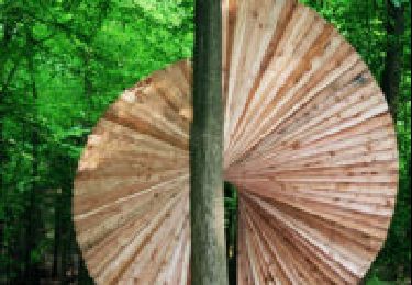
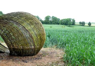
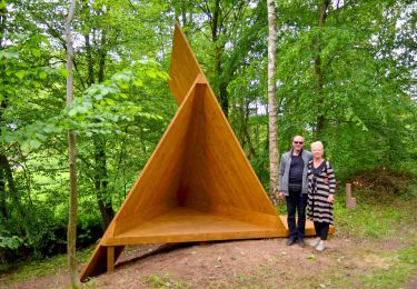
Sentiers d’art, c’est un nouveau circuit de grande randonnée, balisé, attractif et unique en Wallonie qui s’étend sur 141km. Il est parsemé de plus de 42 œuvres d’art dans la nature réalisées par des artistes de différents pays. Ce sentier traverse les communes de Ciney, Hamois, Somme-Leuze, Havelange, Gesves et Ohey. De petites boucles familiales de 6 à 15 km sont proposées tout au long du sentier.
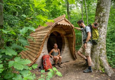
7 abris artistiques et poétiques permettent aux randonneurs de s’abriter et se reposer une nuit au cours de leur progression sur le sentier….Pas de réservation possible. Premier arrivé, premier installé ! Respectez le code forestier ! Pas de feu, pas de véhicule à moteur, une pause de quelques heures seulement, périodes de fermeture, ...
Le Sentier est balisé (rectangle rouge avec inscription Sentiers d'art) et est accessible gratuitement toute l’année, 24h/24, 7j/7 et pour tous les usagers non-motorisés. Attention durant la période de chasses, certains accès pourraient être fermés. Renseignez- vous avant votre départ.
POI's
Plaatsbepaling
Opmerkingen
Wandeltochten in de omgeving
![Stappen Stappen](https://static1.geolcdn.com/sitytour/trail-icons/101.png)
Stappen
![](/images/other/stat-length.png)
![](https://static1.geolcdn.com/siteimages/upload/files/16400158638029165_repeat_loop_refresh_sync_direction_icon.png)
![Tocht Stappen Ohey - OHEY- Evelette (Libois)- N° 13 Eau - Photo](https://media.geolcdn.com/t/375/260/ext.jpg?maxdim=2&url=https%3A%2F%2Fservices.sitytrail.com%2FGeolivesWS%2FDownloadMedia.ashx%3FTrailID%3D121420%26Media%3Dde7ff550-e553-4241-aaa7-7bac1b671239.jpg)
![Stappen Stappen](https://static1.geolcdn.com/sitytour/trail-icons/101.png)
Stappen
![](/images/other/stat-length.png)
![](https://static1.geolcdn.com/siteimages/upload/files/16400158638029165_repeat_loop_refresh_sync_direction_icon.png)
![Tocht Stappen Ohey - OHEY- Haillot- N°12-Bois - Photo](https://media.geolcdn.com/t/375/260/ext.jpg?maxdim=2&url=https%3A%2F%2Fservices.sitytrail.com%2FGeolivesWS%2FDownloadMedia.ashx%3FTrailID%3D121419%26Media%3Dd288ef38-31a8-435a-872c-4c8caba863e7.JPG)
![Stappen Stappen](https://static1.geolcdn.com/sitytour/trail-icons/101.png)
Stappen
![](/images/other/stat-length.png)
![](https://static1.geolcdn.com/siteimages/upload/files/16400158638029165_repeat_loop_refresh_sync_direction_icon.png)
![Tocht Stappen Gesves - GESVES- Le Pré D'Amite- N°07- Bois - Photo](https://media.geolcdn.com/t/375/260/ext.jpg?maxdim=2&url=https%3A%2F%2Fservices.sitytrail.com%2FGeolivesWS%2FDownloadMedia.ashx%3FTrailID%3D121401%26Media%3D56c27e3a-fec1-4804-be43-ac45373f04b7.jpg)
![Stappen Stappen](https://static1.geolcdn.com/sitytour/trail-icons/101.png)
Stappen
![](/images/other/stat-length.png)
![](https://static1.geolcdn.com/siteimages/upload/files/16400158638029165_repeat_loop_refresh_sync_direction_icon.png)
![Tocht Stappen Gesves - Sentiers d'art : Boucle 11- Haltinne - Photo](https://media.geolcdn.com/t/375/260/ext.jpg?maxdim=2&url=https%3A%2F%2Fservices.sitytrail.com%2FGeolivesWS%2FDownloadMedia.ashx%3FTrailID%3D993205%26Media%3D139263e1-20ce-42ae-8880-fc99e747d4c7.jpg)
![Stappen Stappen](https://static1.geolcdn.com/sitytour/trail-icons/101.png)
Stappen
![](/images/other/stat-length.png)
![](https://static1.geolcdn.com/siteimages/upload/files/16400158638029165_repeat_loop_refresh_sync_direction_icon.png)
![Tocht Stappen Hamois - HAMOIS- Schaltin- Promenade du Bois du Bocq au Colombier - Photo](https://media.geolcdn.com/t/375/260/ext.jpg?maxdim=2&url=https%3A%2F%2Fservices.sitytrail.com%2FGeolivesWS%2FDownloadMedia.ashx%3FTrailID%3D250699%26Media%3Df5fa6a8e-df6b-4e51-95e3-c58e93d30411.jpg)
![Stappen Stappen](https://static1.geolcdn.com/sitytour/trail-icons/101.png)
Stappen
![](/images/other/stat-length.png)
![](https://static1.geolcdn.com/siteimages/upload/files/16400158638029165_repeat_loop_refresh_sync_direction_icon.png)
![Stappen Stappen](https://static1.geolcdn.com/sitytour/trail-icons/101.png)
Stappen
![](/images/other/stat-length.png)
![](https://static1.geolcdn.com/siteimages/upload/files/16400158638029165_repeat_loop_refresh_sync_direction_icon.png)
![Stappen Stappen](https://static1.geolcdn.com/sitytour/trail-icons/101.png)
Stappen
![](/images/other/stat-length.png)
![](https://static1.geolcdn.com/siteimages/upload/files/16400158638029165_repeat_loop_refresh_sync_direction_icon.png)
![Tocht Te voet Hamois - Sentiers d'Art : Boucle 4 Hamois - Schaltin - Photo](https://media.geolcdn.com/t/375/260/2c7c2e61-e4de-40f0-ab0a-7cb107473369.jpg&format=jpg&maxdim=2)
![Te voet Te voet](https://static1.geolcdn.com/sitytour/trail-icons/100.png)
Te voet
![](/images/other/stat-length.png)
![](https://static1.geolcdn.com/siteimages/upload/files/16400158638029165_repeat_loop_refresh_sync_direction_icon.png)