![](/images/other/stat-length.png)
![Tocht Mountainbike Sainte-Marie-aux-Mines - 2021-06-19 090030.gpx - Photo](https://media.geolcdn.com/t/1900/400/ext.pjpeg?maxdim=2&url=https%3A%2F%2Fstatic1.geolcdn.com%2Fsiteimages%2Fupload%2Ffiles%2F1524743154velo.jpg)
2021-06-19 090030.gpx
patandre
Gebruiker
![Lengte](/images/other/stat-length.png)
Lengte
35 km
![Max. hoogte](https://static1.geolcdn.com/siteimages/upload/files/1508320355ic_sort_altitude_max_24dp.png)
Max. hoogte
1019 m
![Positief hoogteverschil](https://static1.geolcdn.com/siteimages/upload/files/1508320355ic_sort_den_pos_24dp.png)
Positief hoogteverschil
1108 m
![Km-Effort](/images/other/stat-length.png)
Km-Effort
50 km
![Min. hoogte](https://static1.geolcdn.com/siteimages/upload/files/1508320355ic_sort_altitude_min_24dp.png)
Min. hoogte
364 m
![Negatief hoogteverschil](https://static1.geolcdn.com/siteimages/upload/files/1508320355ic_sort_den_neg_24dp.png)
Negatief hoogteverschil
1138 m
![Boucle](https://static1.geolcdn.com/siteimages/upload/files/16400158638029165_repeat_loop_refresh_sync_direction_icon.png)
Boucle
Neen
Datum van aanmaak :
2021-06-20 06:13:33.222
Laatste wijziging :
2021-06-20 06:20:38.314
![Mountainbike](https://static1.geolcdn.com/sitytour/trail-icons/202.png)
2h45
Moeilijkheid : Medium
![Scan deze QR-code om de tocht te openen in de SityTrail-applicatie](https://capi.geolives.com/qq0zvz2zws4bq2lad0pu/sitytour/trails/2832877/qr.png?size=200)
Gratisgps-wandelapplicatie
Over ons
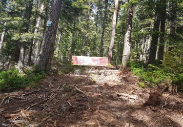
Tocht Mountainbike van 35 km beschikbaar op Grand Est, Haut-Rhin, Sainte-Marie-aux-Mines. Deze tocht wordt voorgesteld door patandre.
Beschrijving
Fenarupt - Robinot - Col de Ste Marie - Arbre de la Liberté - Pré de Raves - col des Bagenelles - Rauenthal - Baraque de l'Etoile - Chauffour - Echery
Plaatsbepaling
Land:
France
Regio :
Grand Est
Departement/Provincie :
Haut-Rhin
Gemeente :
Sainte-Marie-aux-Mines
Locatie:
Unknown
Vertrek:(Dec)
Vertrek:(UTM)
364603 ; 5345034 (32U) N.
Opmerkingen
Wandeltochten in de omgeving
![Tocht Stappen Sainte-Marie-aux-Mines - 2020-06-20 Marche Tete du Violu Col de Ste Marie - Photo](https://media.geolcdn.com/t/375/260/d44ae4f7-8944-4d5a-a40f-b5db5e1cd846.jpg&format=jpg&maxdim=2)
![Stappen Stappen](https://static1.geolcdn.com/sitytour/trail-icons/101.png)
2020-06-20 Marche Tete du Violu Col de Ste Marie
Stappen
Heel gemakkelijk
Sainte-Marie-aux-Mines,
Grand Est,
Haut-Rhin,
France
![](/images/other/stat-length.png)
14,1 km | 21 km-effort
4h 14min
![](https://static1.geolcdn.com/siteimages/upload/files/16400158638029165_repeat_loop_refresh_sync_direction_icon.png)
Ja
![Tocht Paardrijden Aubure - 2019-11-03 WE Aubure Taennchel - Photo](https://media.geolcdn.com/t/375/260/c26e7bc2-614c-4d3d-aa64-9841fd99c8a7.jpg&format=jpg&maxdim=2)
![Paardrijden Paardrijden](https://static1.geolcdn.com/sitytour/trail-icons/301.png)
2019-11-03 WE Aubure Taennchel
Paardrijden
Heel gemakkelijk
Aubure,
Grand Est,
Haut-Rhin,
France
![](/images/other/stat-length.png)
27 km | 41 km-effort
7h 45min
![](https://static1.geolcdn.com/siteimages/upload/files/16400158638029165_repeat_loop_refresh_sync_direction_icon.png)
Ja
![Tocht Paardrijden Aubure - 2019-11-02 WE Aubure Brezouard - Photo](https://media.geolcdn.com/t/375/260/5d69d4d4-e700-46e3-b109-02de2c2499c8.jpg&format=jpg&maxdim=2)
![Paardrijden Paardrijden](https://static1.geolcdn.com/sitytour/trail-icons/301.png)
2019-11-02 WE Aubure Brezouard
Paardrijden
Heel gemakkelijk
Aubure,
Grand Est,
Haut-Rhin,
France
![](/images/other/stat-length.png)
25 km | 39 km-effort
5h 57min
![](https://static1.geolcdn.com/siteimages/upload/files/16400158638029165_repeat_loop_refresh_sync_direction_icon.png)
Ja
![Tocht Stappen Sainte-Marie-aux-Mines - la croix de Ribeauvillé - Photo](https://media.geolcdn.com/t/375/260/d5b1ea95-9e8b-4e75-bd59-dd918afbb44b.jpg&format=jpg&maxdim=2)
![Stappen Stappen](https://static1.geolcdn.com/sitytour/trail-icons/101.png)
la croix de Ribeauvillé
Stappen
Medium
Sainte-Marie-aux-Mines,
Grand Est,
Haut-Rhin,
France
![](/images/other/stat-length.png)
12,5 km | 18,1 km-effort
6h 2min
![](https://static1.geolcdn.com/siteimages/upload/files/16400158638029165_repeat_loop_refresh_sync_direction_icon.png)
Ja
![Tocht Paardrijden Aubure - Circuit Alsace Vosges Aubure Orbey Et Cigognes - Photo](https://media.geolcdn.com/t/375/260/afad8878-23a0-4d83-b9b1-56130ab42de1.jpg&format=jpg&maxdim=2)
![Paardrijden Paardrijden](https://static1.geolcdn.com/sitytour/trail-icons/301.png)
Circuit Alsace Vosges Aubure Orbey Et Cigognes
Paardrijden
Moeilijk
Aubure,
Grand Est,
Haut-Rhin,
France
![](/images/other/stat-length.png)
30 km | 44 km-effort
5h 44min
![](https://static1.geolcdn.com/siteimages/upload/files/16400158638029165_repeat_loop_refresh_sync_direction_icon.png)
Neen
![Tocht Stappen Sainte-Marie-aux-Mines - taenichel - Photo](https://media.geolcdn.com/t/375/260/f89cec21-9478-4217-bf8a-15cadae40096.jpg&format=jpg&maxdim=2)
![Stappen Stappen](https://static1.geolcdn.com/sitytour/trail-icons/101.png)
taenichel
Stappen
Medium
Sainte-Marie-aux-Mines,
Grand Est,
Haut-Rhin,
France
![](/images/other/stat-length.png)
13,3 km | 19,1 km-effort
5h 26min
![](https://static1.geolcdn.com/siteimages/upload/files/16400158638029165_repeat_loop_refresh_sync_direction_icon.png)
Ja
![Tocht Stappen Sainte-Marie-aux-Mines - Col du Haut de Ribeauvillé - Rochers des Géants (Rother n°31) - Photo](https://media.geolcdn.com/t/375/260/cfbc15a6-3f32-42dc-813b-8bce71fe94c9.jpg&format=jpg&maxdim=2)
![Stappen Stappen](https://static1.geolcdn.com/sitytour/trail-icons/101.png)
Col du Haut de Ribeauvillé - Rochers des Géants (Rother n°31)
Stappen
Medium
Sainte-Marie-aux-Mines,
Grand Est,
Haut-Rhin,
France
![](/images/other/stat-length.png)
15,3 km | 22 km-effort
3h 56min
![](https://static1.geolcdn.com/siteimages/upload/files/16400158638029165_repeat_loop_refresh_sync_direction_icon.png)
Ja
![Tocht Stappen Sainte-Marie-aux-Mines - rocher des chèvred - Photo](https://media.geolcdn.com/t/375/260/1ee03ea7-dcc4-4aab-8946-92ada103a5f7.jpg&format=jpg&maxdim=2)
![Stappen Stappen](https://static1.geolcdn.com/sitytour/trail-icons/101.png)
rocher des chèvred
Stappen
Moeilijk
(2)
Sainte-Marie-aux-Mines,
Grand Est,
Haut-Rhin,
France
![](/images/other/stat-length.png)
8,9 km | 13,3 km-effort
2h 40min
![](https://static1.geolcdn.com/siteimages/upload/files/16400158638029165_repeat_loop_refresh_sync_direction_icon.png)
Ja
![Tocht Stappen Gemaingoutte - col Sainte Marie aux mines - Photo](https://media.geolcdn.com/t/375/260/644b77d8-a894-4e68-a040-8ae35dcbcebd.jpg&format=jpg&maxdim=2)
![Stappen Stappen](https://static1.geolcdn.com/sitytour/trail-icons/101.png)
col Sainte Marie aux mines
Stappen
Zeer moeilijk
Gemaingoutte,
Grand Est,
Vogezen,
France
![](/images/other/stat-length.png)
14,5 km | 22 km-effort
4h 20min
![](https://static1.geolcdn.com/siteimages/upload/files/16400158638029165_repeat_loop_refresh_sync_direction_icon.png)
Ja