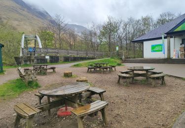
67 km | 78 km-effort
008 Letterfinlay Craigellachie
gpstracks
Gebruiker
Lengte
142 km
Max. hoogte
1057 m
Positief hoogteverschil
5657 m
Km-Effort
217 km
Min. hoogte
41 m
Negatief hoogteverschil
5618 m
Boucle
Neen
Datum van aanmaak :
2014-12-10 00:00:00.0
Laatste wijziging :
2014-12-10 00:00:00.0
--
Moeilijkheid : Onbekend
Gratisgps-wandelapplicatie
Over ons
Tocht Motor van 142 km beschikbaar op Schotland, Highland. Deze tocht wordt voorgesteld door gpstracks.
Beschrijving
More information on GPStracks.nl : http://www.gpstracks.nl
Plaatsbepaling
Land:
United Kingdom
Regio :
Schotland
Departement/Provincie :
Highland
Gemeente :
Unknown
Locatie:
Unknown
Vertrek:(Dec)
Vertrek:(UTM)
385566 ; 6316572 (30V) N.
Opmerkingen
Wandeltochten in de omgeving
Ben Nevis face Nord
sport
Heel gemakkelijk
,
Schotland,
Highland,
United Kingdom
11,7 km | 20 km-effort
Onbekend
Ja
Ecosse Clunie
Stappen
Gemakkelijk
,
Schotland,
Highland,
United Kingdom
1,3 km | 1,4 km-effort
48min
Ja
Rando Ecosse refuge CIC
Stappen
Moeilijk
,
Schotland,
Highland,
United Kingdom
11,6 km | 18 km-effort
2h 56min
Ja
Ben Nevis
Trail
Heel gemakkelijk
,
Schotland,
Highland,
United Kingdom
16,2 km | 34 km-effort
3h 12min
Ja
w-schotland-great-glen-way
Stappen
Heel gemakkelijk
,
Schotland,
Highland,
United Kingdom
210 km | 245 km-effort
Onbekend
Ja
2023 Ecosse J07
Stappen
Medium
,
Schotland,
Highland,
United Kingdom
9,2 km | 10,8 km-effort
2h 27min
Neen
Ben Nevis
Stappen
Moeilijk
,
Schotland,
Highland,
United Kingdom
7,9 km | 21 km-effort
4h 51min
Neen
ECOSSE-138
Stappen
Moeilijk
,
Schotland,
Highland,
United Kingdom
182 km | 322 km-effort
60h 35min
Neen