![](/images/other/stat-length.png)
![Tocht Stappen Cadenet - Cadenet Lourmarin Cadenet - Photo](https://media.geolcdn.com/t/1900/400/9ae9fb37-52f2-488e-8d20-dd9900ea5cda.jpg&format=pjpeg&maxdim=2)
Cadenet Lourmarin Cadenet
jll7513
Gebruiker
![Lengte](/images/other/stat-length.png)
![Max. hoogte](https://static1.geolcdn.com/siteimages/upload/files/1508320355ic_sort_altitude_max_24dp.png)
![Positief hoogteverschil](https://static1.geolcdn.com/siteimages/upload/files/1508320355ic_sort_den_pos_24dp.png)
![Km-Effort](/images/other/stat-length.png)
![Min. hoogte](https://static1.geolcdn.com/siteimages/upload/files/1508320355ic_sort_altitude_min_24dp.png)
![Negatief hoogteverschil](https://static1.geolcdn.com/siteimages/upload/files/1508320355ic_sort_den_neg_24dp.png)
![Boucle](https://static1.geolcdn.com/siteimages/upload/files/16400158638029165_repeat_loop_refresh_sync_direction_icon.png)
![Stappen](https://static1.geolcdn.com/sitytour/trail-icons/101.png)
3h01
Moeilijkheid : Gemakkelijk
![Noords wandelen](https://static1.geolcdn.com/sitytour/trail-icons/102.png)
2h03
Moeilijkheid : Gemakkelijk
![Scan deze QR-code om de tocht te openen in de SityTrail-applicatie](https://capi.geolives.com/qq0zvz2zws4bq2lad0pu/sitytour/trails/2824823/qr.png?size=200)
Gratisgps-wandelapplicatie
Over ons
Tocht Stappen van 10,5 km beschikbaar op Provence-Alpes-Côte d'Azur, Vaucluse, Cadenet. Deze tocht wordt voorgesteld door jll7513.
Beschrijving
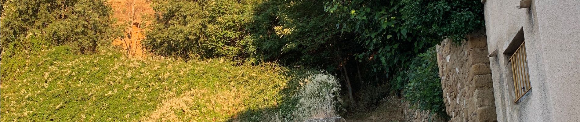
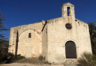
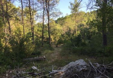
Circuit intéressant. On commence par le château de Cadenet. Puis le château de Lourmarin et retour par les vignes. Lorsque l'on contourne Lourmarin par le sud à un moment on a l'impression que le petit chemin très étroit se termine par un escalier qui monte à une maison. Continuer il y a un passages où il faut passer arc-bouté. En général des pistes assez large. En partant à 7h du matin mi-juin parcours plutôt bien ombragé. De beaux paysages avec de belles vues sur le LUBERON.
Plaatsbepaling
Opmerkingen
Wandeltochten in de omgeving
![Tocht Stappen Vaugines - PF-Vaugines - Cucuron - l'Ermitage - Vaugines - 17.06.2021 - Photo](https://media.geolcdn.com/t/375/260/49a6fcb0-e7e8-4e10-aa10-ef2270b11aa9.jpg&format=jpg&maxdim=2)
![Stappen Stappen](https://static1.geolcdn.com/sitytour/trail-icons/101.png)
Stappen
![](/images/other/stat-length.png)
![](https://static1.geolcdn.com/siteimages/upload/files/16400158638029165_repeat_loop_refresh_sync_direction_icon.png)
![Stappen Stappen](https://static1.geolcdn.com/sitytour/trail-icons/101.png)
Stappen
![](/images/other/stat-length.png)
![](https://static1.geolcdn.com/siteimages/upload/files/16400158638029165_repeat_loop_refresh_sync_direction_icon.png)
![Tocht Stappen Cadenet - Cadenet -Lourmarin - Photo](https://media.geolcdn.com/t/375/260/f0fee848-9372-4ead-90a1-4f47846561d2.jpg&format=jpg&maxdim=2)
![Stappen Stappen](https://static1.geolcdn.com/sitytour/trail-icons/101.png)
Stappen
![](/images/other/stat-length.png)
![](https://static1.geolcdn.com/siteimages/upload/files/16400158638029165_repeat_loop_refresh_sync_direction_icon.png)
![Tocht Mountainbike Cucuron - Le Coteau des Gamates - Photo](https://media.geolcdn.com/t/375/260/ext.jpg?maxdim=2&url=https%3A%2F%2Fservices.sitytrail.com%2FGeolivesWS%2FDownloadMedia.ashx%3FTrailID%3D108569%26Media%3D1477_1.jpg)
![Mountainbike Mountainbike](https://static1.geolcdn.com/sitytour/trail-icons/202.png)
Mountainbike
![](/images/other/stat-length.png)
![](https://static1.geolcdn.com/siteimages/upload/files/16400158638029165_repeat_loop_refresh_sync_direction_icon.png)
![Stappen Stappen](https://static1.geolcdn.com/sitytour/trail-icons/101.png)
Stappen
![](/images/other/stat-length.png)
![](https://static1.geolcdn.com/siteimages/upload/files/16400158638029165_repeat_loop_refresh_sync_direction_icon.png)
![Tocht Stappen La Roque-d'Anthéron - PF-La Roque-d'Anthéron - Vallon de la Baume - Roques Menoures - Photo](https://media.geolcdn.com/t/375/260/f10bcc89-8bdb-41c9-a4f0-78f4b8f29ff3.jpg&format=jpg&maxdim=2)
![Stappen Stappen](https://static1.geolcdn.com/sitytour/trail-icons/101.png)
Stappen
![](/images/other/stat-length.png)
![](https://static1.geolcdn.com/siteimages/upload/files/16400158638029165_repeat_loop_refresh_sync_direction_icon.png)
![Tocht Stappen Cadenet - PF-Cadenet - De Cadenet à Lourmarin - 3 - Photo](https://media.geolcdn.com/t/375/260/a6ee6e4b-3e12-4299-848e-3348098a84d0.jpg&format=jpg&maxdim=2)
![Stappen Stappen](https://static1.geolcdn.com/sitytour/trail-icons/101.png)
Stappen
![](/images/other/stat-length.png)
![](https://static1.geolcdn.com/siteimages/upload/files/16400158638029165_repeat_loop_refresh_sync_direction_icon.png)
![Stappen Stappen](https://static1.geolcdn.com/sitytour/trail-icons/101.png)
Stappen
![](/images/other/stat-length.png)
![](https://static1.geolcdn.com/siteimages/upload/files/16400158638029165_repeat_loop_refresh_sync_direction_icon.png)
![Tocht Stappen La Roque-d'Anthéron - Gambadous - La Roque d'Antheron - Photo](https://media.geolcdn.com/t/375/260/ext.jpg?maxdim=2&url=https%3A%2F%2Fstatic1.geolcdn.com%2Fsiteimages%2Fupload%2Ffiles%2F1553511878bg_sport_marche.png)
![Stappen Stappen](https://static1.geolcdn.com/sitytour/trail-icons/101.png)
Stappen
![](/images/other/stat-length.png)
![](https://static1.geolcdn.com/siteimages/upload/files/16400158638029165_repeat_loop_refresh_sync_direction_icon.png)