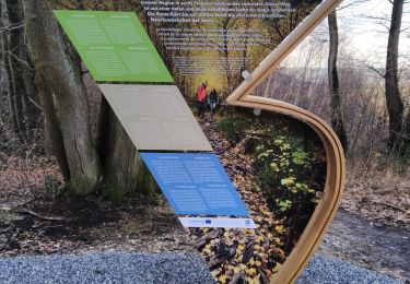
12,9 km | 16,3 km-effort
Limburg - Rondje Nederland-Belgisch limburg
gpstracks
Gebruiker
Lengte
144 km
Max. hoogte
228 m
Positief hoogteverschil
1467 m
Km-Effort
163 km
Min. hoogte
20 m
Negatief hoogteverschil
1466 m
Boucle
Ja
Datum van aanmaak :
2014-12-10 00:00:00.0
Laatste wijziging :
2014-12-10 00:00:00.0
--
Moeilijkheid : Onbekend
Gratisgps-wandelapplicatie
Over ons
Tocht Fiets van 144 km beschikbaar op Limburg, Onbekend, Vaals. Deze tocht wordt voorgesteld door gpstracks.
Beschrijving
More information on GPStracks.nl : http://www.gpstracks.nl
Plaatsbepaling
Land:
Netherlands
Regio :
Limburg
Departement/Provincie :
Onbekend
Gemeente :
Vaals
Locatie:
Unknown
Vertrek:(Dec)
Vertrek:(UTM)
289612 ; 5629130 (32U) N.
Opmerkingen
Wandeltochten in de omgeving
2023-04-07_19h07m33_235
Stappen
Medium
(1)
Vaals,
Limburg,
Onbekend,
Netherlands
14,7 km | 18,3 km-effort
4h 9min
Ja
Aix-la-Chapelle
Stappen
Gemakkelijk
(1)
Aken,
Noordrijn-Westfalen,
Städteregion Aachen,
Germany
11,4 km | 15,4 km-effort
3h 30min
Ja
2022-11-11_17h47m43_wandelroute---cittaslow-rondje-viele
Stappen
Medium
(1)
Vaals,
Limburg,
Onbekend,
Netherlands
12,8 km | 17,1 km-effort
3h 53min
Ja
2021-07-14_08h55m00_1431
Stappen
Medium
(1)
Vaals,
Limburg,
Onbekend,
Netherlands
13,1 km | 16,6 km-effort
3h 46min
Ja
20200730 - Les 3 Bornes 7.3 Km
Stappen
Moeilijk
(1)
Kelmis,
Wallonië,
Luik,
Belgium
7,4 km | 10,4 km-effort
1h 50min
Ja
Venn Trilogie (1er étape)
Stappen
Medium
(1)
Kelmis,
Wallonië,
Luik,
Belgium
25 km | 30 km-effort
5h 0min
Neen
Promenade du Vieux Moulin (9,5km)
Stappen
Heel gemakkelijk
(2)
Blieberg,
Wallonië,
Luik,
Belgium
8,3 km | 11 km-effort
Onbekend
Ja
Promenade Köning-Rabenpfuhl (10km)
Stappen
Heel gemakkelijk
(1)
Blieberg,
Wallonië,
Luik,
Belgium
9,5 km | 12,3 km-effort
Onbekend
Ja