![](/images/other/stat-length.png)
![Tocht Stappen Arès - Ares Anderno Ares - Photo](https://media.geolcdn.com/t/1900/400/ext.pjpeg?maxdim=2&url=https%3A%2F%2Fmedia.geolcdn.com%2Ff%2F92a2b066-7733-46d8-9e62-4a378ff813e2.jpg)
Ares Anderno Ares
mimilolo
Gebruiker
![Lengte](/images/other/stat-length.png)
Lengte
6,7 km
![Max. hoogte](https://static1.geolcdn.com/siteimages/upload/files/1508320355ic_sort_altitude_max_24dp.png)
Max. hoogte
13 m
![Positief hoogteverschil](https://static1.geolcdn.com/siteimages/upload/files/1508320355ic_sort_den_pos_24dp.png)
Positief hoogteverschil
40 m
![Km-Effort](/images/other/stat-length.png)
Km-Effort
7,2 km
![Min. hoogte](https://static1.geolcdn.com/siteimages/upload/files/1508320355ic_sort_altitude_min_24dp.png)
Min. hoogte
-2 m
![Negatief hoogteverschil](https://static1.geolcdn.com/siteimages/upload/files/1508320355ic_sort_den_neg_24dp.png)
Negatief hoogteverschil
39 m
![Boucle](https://static1.geolcdn.com/siteimages/upload/files/16400158638029165_repeat_loop_refresh_sync_direction_icon.png)
Boucle
Ja
Datum van aanmaak :
2021-06-01 07:41:25.949
Laatste wijziging :
2021-06-01 09:48:58.689
![Stappen](https://static1.geolcdn.com/sitytour/trail-icons/101.png)
1h44
Moeilijkheid : Heel gemakkelijk
![Scan deze QR-code om de tocht te openen in de SityTrail-applicatie](https://capi.geolives.com/qq0zvz2zws4bq2lad0pu/sitytour/trails/2809857/qr.png?size=200)
Gratisgps-wandelapplicatie
Over ons
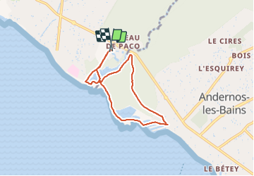
Tocht Stappen van 6,7 km beschikbaar op Nieuw-Aquitanië, Gironde, Arès. Deze tocht wordt voorgesteld door mimilolo.
Beschrijving
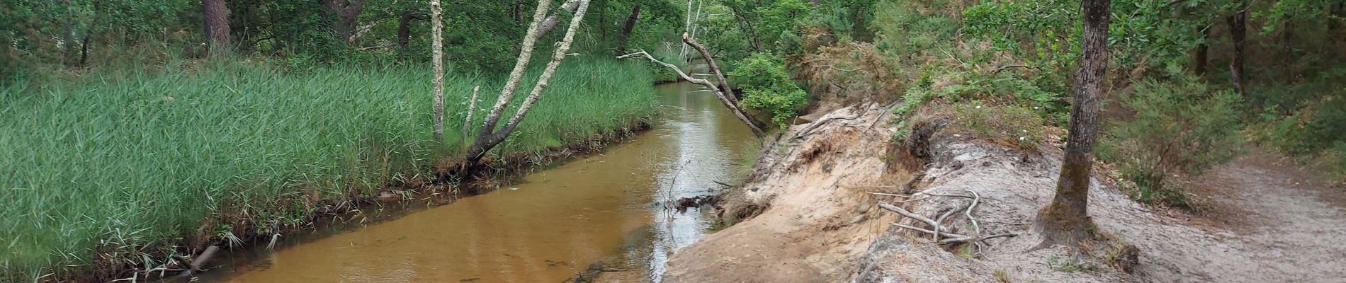
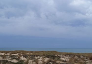
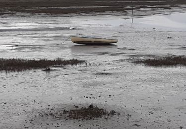
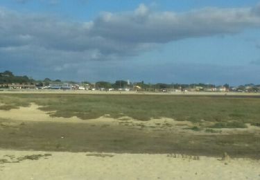
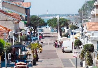
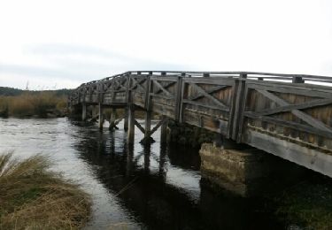
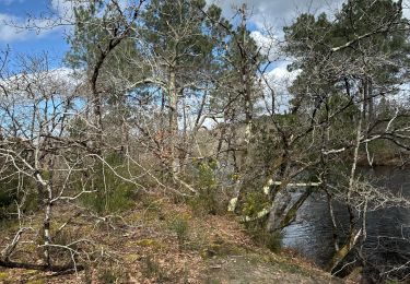
depart residence les Rives de saint Brice ballade par PR et GRP passage en forêt puis bord de mer à Andernos traversée des Cabanes
Plaatsbepaling
Land:
France
Regio :
Nieuw-Aquitanië
Departement/Provincie :
Gironde
Gemeente :
Arès
Locatie:
Unknown
Vertrek:(Dec)
Vertrek:(UTM)
648773 ; 4957624 (30T) N.
Opmerkingen
Wandeltochten in de omgeving
![Tocht Hybride fiets Arès - Vélo Arès Cap Feret - Photo](https://media.geolcdn.com/t/375/260/ext.jpg?maxdim=2&url=https%3A%2F%2Fmedia.geolcdn.com%2Ff%2F873f7bb6-c81f-4ee5-ac74-bed0238ffe60.jpg)
![Hybride fiets Hybride fiets](https://static1.geolcdn.com/sitytour/trail-icons/203.png)
Vélo Arès Cap Feret
Hybride fiets
Medium
Arès,
Nieuw-Aquitanië,
Gironde,
France
![](/images/other/stat-length.png)
56 km | 62 km-effort
4h 48min
![](https://static1.geolcdn.com/siteimages/upload/files/16400158638029165_repeat_loop_refresh_sync_direction_icon.png)
Neen
![Tocht Stappen Andernos-les-Bains - Les quinconces - Photo](https://media.geolcdn.com/t/375/260/ext.jpg?maxdim=2&url=https%3A%2F%2Fstatic1.geolcdn.com%2Fsiteimages%2Fupload%2Ffiles%2F1553511878bg_sport_marche.png)
![Stappen Stappen](https://static1.geolcdn.com/sitytour/trail-icons/101.png)
Les quinconces
Stappen
Heel gemakkelijk
(1)
Andernos-les-Bains,
Nieuw-Aquitanië,
Gironde,
France
![](/images/other/stat-length.png)
7 km | 7,6 km-effort
2h 55min
![](https://static1.geolcdn.com/siteimages/upload/files/16400158638029165_repeat_loop_refresh_sync_direction_icon.png)
Ja
![Tocht Stappen Arès - les prés salés la teste de buch - Photo](https://media.geolcdn.com/t/375/260/ext.jpg?maxdim=2&url=https%3A%2F%2Fmedia.geolcdn.com%2Ff%2Ffc01b79f-f710-46c8-99b3-a8ce921b7899.jpg)
![Stappen Stappen](https://static1.geolcdn.com/sitytour/trail-icons/101.png)
les prés salés la teste de buch
Stappen
Heel gemakkelijk
(1)
Arès,
Nieuw-Aquitanië,
Gironde,
France
![](/images/other/stat-length.png)
7,1 km | 7,5 km-effort
2h 37min
![](https://static1.geolcdn.com/siteimages/upload/files/16400158638029165_repeat_loop_refresh_sync_direction_icon.png)
Ja
![Tocht Stappen Andernos-les-Bains - ANDERNOS Les Bains - Photo](https://media.geolcdn.com/t/375/260/ext.jpg?maxdim=2&url=https%3A%2F%2Fservices.sitytrail.com%2FGeolivesWS%2FDownloadMedia.ashx%3FTrailID%3D734108%26Media%3Dfix__20170416175245.jpg)
![Stappen Stappen](https://static1.geolcdn.com/sitytour/trail-icons/101.png)
ANDERNOS Les Bains
Stappen
Heel gemakkelijk
(1)
Andernos-les-Bains,
Nieuw-Aquitanië,
Gironde,
France
![](/images/other/stat-length.png)
7,6 km | 8 km-effort
3h 2min
![](https://static1.geolcdn.com/siteimages/upload/files/16400158638029165_repeat_loop_refresh_sync_direction_icon.png)
Neen
![Tocht Fiets Arès - de Ares à Sanguinet - Photo](https://media.geolcdn.com/t/375/260/ext.jpg?maxdim=2&url=https%3A%2F%2Fservices.sitytrail.com%2FGeolivesWS%2FDownloadMedia.ashx%3FTrailID%3D450845%26Media%3D2cca1fec-375e-4780-a004-31cdd349b60d.jpg)
![Fiets Fiets](https://static1.geolcdn.com/sitytour/trail-icons/200.png)
de Ares à Sanguinet
Fiets
Gemakkelijk
Arès,
Nieuw-Aquitanië,
Gironde,
France
![](/images/other/stat-length.png)
82 km | 90 km-effort
5h 8min
![](https://static1.geolcdn.com/siteimages/upload/files/16400158638029165_repeat_loop_refresh_sync_direction_icon.png)
Neen
![Tocht Stappen Andernos-les-Bains - les près salés - Photo](https://media.geolcdn.com/t/375/260/ext.jpg?maxdim=2&url=https%3A%2F%2Fservices.sitytrail.com%2FGeolivesWS%2FDownloadMedia.ashx%3FTrailID%3D249261%26Media%3Dfix__20140212144514.jpg)
![Stappen Stappen](https://static1.geolcdn.com/sitytour/trail-icons/101.png)
les près salés
Stappen
Medium
(1)
Andernos-les-Bains,
Nieuw-Aquitanië,
Gironde,
France
![](/images/other/stat-length.png)
19,3 km | 21 km-effort
4h 28min
![](https://static1.geolcdn.com/siteimages/upload/files/16400158638029165_repeat_loop_refresh_sync_direction_icon.png)
Ja
![Tocht Stappen Andernos-les-Bains - Arés - Photo](https://media.geolcdn.com/t/375/260/ext.jpg?maxdim=2&url=https%3A%2F%2Fstatic1.geolcdn.com%2Fsiteimages%2Fupload%2Ffiles%2F1553511878bg_sport_marche.png)
![Stappen Stappen](https://static1.geolcdn.com/sitytour/trail-icons/101.png)
Arés
Stappen
Gemakkelijk
(1)
Andernos-les-Bains,
Nieuw-Aquitanië,
Gironde,
France
![](/images/other/stat-length.png)
11,8 km | 12,8 km-effort
2h 0min
![](https://static1.geolcdn.com/siteimages/upload/files/16400158638029165_repeat_loop_refresh_sync_direction_icon.png)
Ja
![Tocht Noords wandelen Lège-Cap-Ferret - Lège Cap Ferret - le canal - Photo](https://media.geolcdn.com/t/375/260/ext.jpg?maxdim=2&url=https%3A%2F%2Fmedia.geolcdn.com%2Ff%2F2243a043-a5b0-4b32-b467-fadfd20f096a.jpg)
![Noords wandelen Noords wandelen](https://static1.geolcdn.com/sitytour/trail-icons/102.png)
Lège Cap Ferret - le canal
Noords wandelen
Heel gemakkelijk
Lège-Cap-Ferret,
Nieuw-Aquitanië,
Gironde,
France
![](/images/other/stat-length.png)
15,4 km | 16,4 km-effort
Onbekend
![](https://static1.geolcdn.com/siteimages/upload/files/16400158638029165_repeat_loop_refresh_sync_direction_icon.png)
Ja
![Tocht Lopen Lège-Cap-Ferret - Solocéan - Photo](https://media.geolcdn.com/t/375/260/ext.jpg?maxdim=2&url=https%3A%2F%2Fmedia.geolcdn.com%2Ff%2F64b33a6a-464a-4678-b2a1-70c6bfa068e8.jpg)
![Lopen Lopen](https://static1.geolcdn.com/sitytour/trail-icons/103.png)