Tocht Stappen Fontpédrouse - font pedrouse corral machuma 600m 9.7 km 5h - Photo

font pedrouse corral machuma 600m 9.7 km 5h

 Erius
Erius

Gebruiker

© OpenStreetMap contributors
Lengte
Lengte
9,7 km
Max. hoogte
Max. hoogte
1546 m
Positief hoogteverschil
604 m
Km-Effort
Km-Effort  
17,7 km
Min. hoogte
Min. hoogte
1023 m
Negatief hoogteverschil
607 m
Boucle
Boucle
Ja
Datum van aanmaak :
2021-05-15 07:12:18.489
Laatste wijziging :
2021-05-18 09:25:40.034

(0 Bericht)

Stappen
Stappen
3h11
Moeilijkheid : Moeilijk

Scan deze QR-code om de tocht te openen in de SityTrail-applicatie

Gratisgps-wandelapplicatie

Logo SityTrail SityTrail

IGN / Geografische instituten

SityTrail uit de App Store downloaden SityTrail uit Google Play downloaden

Logo SityTrail SityTrail World

De wereld gaat voor u open

SityTrail uit de App Store downloaden SityTrail uit Google Play downloaden SityTrail op Huawei AppGallery downloaden

Over ons

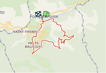
Tocht Stappen van 9,7 km beschikbaar op Occitanië, Pyrénées-Orientales, Fontpédrouse. Deze tocht wordt voorgesteld door Erius.

Beschrijving

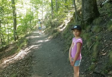
parcours sportif à trouver le sentier
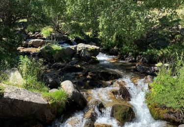
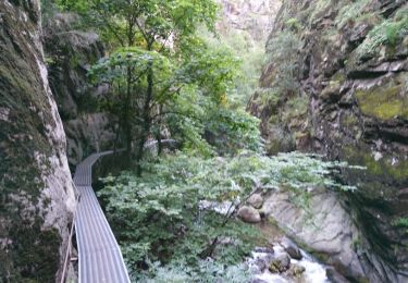
corral magnifique peu commun
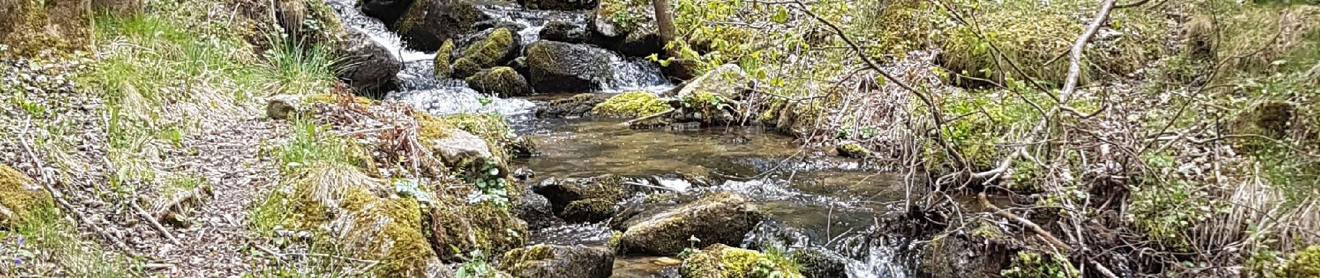
petit torrent
bonne descente

Hoogteprofiel

Foto's

Plaatsbepaling

Land:
France
Regio :
Occitanië
Departement/Provincie :
Pyrénées-Orientales
Gemeente :
Fontpédrouse
Locatie:
Unknown
Vertrek:(UTM)
432348 ; 4706644 (31T) N.

Wandeltochten in de omgeving

Tocht Stappen Thuès-Entre-Valls - boucle des gorges de Caranca - Photo
Stappen
PVERTICAL

Stappen

Medium
(2)
Thuès-Entre-Valls, Occitanië, Pyrénées-Orientales, France
7,2 km | 15,3 km-effort
3h 1min
Ja
Tocht Stappen Thuès-Entre-Valls - Gorges de la garanca - Photo
Stappen
attelageplaisir

Stappen

Heel gemakkelijk
(1)
Thuès-Entre-Valls, Occitanië, Pyrénées-Orientales, France
6,7 km | 13,1 km-effort
3h 39min
Neen
Tocht Stappen Fontpédrouse - Tour du Cucurucull - Photo
Stappen
Pek56

Stappen

Medium
(1)
Fontpédrouse, Occitanië, Pyrénées-Orientales, France
9,3 km | 18,5 km-effort
3h 24min
Ja
Tocht Stappen Planès - étang de Planès - Photo
Stappen
fhascoet

Stappen

Medium
(2)
Planès, Occitanië, Pyrénées-Orientales, France
10,8 km | 19,6 km-effort
3h 54min
Neen
Tocht Stappen Fontpédrouse - fontpérouse sentier des canaux et sources chaudes naturelles_T - Photo
Stappen
force

Stappen

Medium
(1)
Fontpédrouse, Occitanië, Pyrénées-Orientales, France
13,7 km | 25 km-effort
5h 9min
Ja
Tocht Stappen Saint-Pierre-dels-Forcats - bains  de St Thomas  - Photo
Stappen
Ptitjack30

Stappen

Medium
(1)
Saint-Pierre-dels-Forcats, Occitanië, Pyrénées-Orientales, France
8,6 km | 12,2 km-effort
2h 42min
Neen
Tocht Stappen La Llagonne - llagonne - Calvet - Photo
Stappen
merencianoep

Stappen

Medium
(2)
La Llagonne, Occitanië, Pyrénées-Orientales, France
11,2 km | 14,2 km-effort
3h 0min
Neen
Tocht Stappen Thuès-Entre-Valls - Gorges de Carança - Photo
Stappen
ochamley

Stappen

Medium
(2)
Thuès-Entre-Valls, Occitanië, Pyrénées-Orientales, France
13,6 km | 30 km-effort
3h 43min
Ja
Tocht Stappen Fontpédrouse - Refuges Ras Carança - Ulldeter via col del Geant  - Photo
Stappen
chrisgps

Stappen

Medium
Fontpédrouse, Occitanië, Pyrénées-Orientales, France
8,9 km | 19 km-effort
6h 10min
Neen


Sluiten
Mijn abonnementen