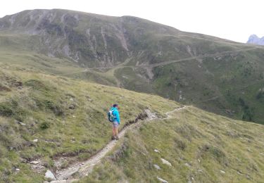
9,2 km | 14,2 km-effort
w-italie-alta-via-2
gpstracks
Gebruiker
Lengte
40 km
Max. hoogte
2955 m
Positief hoogteverschil
4767 m
Km-Effort
100 km
Min. hoogte
960 m
Negatief hoogteverschil
3475 m
Boucle
Neen
Datum van aanmaak :
2014-12-10 00:00:00.0
Laatste wijziging :
2014-12-10 00:00:00.0
--
Moeilijkheid : Onbekend
Gratisgps-wandelapplicatie
Over ons
Tocht Stappen van 40 km beschikbaar op Trento-Zuid-Tirol, Bolzano - Bozen, Brixen - Bressanone. Deze tocht wordt voorgesteld door gpstracks.
Beschrijving
More information on GPStracks.nl : http://www.gpstracks.nl
POI's
Plaatsbepaling
Land:
Italy
Regio :
Trento-Zuid-Tirol
Departement/Provincie :
Bolzano - Bozen
Gemeente :
Brixen - Bressanone
Locatie:
Unknown
Vertrek:(Dec)
Vertrek:(UTM)
704531 ; 5175245 (32T) N.
Opmerkingen
Wandeltochten in de omgeving
Plose - Schatzerhütte
Stappen
Medium
(1)
Brixen - Bressanone,
Trento-Zuid-Tirol,
Bolzano - Bozen,
Italy
3h 1min
Ja
Dolomiten Panoramaweg
Stappen
Medium
(1)
Brixen - Bressanone,
Trento-Zuid-Tirol,
Bolzano - Bozen,
Italy
15,6 km | 23 km-effort
5h 10min
Ja
Telegraph - Leonharder Kreuz
Stappen
Medium
(1)
Brixen - Bressanone,
Trento-Zuid-Tirol,
Bolzano - Bozen,
Italy
11,5 km | 19,1 km-effort
5h 13min
Ja
AVS 5 - Vahrn - Bad Schalders - Lorenzischarte - Fortschellscharte - Durnholz
Te voet
Zeer moeilijk
Vahrn - Varna,
Trento-Zuid-Tirol,
Bolzano - Bozen,
Italy
23 km | 44 km-effort
9h 55min
Neen
Wanderweg 3 - Lüsen
Te voet
Gemakkelijk
Lüsen - Luson,
Trento-Zuid-Tirol,
Bolzano - Bozen,
Italy
6,8 km | 11,6 km-effort
2h 38min
Neen
Brixener Höhenweg
Te voet
Gemakkelijk
Brixen - Bressanone,
Trento-Zuid-Tirol,
Bolzano - Bozen,
Italy
5,1 km | 7 km-effort
1h 35min
Neen
IT-9
Te voet
Gemakkelijk
Brixen - Bressanone,
Trento-Zuid-Tirol,
Bolzano - Bozen,
Italy
5,3 km | 6,4 km-effort
1h 26min
Neen
IT-8
Te voet
Gemakkelijk
Brixen - Bressanone,
Trento-Zuid-Tirol,
Bolzano - Bozen,
Italy
4,2 km | 9,6 km-effort
2h 11min
Neen
IT-12
Te voet
Medium
Brixen - Bressanone,
Trento-Zuid-Tirol,
Bolzano - Bozen,
Italy
13,1 km | 23 km-effort
5h 7min
Neen