17,6 km | 24 km-effort
w-frankrijk-dorp-in-de-hemel
gpstracks
Gebruiker
Lengte
8,1 km
Max. hoogte
714 m
Positief hoogteverschil
152 m
Km-Effort
10,1 km
Min. hoogte
636 m
Negatief hoogteverschil
154 m
Boucle
Ja
Datum van aanmaak :
2014-12-10 00:00:00.0
Laatste wijziging :
2014-12-10 00:00:00.0
--
Moeilijkheid : Onbekend
Gratisgps-wandelapplicatie
Over ons
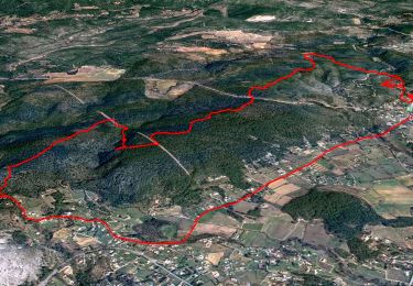
Tocht Stappen van 8,1 km beschikbaar op Provence-Alpes-Côte d'Azur, Var, Tourtour. Deze tocht wordt voorgesteld door gpstracks.
Beschrijving
More information on GPStracks.nl : http://www.gpstracks.nl
Plaatsbepaling
Land:
France
Regio :
Provence-Alpes-Côte d'Azur
Departement/Provincie :
Var
Gemeente :
Tourtour
Locatie:
Unknown
Vertrek:(Dec)
Vertrek:(UTM)
282415 ; 4829634 (32T) N.
Opmerkingen
Wandeltochten in de omgeving
2023-10-31 Villecroz - Tourtour et tourisme
Stappen
Medium
Villecroze,
Provence-Alpes-Côte d'Azur,
Var,
France
5h 28min
Ja
Tourtour - Les Moulières
Stappen
Medium
(1)
Tourtour,
Provence-Alpes-Côte d'Azur,
Var,
France
13,1 km | 15,6 km-effort
5h 0min
Ja
fox
Andere activiteiten
Medium
(1)
Villecroze,
Provence-Alpes-Côte d'Azur,
Var,
France
42 km | 52 km-effort
2h 24min
Ja
st bart
Mountainbike
Moeilijk
(1)
Villecroze,
Provence-Alpes-Côte d'Azur,
Var,
France
33 km | 42 km-effort
2h 20min
Ja
giant vs haibike
Mountainbike
Medium
(1)
Villecroze,
Provence-Alpes-Côte d'Azur,
Var,
France
29 km | 36 km-effort
1h 49min
Ja
Villecroze- Domaine Saint Jean
Stappen
Gemakkelijk
Villecroze,
Provence-Alpes-Côte d'Azur,
Var,
France
4,3 km | 5,4 km-effort
1h 16min
Neen
Autour de Villecroze - Chapelles, Parcs et jardins
Stappen
Medium
Villecroze,
Provence-Alpes-Côte d'Azur,
Var,
France
15,8 km | 21 km-effort
7h 0min
Ja
Villecroze de Chapelles en Grottes
Stappen
Zeer moeilijk
Villecroze,
Provence-Alpes-Côte d'Azur,
Var,
France
19,9 km | 28 km-effort
5h 49min
Ja
Villecroze - Chapelle Saint Victor - Pont Gourgeon - Jardin botanique
Stappen
Medium
Villecroze,
Provence-Alpes-Côte d'Azur,
Var,
France
15,1 km | 21 km-effort
4h 26min
Ja
Daphne ?
Daphne ?