


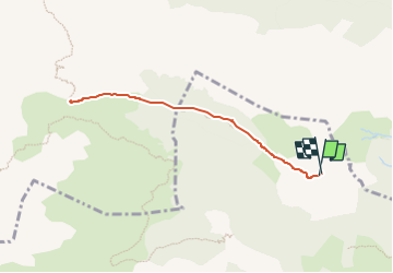

5,4 km | 7,4 km-effort


Gebruiker GUIDE


Gratisgps-wandelapplicatie
 SityTrail
IGN / Geografische instituten
SityTrail World
De wereld gaat voor u open
Tocht Te voet van 7,3 km beschikbaar op Nieuw-Aquitanië, Pyrénées-Atlantiques, Lescun. Deze tocht wordt voorgesteld door marmotte65.
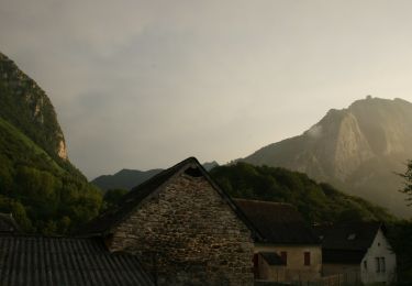
Beau G4 avant peut être qu'une piste quad et 4X4 pour les bergers (2 cabanes concernées) ne vienne entacher ce beau paysage de Lescun

Stappen

Stappen

Te voet

Te voet

Te voet

Te voet
Te voet

Te voet

Stappen