


29 km | 35 km-effort

Gebruiker


Gratisgps-wandelapplicatie
 SityTrail
IGN / Geografische instituten
SityTrail World
De wereld gaat voor u open
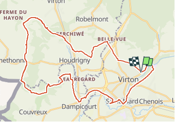
Tocht Mountainbike van 24 km beschikbaar op Wallonië, Luxemburg, Virton. Deze tocht wordt voorgesteld door Pascal L.
Départ/Retour: Virton (Delhaize)
Endrois de passage: Grange au Bois, Houdrigny, Moulin de Berchiwé, La Chevratte, Bois de Lavau, Naue Godin, Bois d'Arrentement, Bois de Mont Rivaux, Bois de Dampicourt, Rue du Moulin (La Chevratte), Rouvroy, Gare de Virton, Vieux-Virton, Solumont (Ravel 155); Pierrard.
Video: https://vimeo.com/668949739
Lat: 49.565839, Lng: 5.459696
Ref. https://www.meix-devant-virton.be/ma-commune/decouvrir/geographie/nos-villages/sommethonne , https://fr.wikipedia.org/wiki/Sommethonne
(2021.05.09)


Stappen

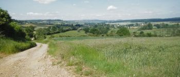
Mountainbike

Stappen

Te voet

Stappen

Stappen


Mountainbike

Mountainbike