


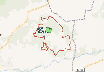

12,2 km | 15,9 km-effort


Gebruiker


Gratisgps-wandelapplicatie
 SityTrail
IGN / Geografische instituten
SityTrail World
De wereld gaat voor u open
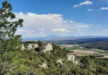
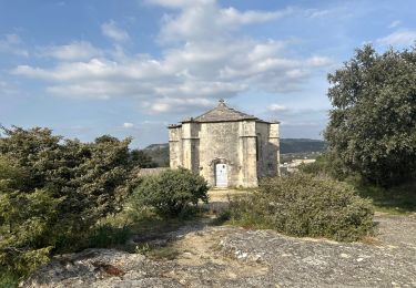
Tocht Mountainbike van 8,5 km beschikbaar op Provence-Alpes-Côte d'Azur, Vaucluse, Bollène. Deze tocht wordt voorgesteld door lespoulpes.
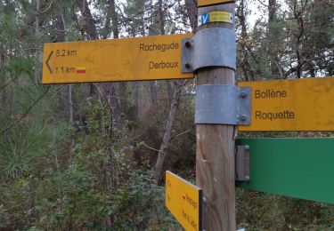
Parcours 7Km Balisé pour course à pied.
Balade facile à faire avec les enfants en vélo.
Suivre les points bleue.
Départ camping de la Simioune.

Stappen
Stappen

Stappen

Stappen

Stappen
Te voet
Stappen

sport
Stappen