![](/images/other/stat-length.png)
![Tocht Lopen Colmar - Boucle Dachsbulh Colmar Course - Photo](https://media.geolcdn.com/t/1900/400/6aa33e0b-f76d-4fe7-bcd9-22d6766b2e29.jpg&format=pjpeg&maxdim=2)
Boucle Dachsbulh Colmar Course
zazie
Gebruiker
![Lengte](/images/other/stat-length.png)
Lengte
11 km
![Max. hoogte](https://static1.geolcdn.com/siteimages/upload/files/1508320355ic_sort_altitude_max_24dp.png)
Max. hoogte
201 m
![Positief hoogteverschil](https://static1.geolcdn.com/siteimages/upload/files/1508320355ic_sort_den_pos_24dp.png)
Positief hoogteverschil
87 m
![Km-Effort](/images/other/stat-length.png)
Km-Effort
12,1 km
![Min. hoogte](https://static1.geolcdn.com/siteimages/upload/files/1508320355ic_sort_altitude_min_24dp.png)
Min. hoogte
183 m
![Negatief hoogteverschil](https://static1.geolcdn.com/siteimages/upload/files/1508320355ic_sort_den_neg_24dp.png)
Negatief hoogteverschil
90 m
![Boucle](https://static1.geolcdn.com/siteimages/upload/files/16400158638029165_repeat_loop_refresh_sync_direction_icon.png)
Boucle
Ja
Datum van aanmaak :
2021-05-02 07:17:38.977
Laatste wijziging :
2021-05-02 08:29:01.235
![Lopen](https://static1.geolcdn.com/sitytour/trail-icons/103.png)
1h01
Moeilijkheid : Heel gemakkelijk
![Scan deze QR-code om de tocht te openen in de SityTrail-applicatie](https://capi.geolives.com/qq0zvz2zws4bq2lad0pu/sitytour/trails/2769705/qr.png?size=200)
Gratisgps-wandelapplicatie
Over ons
Tocht Lopen van 11 km beschikbaar op Grand Est, Haut-Rhin, Colmar. Deze tocht wordt voorgesteld door zazie.
Beschrijving
Circuit pour course, traversée de routes et le long de l'autoroute, donc avec des 🎧, c'est supportable.
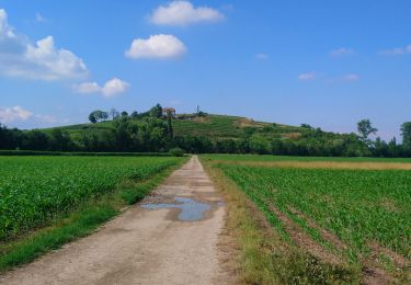
Parcours varié en sous nous lignes droites petites pentes.
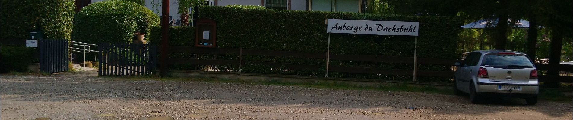
Ne pas hésiter à réserver à l'auberge, cuisine très bonne et terrasse agréable.
Plaatsbepaling
Land:
France
Regio :
Grand Est
Departement/Provincie :
Haut-Rhin
Gemeente :
Colmar
Locatie:
Unknown
Vertrek:(Dec)
Vertrek:(UTM)
379299 ; 5324183 (32U) N.
Opmerkingen
Wandeltochten in de omgeving
![Tocht Lopen Colmar - Covid-19 - A la recherche du cercle parfait - Photo](https://media.geolcdn.com/t/375/260/ext.jpg?maxdim=2&url=https%3A%2F%2Fstatic1.geolcdn.com%2Fsiteimages%2Fupload%2Ffiles%2F1524743154running.jpg)
![Lopen Lopen](https://static1.geolcdn.com/sitytour/trail-icons/103.png)
Covid-19 - A la recherche du cercle parfait
Lopen
Heel gemakkelijk
(1)
Colmar,
Grand Est,
Haut-Rhin,
France
![](/images/other/stat-length.png)
11,2 km | 11,9 km-effort
1h 0min
![](https://static1.geolcdn.com/siteimages/upload/files/16400158638029165_repeat_loop_refresh_sync_direction_icon.png)
Ja
![Tocht Stappen Colmar - grand tour de Colmar - Photo](https://media.geolcdn.com/t/375/260/ext.jpg?maxdim=2&url=https%3A%2F%2Fstatic1.geolcdn.com%2Fsiteimages%2Fupload%2Ffiles%2F1553511878bg_sport_marche.png)
![Stappen Stappen](https://static1.geolcdn.com/sitytour/trail-icons/101.png)
grand tour de Colmar
Stappen
Heel gemakkelijk
(1)
Colmar,
Grand Est,
Haut-Rhin,
France
![](/images/other/stat-length.png)
4,7 km | 5,1 km-effort
1h 22min
![](https://static1.geolcdn.com/siteimages/upload/files/16400158638029165_repeat_loop_refresh_sync_direction_icon.png)
Ja
![Tocht Stappen Colmar - Colmar petite Venise - Photo](https://media.geolcdn.com/t/375/260/cb1a55ed-d7ca-476a-8a88-d48c10da04cb.jpg&format=jpg&maxdim=2)
![Stappen Stappen](https://static1.geolcdn.com/sitytour/trail-icons/101.png)
Colmar petite Venise
Stappen
Colmar,
Grand Est,
Haut-Rhin,
France
![](/images/other/stat-length.png)
9,3 km | 10,1 km-effort
3h 16min
![](https://static1.geolcdn.com/siteimages/upload/files/16400158638029165_repeat_loop_refresh_sync_direction_icon.png)
Ja
![Tocht Stappen Colmar - TREK ALSACIEN (balade découverte de Colmar) - Photo](https://media.geolcdn.com/t/375/260/e8ad7e37-631a-4269-a9e6-75a8f9f64336.jpg&format=jpg&maxdim=2)
![Stappen Stappen](https://static1.geolcdn.com/sitytour/trail-icons/101.png)
TREK ALSACIEN (balade découverte de Colmar)
Stappen
Heel gemakkelijk
Colmar,
Grand Est,
Haut-Rhin,
France
![](/images/other/stat-length.png)
6,4 km | 7 km-effort
2h 50min
![](https://static1.geolcdn.com/siteimages/upload/files/16400158638029165_repeat_loop_refresh_sync_direction_icon.png)
Ja
![Tocht Mountainbike Andolsheim - VTT 15/11/22 effectuée - Photo](https://media.geolcdn.com/t/375/260/ext.jpg?maxdim=2&url=https%3A%2F%2Fstatic1.geolcdn.com%2Fsiteimages%2Fupload%2Ffiles%2F1524743154velo.jpg)
![Mountainbike Mountainbike](https://static1.geolcdn.com/sitytour/trail-icons/202.png)
VTT 15/11/22 effectuée
Mountainbike
Gemakkelijk
(1)
Andolsheim,
Grand Est,
Haut-Rhin,
France
![](/images/other/stat-length.png)
11,6 km | 12,5 km-effort
1h 26min
![](https://static1.geolcdn.com/siteimages/upload/files/16400158638029165_repeat_loop_refresh_sync_direction_icon.png)
Neen
![Tocht Stappen Colmar - Sur un parcours d'une course d'orientation - Photo](https://media.geolcdn.com/t/375/260/c8a73b1e-1924-4d74-bfc8-611dd53e5910.jpg&format=jpg&maxdim=2)
![Stappen Stappen](https://static1.geolcdn.com/sitytour/trail-icons/101.png)
Sur un parcours d'une course d'orientation
Stappen
Heel gemakkelijk
Colmar,
Grand Est,
Haut-Rhin,
France
![](/images/other/stat-length.png)
4,6 km | 5 km-effort
51min
![](https://static1.geolcdn.com/siteimages/upload/files/16400158638029165_repeat_loop_refresh_sync_direction_icon.png)
Neen
![Tocht Hybride fiets Colmar - Vélo randonnée Colmar Guebwiller - Photo](https://media.geolcdn.com/t/375/260/6cf00bf4-257c-4f82-9b53-86096a3e95e9.jpg&format=jpg&maxdim=2)
![Hybride fiets Hybride fiets](https://static1.geolcdn.com/sitytour/trail-icons/203.png)
Vélo randonnée Colmar Guebwiller
Hybride fiets
Gemakkelijk
Colmar,
Grand Est,
Haut-Rhin,
France
![](/images/other/stat-length.png)
59 km | 64 km-effort
3h 29min
![](https://static1.geolcdn.com/siteimages/upload/files/16400158638029165_repeat_loop_refresh_sync_direction_icon.png)
Ja
![Te voet Te voet](https://static1.geolcdn.com/sitytour/trail-icons/100.png)
Colmar centre Enseignes
Te voet
Gemakkelijk
Colmar,
Grand Est,
Haut-Rhin,
France
![](/images/other/stat-length.png)
4,8 km | 5,2 km-effort
Onbekend
![](https://static1.geolcdn.com/siteimages/upload/files/16400158638029165_repeat_loop_refresh_sync_direction_icon.png)
Ja
![Tocht Stappen Colmar - Willer sur Thur - Grand Ballon- Willer sur Thur - Photo](https://media.geolcdn.com/t/375/260/c1b49f34-58de-40fa-a641-c3caa279b53a.jpg&format=jpg&maxdim=2)
![Stappen Stappen](https://static1.geolcdn.com/sitytour/trail-icons/101.png)
Willer sur Thur - Grand Ballon- Willer sur Thur
Stappen
Moeilijk
Colmar,
Grand Est,
Haut-Rhin,
France
![](/images/other/stat-length.png)
51 km | 0 m-effort
5h 34min
![](https://static1.geolcdn.com/siteimages/upload/files/16400158638029165_repeat_loop_refresh_sync_direction_icon.png)
Neen