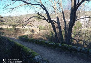
13,1 km | 19,5 km-effort
J C G
horace30900
Gebruiker
Lengte
13,8 km
Max. hoogte
599 m
Positief hoogteverschil
471 m
Km-Effort
20 km
Min. hoogte
213 m
Negatief hoogteverschil
472 m
Boucle
Ja
Datum van aanmaak :
2014-12-10 00:00:00.0
Laatste wijziging :
2014-12-10 00:00:00.0
--
Moeilijkheid : Medium
Gratisgps-wandelapplicatie
Over ons
Tocht Stappen van 13,8 km beschikbaar op Occitanië, Gard, Lasalle. Deze tocht wordt voorgesteld door horace30900.
Beschrijving
Randonnée au coeur des Cévennes 18 km
Plaatsbepaling
Land:
France
Regio :
Occitanië
Departement/Provincie :
Gard
Gemeente :
Lasalle
Locatie:
Unknown
Vertrek:(Dec)
Vertrek:(UTM)
568521 ; 4877316 (31T) N.
Opmerkingen
Wandeltochten in de omgeving
Vallée Salindrenque
Stappen
Moeilijk
Soudorgues,
Occitanië,
Gard,
France
19,4 km | 30 km-effort
6h 20min
Ja
LASALLE - SAINTE-CROIX-DE-CADERLE – CALVIAC - 8.3Km - 02h30 - Dénivelé 352 m
Stappen
Moeilijk
(1)
Lasalle,
Occitanië,
Gard,
France
12,8 km | 19,1 km-effort
3h 59min
Ja
30 le mauripe 12/01/25
Stappen
Medium
Soudorgues,
Occitanië,
Gard,
France
6,8 km | 11,7 km-effort
4h 5min
Ja
Sainte croix de caderne
Stappen
Moeilijk
Sainte-Croix-de-Caderle,
Occitanië,
Gard,
France
19,4 km | 30 km-effort
7h 11min
Ja
30 du Cayrel au Camp Barrat 20/02/24
Te voet
Medium
Colognac,
Occitanië,
Gard,
France
16 km | 25 km-effort
5h 38min
Ja
Lasalle
Stappen
Zeer moeilijk
Lasalle,
Occitanië,
Gard,
France
15,3 km | 22 km-effort
10h 52min
Neen
vallée Salindrenque autour de Lasalle
Stappen
Medium
Lasalle,
Occitanië,
Gard,
France
13,3 km | 19,7 km-effort
5h 9min
Ja