![](/images/other/stat-length.png)
![Tocht Stappen Les Ollières-sur-Eyrieux - la croix du banc - Photo](https://media.geolcdn.com/t/1900/400/d82c3cd3-35d0-4e92-bd70-cb6fc678571a.jpg&format=pjpeg&maxdim=2)
la croix du banc
AIGUIER
Gebruiker
![Lengte](/images/other/stat-length.png)
![Max. hoogte](https://static1.geolcdn.com/siteimages/upload/files/1508320355ic_sort_altitude_max_24dp.png)
![Positief hoogteverschil](https://static1.geolcdn.com/siteimages/upload/files/1508320355ic_sort_den_pos_24dp.png)
![Km-Effort](/images/other/stat-length.png)
![Min. hoogte](https://static1.geolcdn.com/siteimages/upload/files/1508320355ic_sort_altitude_min_24dp.png)
![Negatief hoogteverschil](https://static1.geolcdn.com/siteimages/upload/files/1508320355ic_sort_den_neg_24dp.png)
![Boucle](https://static1.geolcdn.com/siteimages/upload/files/16400158638029165_repeat_loop_refresh_sync_direction_icon.png)
![Stappen](https://static1.geolcdn.com/sitytour/trail-icons/101.png)
4h27
Moeilijkheid : Medium
![Scan deze QR-code om de tocht te openen in de SityTrail-applicatie](https://capi.geolives.com/qq0zvz2zws4bq2lad0pu/sitytour/trails/2730980/qr.png?size=200)
Gratisgps-wandelapplicatie
Over ons
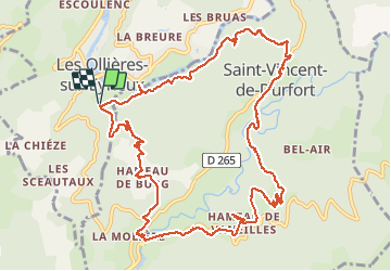
Tocht Stappen van 13,6 km beschikbaar op Auvergne-Rhône-Alpes, Ardèche, Les Ollières-sur-Eyrieux. Deze tocht wordt voorgesteld door AIGUIER.
Beschrijving
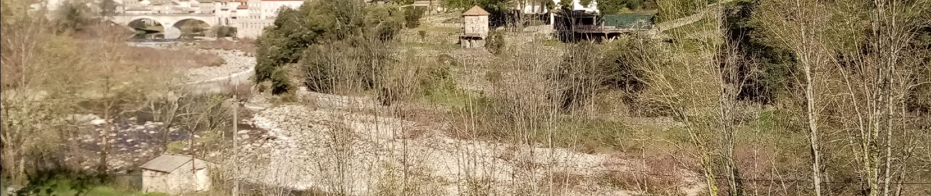
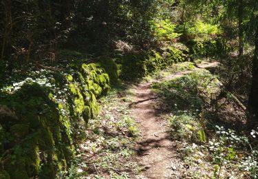
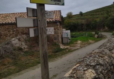
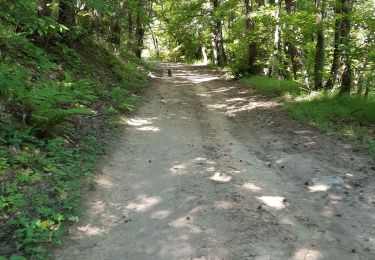
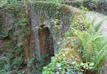
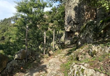
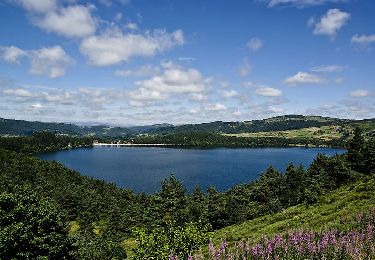
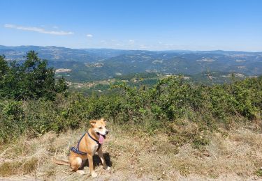
Magnifique rando, Village des Ollières sur l’Eyrieux. Multiples petits sentiers, Hameau de Vaneilles
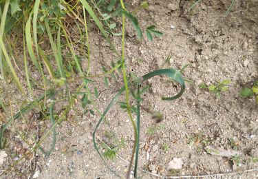
à voir les mosaïques. Passage sur ruisseau, grimpette corsée dans un sous bois. Jardin splendide et ludique ouvert à tous les passants. Hameau de Chambon de Bavas, passage sous maisons. Merveilleux paysage, arbre Houx avec ses fruits rouges. Journée agréable avec du soleil chaud.
Plaatsbepaling
Opmerkingen
Wandeltochten in de omgeving
![Tocht Stappen Saint-Michel-de-Chabrillanoux - 07 st Michel de chabrillanoux 19.05.24 - Photo](https://media.geolcdn.com/t/375/260/9f01ef04-ea67-4f25-9a7e-6220ab4ae4e0.jpg&format=jpg&maxdim=2)
![Stappen Stappen](https://static1.geolcdn.com/sitytour/trail-icons/101.png)
Stappen
![](/images/other/stat-length.png)
![](https://static1.geolcdn.com/siteimages/upload/files/16400158638029165_repeat_loop_refresh_sync_direction_icon.png)
![Tocht Stappen Pranles - 07 chirouze prandes - Photo](https://media.geolcdn.com/t/375/260/410f3c87-d596-4d9a-9969-d749769d3ba9.jpg&format=jpg&maxdim=2)
![Stappen Stappen](https://static1.geolcdn.com/sitytour/trail-icons/101.png)
Stappen
![](/images/other/stat-length.png)
![](https://static1.geolcdn.com/siteimages/upload/files/16400158638029165_repeat_loop_refresh_sync_direction_icon.png)
![Tocht Stappen Saint-Fortunat-sur-Eyrieux - 07 st fortunat dubieres st Vincent dufort - Photo](https://media.geolcdn.com/t/375/260/c34c03c4-9768-4a05-aafb-3fcd76453ebb.jpg&format=jpg&maxdim=2)
![Stappen Stappen](https://static1.geolcdn.com/sitytour/trail-icons/101.png)
Stappen
![](/images/other/stat-length.png)
![](https://static1.geolcdn.com/siteimages/upload/files/16400158638029165_repeat_loop_refresh_sync_direction_icon.png)
![Tocht Stappen Les Ollières-sur-Eyrieux - 07 ollieres sur eyrieux Gruas - Photo](https://media.geolcdn.com/t/375/260/9ffda187-d312-43bf-86a6-ea773d0d4ffe.jpg&format=jpg&maxdim=2)
![Stappen Stappen](https://static1.geolcdn.com/sitytour/trail-icons/101.png)
Stappen
![](/images/other/stat-length.png)
![](https://static1.geolcdn.com/siteimages/upload/files/16400158638029165_repeat_loop_refresh_sync_direction_icon.png)
![Tocht sport Pranles - Volcan des Chirouses - Azur - Photo](https://media.geolcdn.com/t/375/260/e60b1bfd-acf1-4756-a1be-a13c787b6ba0.jpg&format=jpg&maxdim=2)
sport
![](/images/other/stat-length.png)
![](https://static1.geolcdn.com/siteimages/upload/files/16400158638029165_repeat_loop_refresh_sync_direction_icon.png)
![Tocht Wegfiets Saint-Fortunat-sur-Eyrieux - 07 st Fortunat st agreve vv - Photo](https://media.geolcdn.com/t/375/260/8f83dac9-764a-4d77-bc61-77b94ef715b6.jpg&format=jpg&maxdim=2)
![Wegfiets Wegfiets](https://static1.geolcdn.com/sitytour/trail-icons/201.png)
Wegfiets
![](/images/other/stat-length.png)
![](https://static1.geolcdn.com/siteimages/upload/files/16400158638029165_repeat_loop_refresh_sync_direction_icon.png)
![Tocht Stappen Saint-Sauveur-de-Montagut - photos de Saint-Sauveur Montagut - Photo](https://media.geolcdn.com/t/375/260/6f802caa-1bc0-44fb-aa94-5404077a498d.jpg&format=jpg&maxdim=2)
![Stappen Stappen](https://static1.geolcdn.com/sitytour/trail-icons/101.png)
Stappen
![](/images/other/stat-length.png)
![](https://static1.geolcdn.com/siteimages/upload/files/16400158638029165_repeat_loop_refresh_sync_direction_icon.png)
![Tocht Stappen Pranles - Volcan de Chirouse 14 km. - Photo](https://media.geolcdn.com/t/375/260/aa0a374f-85d6-48cb-ab24-139c041e256a.jpeg&format=jpg&maxdim=2)
![Stappen Stappen](https://static1.geolcdn.com/sitytour/trail-icons/101.png)
Stappen
![](/images/other/stat-length.png)
![](https://static1.geolcdn.com/siteimages/upload/files/16400158638029165_repeat_loop_refresh_sync_direction_icon.png)
![Tocht Stappen Saint-Vincent-de-Durfort - croix de grua - Photo](https://media.geolcdn.com/t/375/260/8757bbe0-ad12-42b9-b0e8-88a1f3bf1001.jpg&format=jpg&maxdim=2)
![Stappen Stappen](https://static1.geolcdn.com/sitytour/trail-icons/101.png)
Stappen
![](/images/other/stat-length.png)
![](https://static1.geolcdn.com/siteimages/upload/files/16400158638029165_repeat_loop_refresh_sync_direction_icon.png)