![](/images/other/stat-length.png)
Baou de la Gaude, Mouton d'Anou et Monséguise
aris
Gebruiker
![Lengte](/images/other/stat-length.png)
![Max. hoogte](https://static1.geolcdn.com/siteimages/upload/files/1508320355ic_sort_altitude_max_24dp.png)
![Positief hoogteverschil](https://static1.geolcdn.com/siteimages/upload/files/1508320355ic_sort_den_pos_24dp.png)
![Km-Effort](/images/other/stat-length.png)
![Min. hoogte](https://static1.geolcdn.com/siteimages/upload/files/1508320355ic_sort_altitude_min_24dp.png)
![Negatief hoogteverschil](https://static1.geolcdn.com/siteimages/upload/files/1508320355ic_sort_den_neg_24dp.png)
![Boucle](https://static1.geolcdn.com/siteimages/upload/files/16400158638029165_repeat_loop_refresh_sync_direction_icon.png)
![Stappen](https://static1.geolcdn.com/sitytour/trail-icons/101.png)
7h47
Moeilijkheid : Moeilijk
![Scan deze QR-code om de tocht te openen in de SityTrail-applicatie](https://capi.geolives.com/qq0zvz2zws4bq2lad0pu/sitytour/trails/2715839/qr.png?size=200)
Gratisgps-wandelapplicatie
Over ons
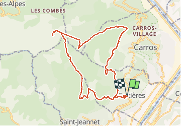
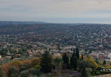
Tocht Stappen van 23 km beschikbaar op Provence-Alpes-Côte d'Azur, Alpes-Maritimes, Gattières. Deze tocht wordt voorgesteld door aris.
Beschrijving
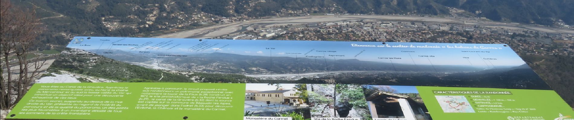
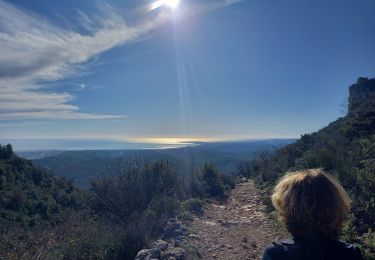
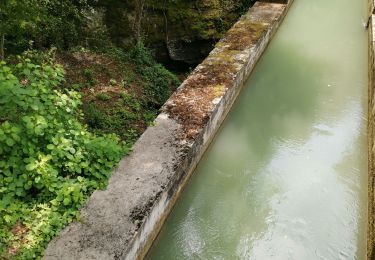
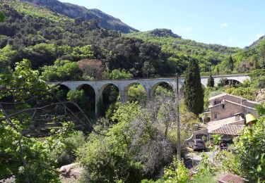
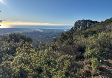
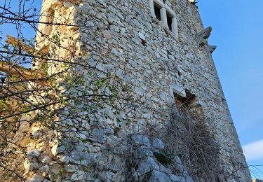
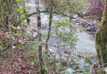
Boucle au départ de Gattières. Montée vers le Baou de la Gaude, puis traversée du plateau jusqu'au Monton d'Anou. Retour par la conduite de gaz jusqu'au vallon de la Sine (borne 57), et remontée vers le plateau de Monséguise. Redescente par la piste (belles vues sur la vallée du Var et les sommets enneigés du Mercantour). A la borne 32, je prends une sente qui suit le canal de la Gravière (pas très entretenue, mais praticable).
Balade assez longue mais bien sympathique.
Plaatsbepaling
Opmerkingen
Wandeltochten in de omgeving
![Tocht Stappen Saint-Jeannet - Baou de Saint-Jeannet - Photo](https://media.geolcdn.com/t/375/260/d4c22365-bd73-4ba1-a46d-47812961244f.jpg&format=jpg&maxdim=2)
![Stappen Stappen](https://static1.geolcdn.com/sitytour/trail-icons/101.png)
Stappen
![](/images/other/stat-length.png)
![](https://static1.geolcdn.com/siteimages/upload/files/16400158638029165_repeat_loop_refresh_sync_direction_icon.png)
![Tocht Stappen Aspremont - Vallon OBSCUR aux portes de Nice - Photo](https://media.geolcdn.com/t/375/260/16c0b49c-5599-47d7-b53d-8d16968f7369.jpg&format=jpg&maxdim=2)
![Stappen Stappen](https://static1.geolcdn.com/sitytour/trail-icons/101.png)
Stappen
![](/images/other/stat-length.png)
![](https://static1.geolcdn.com/siteimages/upload/files/16400158638029165_repeat_loop_refresh_sync_direction_icon.png)
![Tocht Te voet Gattières - Baou de la Gaude - Photo](https://media.geolcdn.com/t/375/260/ab686055-453b-4527-9610-4cf7a5679c21.jpeg&format=jpg&maxdim=2)
![Te voet Te voet](https://static1.geolcdn.com/sitytour/trail-icons/100.png)
Te voet
![](/images/other/stat-length.png)
![](https://static1.geolcdn.com/siteimages/upload/files/16400158638029165_repeat_loop_refresh_sync_direction_icon.png)
![Tocht Te voet Carros - Les Balcons de Carros - Photo](https://media.geolcdn.com/t/375/260/a6a71bca-0b2f-4793-9dae-094488c13d6e.jpeg&format=jpg&maxdim=2)
![Te voet Te voet](https://static1.geolcdn.com/sitytour/trail-icons/100.png)
Te voet
![](/images/other/stat-length.png)
![](https://static1.geolcdn.com/siteimages/upload/files/16400158638029165_repeat_loop_refresh_sync_direction_icon.png)
![Tocht Te voet Saint-Jeannet - Circuit du Castellet - Photo](https://media.geolcdn.com/t/375/260/afc23e4e-bd37-42a8-b455-4fba696582ad.jpeg&format=jpg&maxdim=2)
![Te voet Te voet](https://static1.geolcdn.com/sitytour/trail-icons/100.png)
Te voet
![](/images/other/stat-length.png)
![](https://static1.geolcdn.com/siteimages/upload/files/16400158638029165_repeat_loop_refresh_sync_direction_icon.png)
![Tocht Stappen Saint-Jeannet - St Jeannet : les Baous janv 2025 - Photo](https://media.geolcdn.com/t/375/260/362b31cc-013f-4b2f-a360-d53c75d51365.jpg&format=jpg&maxdim=2)
![Stappen Stappen](https://static1.geolcdn.com/sitytour/trail-icons/101.png)
Stappen
![](/images/other/stat-length.png)
![](https://static1.geolcdn.com/siteimages/upload/files/16400158638029165_repeat_loop_refresh_sync_direction_icon.png)
![Tocht Stappen Saint-Jeannet - Baous de la Gaude et de St Jeannet - Photo](https://media.geolcdn.com/t/375/260/3655e9c4-c4c4-495a-bc74-b57cc8e907b9.jpg&format=jpg&maxdim=2)
![Stappen Stappen](https://static1.geolcdn.com/sitytour/trail-icons/101.png)
Stappen
![](/images/other/stat-length.png)
![](https://static1.geolcdn.com/siteimages/upload/files/16400158638029165_repeat_loop_refresh_sync_direction_icon.png)
![Tocht Stappen La Gaude - La Gaude - Bord de Cagnes - Photo](https://media.geolcdn.com/t/375/260/09cd4e62-6c8c-4128-8210-e963af9700c2.jpg&format=jpg&maxdim=2)
![Stappen Stappen](https://static1.geolcdn.com/sitytour/trail-icons/101.png)
Stappen
![](/images/other/stat-length.png)
![](https://static1.geolcdn.com/siteimages/upload/files/16400158638029165_repeat_loop_refresh_sync_direction_icon.png)
![Tocht Stappen Saint-Jeannet - st jeannet - Photo](https://media.geolcdn.com/t/375/260/a4bcc2c3-eea6-4458-b57e-d23c780581d8.jpg&format=jpg&maxdim=2)
![Stappen Stappen](https://static1.geolcdn.com/sitytour/trail-icons/101.png)
Stappen
![](/images/other/stat-length.png)
![](https://static1.geolcdn.com/siteimages/upload/files/16400158638029165_repeat_loop_refresh_sync_direction_icon.png)