![](/images/other/stat-length.png)
![Tocht Stappen Anthisnes - Anthines - AS03 - Boucle de Tolumont - Losange Bleu - Photo](https://media.geolcdn.com/t/1900/400/a3413dfd-3361-4d9b-b91d-7efec18943a3.jpg&format=pjpeg&maxdim=2)
Anthines - AS03 - Boucle de Tolumont - Losange Bleu
Alfredy
Gebruiker GUIDE
![Lengte](/images/other/stat-length.png)
Lengte
13,9 km
![Max. hoogte](https://static1.geolcdn.com/siteimages/upload/files/1508320355ic_sort_altitude_max_24dp.png)
Max. hoogte
280 m
![Positief hoogteverschil](https://static1.geolcdn.com/siteimages/upload/files/1508320355ic_sort_den_pos_24dp.png)
Positief hoogteverschil
320 m
![Km-Effort](/images/other/stat-length.png)
Km-Effort
18,2 km
![Min. hoogte](https://static1.geolcdn.com/siteimages/upload/files/1508320355ic_sort_altitude_min_24dp.png)
Min. hoogte
182 m
![Negatief hoogteverschil](https://static1.geolcdn.com/siteimages/upload/files/1508320355ic_sort_den_neg_24dp.png)
Negatief hoogteverschil
327 m
![Boucle](https://static1.geolcdn.com/siteimages/upload/files/16400158638029165_repeat_loop_refresh_sync_direction_icon.png)
Boucle
Ja
Datum van aanmaak :
2021-03-07 11:54:40.0
Laatste wijziging :
2021-03-08 10:35:24.681
![Stappen](https://static1.geolcdn.com/sitytour/trail-icons/101.png)
2h56
Moeilijkheid : Medium
![Scan deze QR-code om de tocht te openen in de SityTrail-applicatie](https://capi.geolives.com/qq0zvz2zws4bq2lad0pu/sitytour/trails/2698724/qr.png?size=200)
Gratisgps-wandelapplicatie
Over ons
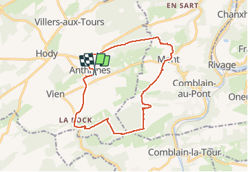
Tocht Stappen van 13,9 km beschikbaar op Wallonië, Luik, Anthisnes. Deze tocht wordt voorgesteld door Alfredy.
Beschrijving
Suivez le balisage Losange Bleu.
Très agréable randonnée d'environ 3 heures.
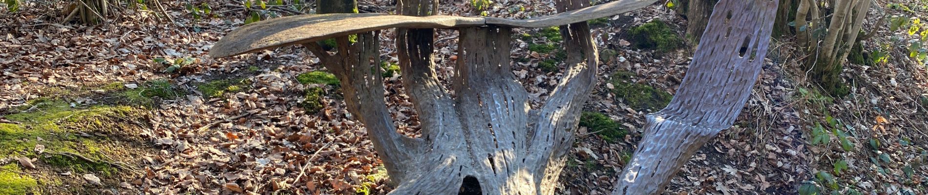
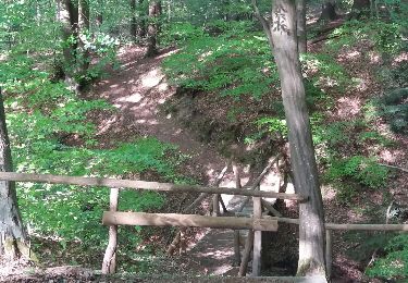
Plaatsbepaling
Land:
Belgium
Regio :
Wallonië
Departement/Provincie :
Luik
Gemeente :
Anthisnes
Locatie:
Anthisnes
Vertrek:(Dec)
Vertrek:(UTM)
679100 ; 5595019 (31U) N.
Opmerkingen
Wandeltochten in de omgeving
![Tocht Stappen Esneux - Esneux bois du mary - Photo](https://media.geolcdn.com/t/375/260/71c77441-f9b7-4220-bb0a-fbf9c3317653.jpg&format=jpg&maxdim=2)
![Stappen Stappen](https://static1.geolcdn.com/sitytour/trail-icons/101.png)
Esneux bois du mary
Stappen
Gemakkelijk
(5)
Esneux,
Wallonië,
Luik,
Belgium
![](/images/other/stat-length.png)
4,4 km | 5,9 km-effort
1h 11min
![](https://static1.geolcdn.com/siteimages/upload/files/16400158638029165_repeat_loop_refresh_sync_direction_icon.png)
Ja
![Tocht Stappen Anthisnes - RB-Lg-18_Tavier - Photo](https://media.geolcdn.com/t/375/260/ext.jpg?maxdim=2&url=https%3A%2F%2Fservices.sitytrail.com%2FGeolivesWS%2FDownloadMedia.ashx%3FTrailID%3D400569%26Media%3D8137f08d-271c-4dcb-b2bd-96adf6706999.jpg)
![Stappen Stappen](https://static1.geolcdn.com/sitytour/trail-icons/101.png)
RB-Lg-18_Tavier
Stappen
Zeer moeilijk
(10)
Anthisnes,
Wallonië,
Luik,
Belgium
![](/images/other/stat-length.png)
22 km | 28 km-effort
6h 19min
![](https://static1.geolcdn.com/siteimages/upload/files/16400158638029165_repeat_loop_refresh_sync_direction_icon.png)
Ja
![Stappen Stappen](https://static1.geolcdn.com/sitytour/trail-icons/101.png)
RB-Lg-11 - Sur les crêtes de l’Amblève
Stappen
Moeilijk
(15)
Comblain-au-Pont,
Wallonië,
Luik,
Belgium
![](/images/other/stat-length.png)
22 km | 30 km-effort
5h 45min
![](https://static1.geolcdn.com/siteimages/upload/files/16400158638029165_repeat_loop_refresh_sync_direction_icon.png)
Ja
![Tocht Stappen Comblain-au-Pont - RF-Lg-04_Comblain-au-Pont_Grande-boucle - Photo](https://media.geolcdn.com/t/375/260/b6c1584e-1801-407f-b05d-19d8f1862ff5.jpg&format=jpg&maxdim=2)
![Stappen Stappen](https://static1.geolcdn.com/sitytour/trail-icons/101.png)
RF-Lg-04_Comblain-au-Pont_Grande-boucle
Stappen
Heel gemakkelijk
(8)
Comblain-au-Pont,
Wallonië,
Luik,
Belgium
![](/images/other/stat-length.png)
12,6 km | 16,5 km-effort
3h 22min
![](https://static1.geolcdn.com/siteimages/upload/files/16400158638029165_repeat_loop_refresh_sync_direction_icon.png)
Ja
![Tocht Stappen Comblain-au-Pont - 2021-06-30_15h22m22_Cirkwi-Autour_de_Comblain-au-Pont_-_Promenade_3___Four_à_chaux_-_Mont_-_Poulseur_-_Canal_de_l_Ourthe_-_Rivage - Photo](https://media.geolcdn.com/t/375/260/e3bd39c1-3623-4715-901d-7409f699ba3a.jpg&format=jpg&maxdim=2)
![Stappen Stappen](https://static1.geolcdn.com/sitytour/trail-icons/101.png)
2021-06-30_15h22m22_Cirkwi-Autour_de_Comblain-au-Pont_-_Promenade_3___Four_à_...
Stappen
Gemakkelijk
(2)
Comblain-au-Pont,
Wallonië,
Luik,
Belgium
![](/images/other/stat-length.png)
12,7 km | 15,3 km-effort
3h 28min
![](https://static1.geolcdn.com/siteimages/upload/files/16400158638029165_repeat_loop_refresh_sync_direction_icon.png)
Ja
![Tocht Stappen Comblain-au-Pont - 2021-05-13_19h25m39_Cirkwi-Autour_de_Comblain-au-Pont_-_Promenade_10___Thier_Pirard_-_Hoyemont_-_Comblinay_-_Comblain-la-Tour_-_Comblain-au-Pont - Photo](https://media.geolcdn.com/t/375/260/978e853c-be9c-453e-b61f-b42dde075b4b.jpg&format=jpg&maxdim=2)
![Stappen Stappen](https://static1.geolcdn.com/sitytour/trail-icons/101.png)
2021-05-13_19h25m39_Cirkwi-Autour_de_Comblain-au-Pont_-_Promenade_10___Thier_...
Stappen
Medium
(3)
Comblain-au-Pont,
Wallonië,
Luik,
Belgium
![](/images/other/stat-length.png)
14 km | 18,1 km-effort
4h 6min
![](https://static1.geolcdn.com/siteimages/upload/files/16400158638029165_repeat_loop_refresh_sync_direction_icon.png)
Ja
![Tocht Stappen Comblain-au-Pont - 2021-04-04_15h31m49_Cirkwi-Autour_de_Comblain-au-Pont_-_Promenade_9___Grotte_-_Raideux_-_Anthisnes_-_Les_Stepennes_-_Géromont - Photo](https://media.geolcdn.com/t/375/260/edfd852c-0012-45e6-9a23-c8c8cd48cf84.jpg&format=jpg&maxdim=2)
![Stappen Stappen](https://static1.geolcdn.com/sitytour/trail-icons/101.png)
2021-04-04_15h31m49_Cirkwi-Autour_de_Comblain-au-Pont_-_Promenade_9___Grotte_...
Stappen
Gemakkelijk
(2)
Comblain-au-Pont,
Wallonië,
Luik,
Belgium
![](/images/other/stat-length.png)
11,2 km | 14,3 km-effort
3h 15min
![](https://static1.geolcdn.com/siteimages/upload/files/16400158638029165_repeat_loop_refresh_sync_direction_icon.png)
Ja
![Tocht Te voet Anthisnes - AS03 Boucle de Tolumont - Photo](https://media.geolcdn.com/t/375/260/bb3be3cf-eddc-4622-8273-ff9944f2671c.jpg&format=jpg&maxdim=2)
![Te voet Te voet](https://static1.geolcdn.com/sitytour/trail-icons/100.png)
AS03 Boucle de Tolumont
Te voet
Medium
(1)
Anthisnes,
Wallonië,
Luik,
Belgium
![](/images/other/stat-length.png)
13,4 km | 17,6 km-effort
3h 20min
![](https://static1.geolcdn.com/siteimages/upload/files/16400158638029165_repeat_loop_refresh_sync_direction_icon.png)
Ja
![Tocht Stappen Esneux - arboretum parc mary . vallée pisserotte . carrière . ry d'oneux - Photo](https://media.geolcdn.com/t/375/260/ext.jpg?maxdim=2&url=https%3A%2F%2Fservices.sitytrail.com%2FGeolivesWS%2FDownloadMedia.ashx%3FTrailID%3D949883%26Media%3Dfix__20180423172523.jpg)
![Stappen Stappen](https://static1.geolcdn.com/sitytour/trail-icons/101.png)
arboretum parc mary . vallée pisserotte . carrière . ry d'oneux
Stappen
Gemakkelijk
(2)
Esneux,
Wallonië,
Luik,
Belgium
![](/images/other/stat-length.png)
9,5 km | 12,8 km-effort
2h 5min
![](https://static1.geolcdn.com/siteimages/upload/files/16400158638029165_repeat_loop_refresh_sync_direction_icon.png)
Ja
Très belle rando et achat de miel au passage après sortie du village de Mont.