


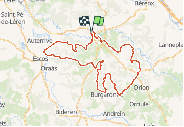

12,4 km | 15,5 km-effort


Gebruiker


Gratisgps-wandelapplicatie
 SityTrail
IGN / Geografische instituten
SityTrail World
De wereld gaat voor u open
Tocht Mountainbike van 45 km beschikbaar op Nieuw-Aquitanië, Pyrénées-Atlantiques, Salies-de-Béarn. Deze tocht wordt voorgesteld door potofe.
Inspiré de : utgtrack-30391
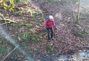
Un gué pas facile, berge abrupte au Km 24,9
Randonnée à faire plutôt par temps sec
07/03/2021
Stappen

Stappen
Stappen

Sneeuwschoenen
Stappen
Stappen


sport
Stappen
Stappen