![](/images/other/stat-length.png)
![Tocht Stappen Arbus - ARBUS boucle du bois de bas M2 reco - Photo](https://media.geolcdn.com/t/1900/400/0be87ab0-cd88-4f67-aff2-a0f6800a6e9e.jpg&format=pjpeg&maxdim=2)
ARBUS boucle du bois de bas M2 reco
marmotte65
Gebruiker GUIDE
![Lengte](/images/other/stat-length.png)
Lengte
7,9 km
![Max. hoogte](https://static1.geolcdn.com/siteimages/upload/files/1508320355ic_sort_altitude_max_24dp.png)
Max. hoogte
272 m
![Positief hoogteverschil](https://static1.geolcdn.com/siteimages/upload/files/1508320355ic_sort_den_pos_24dp.png)
Positief hoogteverschil
252 m
![Km-Effort](/images/other/stat-length.png)
Km-Effort
11,2 km
![Min. hoogte](https://static1.geolcdn.com/siteimages/upload/files/1508320355ic_sort_altitude_min_24dp.png)
Min. hoogte
136 m
![Negatief hoogteverschil](https://static1.geolcdn.com/siteimages/upload/files/1508320355ic_sort_den_neg_24dp.png)
Negatief hoogteverschil
252 m
![Boucle](https://static1.geolcdn.com/siteimages/upload/files/16400158638029165_repeat_loop_refresh_sync_direction_icon.png)
Boucle
Ja
Datum van aanmaak :
2021-02-24 13:02:54.341
Laatste wijziging :
2021-02-24 17:15:15.737
![Stappen](https://static1.geolcdn.com/sitytour/trail-icons/101.png)
2h42
Moeilijkheid : Medium
![Scan deze QR-code om de tocht te openen in de SityTrail-applicatie](https://capi.geolives.com/qq0zvz2zws4bq2lad0pu/sitytour/trails/2683757/qr.png?size=200)
Gratisgps-wandelapplicatie
Over ons
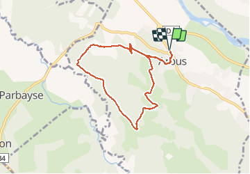
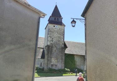
Tocht Stappen van 7,9 km beschikbaar op Nieuw-Aquitanië, Pyrénées-Atlantiques, Arbus. Deze tocht wordt voorgesteld door marmotte65.
Beschrijving
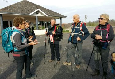
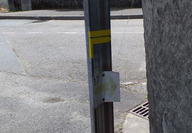
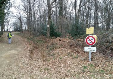
Reco faite du M2 de cette boucle a Arbus.
si le couvre feu reste 18h au mois de Avril il faudra prevoir un plan B.
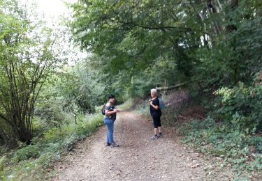
sentier extremement boueux dans certains secteurs, et une denivellée assez musclée pour un mercredi a suivre
Plaatsbepaling
Land:
France
Regio :
Nieuw-Aquitanië
Departement/Provincie :
Pyrénées-Atlantiques
Gemeente :
Arbus
Locatie:
Unknown
Vertrek:(Dec)
Vertrek:(UTM)
702124 ; 4800995 (30T) N.
Opmerkingen
Wandeltochten in de omgeving
![Tocht Mountainbike Abos - Abos - Monein - Abos - Photo](https://media.geolcdn.com/t/375/260/ext.jpg?maxdim=2&url=https%3A%2F%2Fservices.sitytrail.com%2FGeolivesWS%2FDownloadMedia.ashx%3FTrailID%3D106040%26Media%3D10173_1.jpg)
![Mountainbike Mountainbike](https://static1.geolcdn.com/sitytour/trail-icons/202.png)
Abos - Monein - Abos
Mountainbike
Moeilijk
(1)
Abos,
Nieuw-Aquitanië,
Pyrénées-Atlantiques,
France
![](/images/other/stat-length.png)
34 km | 44 km-effort
2h 15min
![](https://static1.geolcdn.com/siteimages/upload/files/16400158638029165_repeat_loop_refresh_sync_direction_icon.png)
Neen
![Tocht Stappen Siros - SIROS Le sentier du gave M2 3143980 - Photo](https://media.geolcdn.com/t/375/260/2adf7da9-eb05-4d5c-bb78-ec6153367b08.jpg&format=jpg&maxdim=2)
![Stappen Stappen](https://static1.geolcdn.com/sitytour/trail-icons/101.png)
SIROS Le sentier du gave M2 3143980
Stappen
Medium
Siros,
Nieuw-Aquitanië,
Pyrénées-Atlantiques,
France
![](/images/other/stat-length.png)
7,9 km | 8,5 km-effort
1h 54min
![](https://static1.geolcdn.com/siteimages/upload/files/16400158638029165_repeat_loop_refresh_sync_direction_icon.png)
Ja
![Tocht Stappen Arbus - ARBUS Le cap d Arrandes N° 47 balisage et signaletique verticale fait le 15/09/2020 - Photo](https://media.geolcdn.com/t/375/260/a2e3dbf3-d618-45af-b80f-84d7f5133529.jpg&format=jpg&maxdim=2)
![Stappen Stappen](https://static1.geolcdn.com/sitytour/trail-icons/101.png)
ARBUS Le cap d Arrandes N° 47 balisage et signaletique verticale fait le 15/0...
Stappen
Gemakkelijk
Arbus,
Nieuw-Aquitanië,
Pyrénées-Atlantiques,
France
![](/images/other/stat-length.png)
4 km | 5,9 km-effort
2h 33min
![](https://static1.geolcdn.com/siteimages/upload/files/16400158638029165_repeat_loop_refresh_sync_direction_icon.png)
Ja
![Tocht Mountainbike Aussevielle - siros labastide aussevielle - Photo](https://media.geolcdn.com/t/375/260/ext.jpg?maxdim=2&url=https%3A%2F%2Fstatic1.geolcdn.com%2Fsiteimages%2Fupload%2Ffiles%2F1524743154velo.jpg)
![Mountainbike Mountainbike](https://static1.geolcdn.com/sitytour/trail-icons/202.png)
siros labastide aussevielle
Mountainbike
Gemakkelijk
(1)
Aussevielle,
Nieuw-Aquitanië,
Pyrénées-Atlantiques,
France
![](/images/other/stat-length.png)
15,6 km | 16,5 km-effort
1h 5min
![](https://static1.geolcdn.com/siteimages/upload/files/16400158638029165_repeat_loop_refresh_sync_direction_icon.png)
Ja
![Tocht Stappen Artiguelouve - ARTIGUELOUVE LA COMMANDE GR653 G4 - Photo](https://media.geolcdn.com/t/375/260/0eb1058d-00a5-4625-be32-6d5c177b89e3.jpg&format=jpg&maxdim=2)
![Stappen Stappen](https://static1.geolcdn.com/sitytour/trail-icons/101.png)
ARTIGUELOUVE LA COMMANDE GR653 G4
Stappen
Medium
Artiguelouve,
Nieuw-Aquitanië,
Pyrénées-Atlantiques,
France
![](/images/other/stat-length.png)
8,4 km | 11 km-effort
2h 29min
![](https://static1.geolcdn.com/siteimages/upload/files/16400158638029165_repeat_loop_refresh_sync_direction_icon.png)
Neen
![Tocht Stappen Beyrie-en-Béarn - BEYRIE en BEARN promenade autour de Beyrie 3180282 - Photo](https://media.geolcdn.com/t/375/260/b77c8a6d-0428-4a7c-aa8b-4febe27ba7e3.jpg&format=jpg&maxdim=2)
![Stappen Stappen](https://static1.geolcdn.com/sitytour/trail-icons/101.png)
BEYRIE en BEARN promenade autour de Beyrie 3180282
Stappen
Moeilijk
Beyrie-en-Béarn,
Nieuw-Aquitanië,
Pyrénées-Atlantiques,
France
![](/images/other/stat-length.png)
10,6 km | 13,4 km-effort
2h 59min
![](https://static1.geolcdn.com/siteimages/upload/files/16400158638029165_repeat_loop_refresh_sync_direction_icon.png)
Ja
![Tocht Stappen Artiguelouve - ARTIGUELOUVE (PPT) balisage N24 les coteaux de la Juscle - Photo](https://media.geolcdn.com/t/375/260/d1007c67-24ef-496a-b525-978ae81d4689.jpg&format=jpg&maxdim=2)
![Stappen Stappen](https://static1.geolcdn.com/sitytour/trail-icons/101.png)
ARTIGUELOUVE (PPT) balisage N24 les coteaux de la Juscle
Stappen
Medium
Artiguelouve,
Nieuw-Aquitanië,
Pyrénées-Atlantiques,
France
![](/images/other/stat-length.png)
11,2 km | 15,8 km-effort
4h 41min
![](https://static1.geolcdn.com/siteimages/upload/files/16400158638029165_repeat_loop_refresh_sync_direction_icon.png)
Ja
![Tocht Stappen Siros - siros n17 nettoyé - Photo](https://media.geolcdn.com/t/375/260/26003ef3-6efd-4473-a02b-5727f30c2cdd.jpg&format=jpg&maxdim=2)
![Stappen Stappen](https://static1.geolcdn.com/sitytour/trail-icons/101.png)
siros n17 nettoyé
Stappen
Heel gemakkelijk
Siros,
Nieuw-Aquitanië,
Pyrénées-Atlantiques,
France
![](/images/other/stat-length.png)
9,2 km | 9,8 km-effort
3h 35min
![](https://static1.geolcdn.com/siteimages/upload/files/16400158638029165_repeat_loop_refresh_sync_direction_icon.png)
Ja
![Tocht Te voet Denguin - DENGUIN (PPT) boucle du trou du loup balisage le 21 01 2020 - Photo](https://media.geolcdn.com/t/375/260/f57a70d9-800b-4dc4-b904-c753d25b20d8.jpg&format=jpg&maxdim=2)
![Te voet Te voet](https://static1.geolcdn.com/sitytour/trail-icons/100.png)
DENGUIN (PPT) boucle du trou du loup balisage le 21 01 2020
Te voet
Heel gemakkelijk
Denguin,
Nieuw-Aquitanië,
Pyrénées-Atlantiques,
France
![](/images/other/stat-length.png)
4 km | 5,4 km-effort
Onbekend
![](https://static1.geolcdn.com/siteimages/upload/files/16400158638029165_repeat_loop_refresh_sync_direction_icon.png)
Ja