


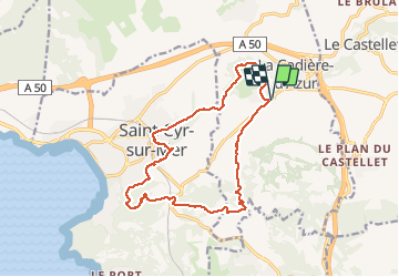


16,1 km | 21 km-effort

Gebruiker


Gratisgps-wandelapplicatie
 SityTrail
IGN / Geografische instituten
SityTrail World
De wereld gaat voor u open
Tocht Stappen van 16,4 km beschikbaar op Provence-Alpes-Côte d'Azur, Var, La Cadière-d'Azur. Deze tocht wordt voorgesteld door chrifor.
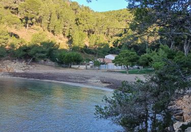
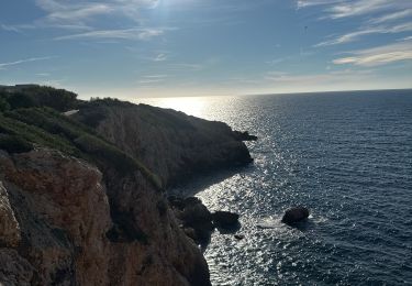
Randonnée (parcourue) agréable entre pinède, vignes et vue sur la sainte Baume et la mer ...si la brume marine n'est pas de la fête!


Stappen

Stappen

Stappen

Noords wandelen
Noords wandelen

Stappen
Stappen
Stappen

Stappen