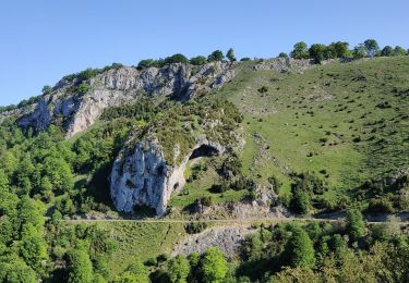
9,8 km | 16,7 km-effort
La Gourgue d' Asque
mitch1952
Gebruiker
Lengte
18,2 km
Max. hoogte
1271 m
Positief hoogteverschil
885 m
Km-Effort
30 km
Min. hoogte
480 m
Negatief hoogteverschil
887 m
Boucle
Ja
Datum van aanmaak :
2021-02-20 15:58:24.851
Laatste wijziging :
2022-06-08 09:13:28.234
6h48
Moeilijkheid : Zeer moeilijk
Gratisgps-wandelapplicatie
Over ons
Tocht Stappen van 18,2 km beschikbaar op Occitanië, Hautes-Pyrénées, Asque. Deze tocht wordt voorgesteld door mitch1952.
Beschrijving
Classée en G1 pour la longueur
Plaatsbepaling
Land:
France
Regio :
Occitanië
Departement/Provincie :
Hautes-Pyrénées
Gemeente :
Asque
Locatie:
Unknown
Vertrek:(Dec)
Vertrek:(UTM)
276974 ; 4767073 (31T) N.
Opmerkingen
Wandeltochten in de omgeving
Asque G3 2023 soum det Raygade
Stappen
Moeilijk
(1)
Asque,
Occitanië,
Hautes-Pyrénées,
France
3h 47min
Ja
FEU 2015 - Etape 3
Stappen
Gemakkelijk
(3)
Esparros,
Occitanië,
Hautes-Pyrénées,
France
23 km | 32 km-effort
6h 45min
Neen
pla de la serre depuis Ste Marie de Campan
Stappen
Medium
Campan,
Occitanië,
Hautes-Pyrénées,
France
9,1 km | 21 km-effort
6h 13min
Ja
Loubetas
Stappen
Gemakkelijk
Asque,
Occitanië,
Hautes-Pyrénées,
France
18,5 km | 26 km-effort
5h 18min
Ja
Signal de Nassia depuis le Pla de Moula après Esparros
Stappen
Moeilijk
Esparros,
Occitanië,
Hautes-Pyrénées,
France
16,1 km | 32 km-effort
4h 36min
Ja
Sentier du Pacte des Loups
Te voet
Gemakkelijk
Asté,
Occitanië,
Hautes-Pyrénées,
France
12,3 km | 16,8 km-effort
3h 48min
Neen
casque de lheris
Stappen
Heel gemakkelijk
Asque,
Occitanië,
Hautes-Pyrénées,
France
11,5 km | 22 km-effort
5h 46min
Neen
batsere G3 fait
Stappen
Heel gemakkelijk
Batsère,
Occitanië,
Hautes-Pyrénées,
France
13 km | 19,4 km-effort
4h 57min
Ja
2019-06-26 vallée de l'Arrose - petite Amazonie - baronie
Stappen
Heel gemakkelijk
(1)
Asque,
Occitanië,
Hautes-Pyrénées,
France
8,3 km | 11,2 km-effort
3h 11min
Ja