![](/images/other/stat-length.png)
![Tocht Noords wandelen Saligney - Saligney - Mont de Vassange - Photo](https://media.geolcdn.com/t/1900/400/ext.pjpeg?maxdim=2&url=https%3A%2F%2Fservices.sitytrail.com%2FGeolivesWS%2FDownloadMedia.ashx%3FTrailID%3D265122%26Media%3Dfix__20140410161220.jpg)
Saligney - Mont de Vassange
albert39
Gebruiker
![Lengte](/images/other/stat-length.png)
Lengte
13,2 km
![Max. hoogte](https://static1.geolcdn.com/siteimages/upload/files/1508320355ic_sort_altitude_max_24dp.png)
Max. hoogte
335 m
![Positief hoogteverschil](https://static1.geolcdn.com/siteimages/upload/files/1508320355ic_sort_den_pos_24dp.png)
Positief hoogteverschil
299 m
![Km-Effort](/images/other/stat-length.png)
Km-Effort
17,1 km
![Min. hoogte](https://static1.geolcdn.com/siteimages/upload/files/1508320355ic_sort_altitude_min_24dp.png)
Min. hoogte
218 m
![Negatief hoogteverschil](https://static1.geolcdn.com/siteimages/upload/files/1508320355ic_sort_den_neg_24dp.png)
Negatief hoogteverschil
297 m
![Boucle](https://static1.geolcdn.com/siteimages/upload/files/16400158638029165_repeat_loop_refresh_sync_direction_icon.png)
Boucle
Ja
Datum van aanmaak :
2014-12-10 00:00:00.0
Laatste wijziging :
2014-12-10 00:00:00.0
![Noords wandelen](https://static1.geolcdn.com/sitytour/trail-icons/102.png)
2h37
Moeilijkheid : Moeilijk
![Scan deze QR-code om de tocht te openen in de SityTrail-applicatie](https://capi.geolives.com/qq0zvz2zws4bq2lad0pu/sitytour/trails/265122/qr.png?size=200)
Gratisgps-wandelapplicatie
Over ons
Tocht Noords wandelen van 13,2 km beschikbaar op Bourgondië-Franche-Comté, Jura, Saligney. Deze tocht wordt voorgesteld door albert39.
Beschrijving
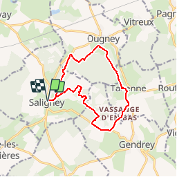
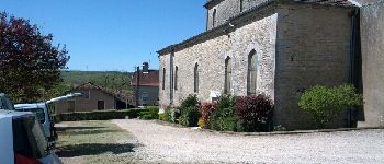
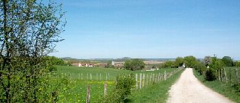
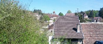
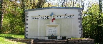
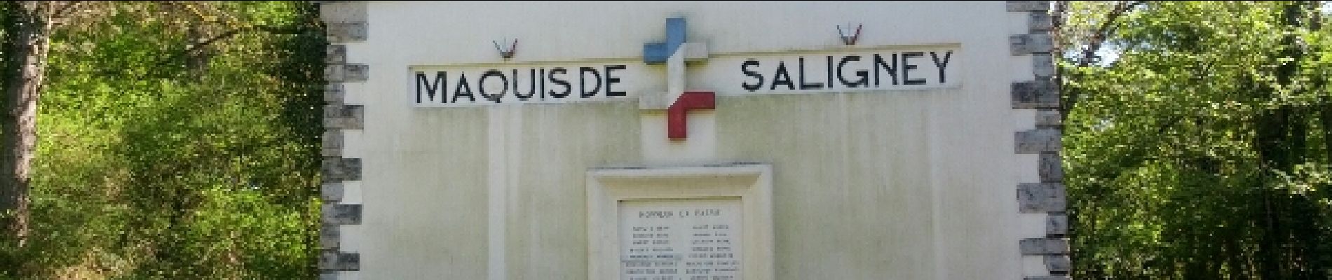
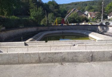
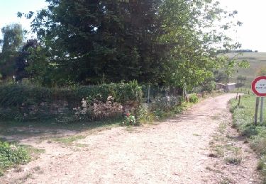
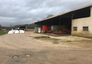
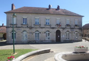
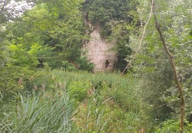
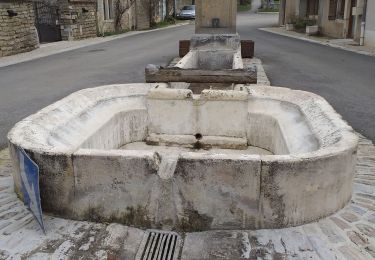
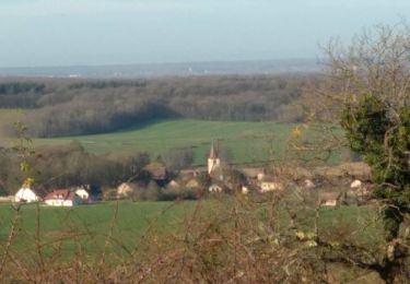
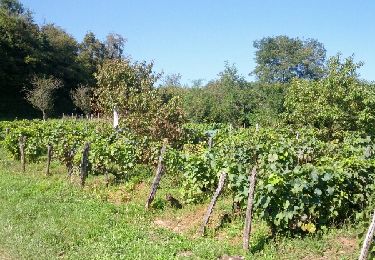
Marche nordique active. Circuit du Mont de Vassange. Départ parking derrière l'église, Le Belmont, Ougney (sur Roche), Taxenne, Vassange en Bas, D12, Bois de Fougeret, Monument au Maquis de Saligney, Fontaine de Berche, et retour parking.
Plaatsbepaling
Land:
France
Regio :
Bourgondië-Franche-Comté
Departement/Provincie :
Jura
Gemeente :
Saligney
Locatie:
Unknown
Vertrek:(Dec)
Vertrek:(UTM)
699928 ; 5232936 (31T) N.
Opmerkingen
Wandeltochten in de omgeving
![Tocht Stappen Ougney - Ougney - Photo](https://media.geolcdn.com/t/375/260/8556a756-8301-4946-bcb3-1299892476e6.jpg&format=jpg&maxdim=2)
![Stappen Stappen](https://static1.geolcdn.com/sitytour/trail-icons/101.png)
Ougney
Stappen
Gemakkelijk
(1)
Ougney,
Bourgondië-Franche-Comté,
Jura,
France
![](/images/other/stat-length.png)
15,4 km | 19,8 km-effort
4h 29min
![](https://static1.geolcdn.com/siteimages/upload/files/16400158638029165_repeat_loop_refresh_sync_direction_icon.png)
Ja
![Tocht Noords wandelen Vriange - Vriange - La Serre - Photo](https://media.geolcdn.com/t/375/260/ext.jpg?maxdim=2&url=https%3A%2F%2Fservices.sitytrail.com%2FGeolivesWS%2FDownloadMedia.ashx%3FTrailID%3D215897%26Media%3Dfix__20130822171149.jpg)
![Noords wandelen Noords wandelen](https://static1.geolcdn.com/sitytour/trail-icons/102.png)
Vriange - La Serre
Noords wandelen
Moeilijk
(1)
Vriange,
Bourgondië-Franche-Comté,
Jura,
France
![](/images/other/stat-length.png)
8,5 km | 11,4 km-effort
1h 47min
![](https://static1.geolcdn.com/siteimages/upload/files/16400158638029165_repeat_loop_refresh_sync_direction_icon.png)
Ja
![Tocht Te voet Ougney - Mont de Vassange - Photo](https://media.geolcdn.com/t/375/260/a82bd0f5-b7f2-4fc5-84c3-34d7e9c05f7d.jpeg&format=jpg&maxdim=2)
![Te voet Te voet](https://static1.geolcdn.com/sitytour/trail-icons/100.png)
Mont de Vassange
Te voet
Gemakkelijk
Ougney,
Bourgondië-Franche-Comté,
Jura,
France
![](/images/other/stat-length.png)
11,6 km | 15,3 km-effort
3h 28min
![](https://static1.geolcdn.com/siteimages/upload/files/16400158638029165_repeat_loop_refresh_sync_direction_icon.png)
Ja
![Tocht Te voet Taxenne - Sentier de la Vigne - Photo](https://media.geolcdn.com/t/375/260/9bc3673e-5b69-4c3a-9376-a4e1ef265916.jpeg&format=jpg&maxdim=2)
![Te voet Te voet](https://static1.geolcdn.com/sitytour/trail-icons/100.png)
Sentier de la Vigne
Te voet
Gemakkelijk
Taxenne,
Bourgondië-Franche-Comté,
Jura,
France
![](/images/other/stat-length.png)
11,7 km | 16,8 km-effort
3h 48min
![](https://static1.geolcdn.com/siteimages/upload/files/16400158638029165_repeat_loop_refresh_sync_direction_icon.png)
Ja
![Tocht Stappen Thervay - Thervay - Photo](https://media.geolcdn.com/t/375/260/228c0f49-6823-49bc-aed9-2dab58bd8f93.jpg&format=jpg&maxdim=2)
![Stappen Stappen](https://static1.geolcdn.com/sitytour/trail-icons/101.png)
Thervay
Stappen
Gemakkelijk
Thervay,
Bourgondië-Franche-Comté,
Jura,
France
![](/images/other/stat-length.png)
16,1 km | 18,3 km-effort
5h 45min
![](https://static1.geolcdn.com/siteimages/upload/files/16400158638029165_repeat_loop_refresh_sync_direction_icon.png)
Neen
![Tocht Te voet Sermange - Circuit des Fontaines - Photo](https://media.geolcdn.com/t/375/260/f006e3f6-e2e1-4693-854f-2d9b686b6d7e.jpeg&format=jpg&maxdim=2)
![Te voet Te voet](https://static1.geolcdn.com/sitytour/trail-icons/100.png)
Circuit des Fontaines
Te voet
Gemakkelijk
Sermange,
Bourgondië-Franche-Comté,
Jura,
France
![](/images/other/stat-length.png)
8,8 km | 11,1 km-effort
2h 31min
![](https://static1.geolcdn.com/siteimages/upload/files/16400158638029165_repeat_loop_refresh_sync_direction_icon.png)
Ja
![Tocht Stappen Taxenne - taxenne - Photo](https://media.geolcdn.com/t/375/260/ffa89f18-ac17-443d-97ec-31e2ee860f3f.jpg&format=jpg&maxdim=2)
![Stappen Stappen](https://static1.geolcdn.com/sitytour/trail-icons/101.png)
taxenne
Stappen
Gemakkelijk
(1)
Taxenne,
Bourgondië-Franche-Comté,
Jura,
France
![](/images/other/stat-length.png)
14,8 km | 18,2 km-effort
2h 22min
![](https://static1.geolcdn.com/siteimages/upload/files/16400158638029165_repeat_loop_refresh_sync_direction_icon.png)
Ja
![Tocht Stappen Serre-les-Moulières - Serre Les Moulières 19 déc 2019 CAF - Photo](https://media.geolcdn.com/t/375/260/085b86e9-9f2c-43ed-9bfd-6794dae0bad8.jpg&format=jpg&maxdim=2)
![Stappen Stappen](https://static1.geolcdn.com/sitytour/trail-icons/101.png)
Serre Les Moulières 19 déc 2019 CAF
Stappen
Moeilijk
Serre-les-Moulières,
Bourgondië-Franche-Comté,
Jura,
France
![](/images/other/stat-length.png)
20 km | 27 km-effort
6h 52min
![](https://static1.geolcdn.com/siteimages/upload/files/16400158638029165_repeat_loop_refresh_sync_direction_icon.png)
Ja
![Tocht Noords wandelen Taxenne - Taxenne - Vitreux - Rouffange - Photo](https://media.geolcdn.com/t/375/260/ext.jpg?maxdim=2&url=https%3A%2F%2Fservices.sitytrail.com%2FGeolivesWS%2FDownloadMedia.ashx%3FTrailID%3D342230%26Media%3Dfix__20140904160222.jpg)
![Noords wandelen Noords wandelen](https://static1.geolcdn.com/sitytour/trail-icons/102.png)
Taxenne - Vitreux - Rouffange
Noords wandelen
Medium
(1)
Taxenne,
Bourgondië-Franche-Comté,
Jura,
France
![](/images/other/stat-length.png)
10,7 km | 14,9 km-effort
2h 43min
![](https://static1.geolcdn.com/siteimages/upload/files/16400158638029165_repeat_loop_refresh_sync_direction_icon.png)
Ja