![](/images/other/stat-length.png)
![Tocht Mountainbike Virton - Fourneau Marchand I - Balade_VTT_26kms - Photo](https://media.geolcdn.com/t/1900/400/ae9cf8cf-2c14-4dbd-bc9f-0f811ea3c0d9.jpg&format=pjpeg&maxdim=2)
Fourneau Marchand I - Balade_VTT_26kms
Pascal L
Gebruiker
![Lengte](/images/other/stat-length.png)
![Max. hoogte](https://static1.geolcdn.com/siteimages/upload/files/1508320355ic_sort_altitude_max_24dp.png)
![Positief hoogteverschil](https://static1.geolcdn.com/siteimages/upload/files/1508320355ic_sort_den_pos_24dp.png)
![Km-Effort](/images/other/stat-length.png)
![Min. hoogte](https://static1.geolcdn.com/siteimages/upload/files/1508320355ic_sort_altitude_min_24dp.png)
![Negatief hoogteverschil](https://static1.geolcdn.com/siteimages/upload/files/1508320355ic_sort_den_neg_24dp.png)
![Boucle](https://static1.geolcdn.com/siteimages/upload/files/16400158638029165_repeat_loop_refresh_sync_direction_icon.png)
![Mountainbike](https://static1.geolcdn.com/sitytour/trail-icons/202.png)
2h32
Moeilijkheid : Medium
![Scan deze QR-code om de tocht te openen in de SityTrail-applicatie](https://capi.geolives.com/qq0zvz2zws4bq2lad0pu/sitytour/trails/2650338/qr.png?size=200)
Gratisgps-wandelapplicatie
Over ons
Tocht Mountainbike van 26 km beschikbaar op Wallonië, Luxemburg, Virton. Deze tocht wordt voorgesteld door Pascal L.
Beschrijving
Départ/Retour: Virton (Delhaize)
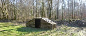
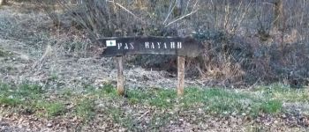
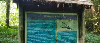
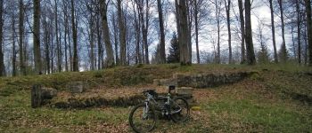
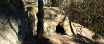
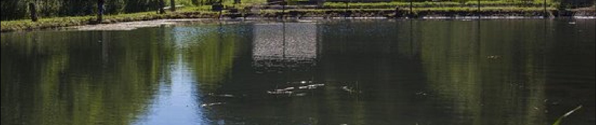
Endroits de passage : Pierrard (Institut des Arts et Métiers), Ravel (ligne 155), Ethe, Ravel (Laclaireau), Ourdon (Ferme de Bar), Bois de l’Acquêt, le Fourneau Marchand et sa pisciculture, Huombois (attention : chiens en liberté !), Haut de la Casquette (Bois de Sainte-Marie), Ruisseau de Hambressart, Bois de Robelmont, Robelmont,
Ref.
- https://www.facebook.com/pecheriefourneaumarchand/
- https://www.facebook.com/PiscicultureduFourneauMarchand/
- https://www.sh-opeditions.com/blog/a-la-pecherie-du-fourneau-marchand
- https://ravel.wallonie.be/home/itineraires/local/ligne-155.html
- https://www.fermedebar.be/
Vidéo: https://vimeo.com/514669397
(2021.01.24)
Plaatsbepaling
Opmerkingen
Wandeltochten in de omgeving
![Tocht Stappen Virton - RB-Lu-17_Ethe_via-var-1-et-2-et-3 - Photo](https://media.geolcdn.com/t/375/260/ext.jpg?maxdim=2&url=https%3A%2F%2Fservices.sitytrail.com%2FGeolivesWS%2FDownloadMedia.ashx%3FTrailID%3D541328%26Media%3Df1aeb673-5eb3-40d2-9e3e-9751bd16961f.jpg)
![Stappen Stappen](https://static1.geolcdn.com/sitytour/trail-icons/101.png)
Stappen
![](/images/other/stat-length.png)
![](https://static1.geolcdn.com/siteimages/upload/files/16400158638029165_repeat_loop_refresh_sync_direction_icon.png)
![Tocht Mountainbike Virton - T2019-06-16-16-47 - Photo](https://media.geolcdn.com/t/375/260/7f02a860-4654-49bb-aa49-fc1e5df64440.jpg&format=jpg&maxdim=2)
![Mountainbike Mountainbike](https://static1.geolcdn.com/sitytour/trail-icons/202.png)
Mountainbike
![](/images/other/stat-length.png)
![](https://static1.geolcdn.com/siteimages/upload/files/16400158638029165_repeat_loop_refresh_sync_direction_icon.png)
![Tocht Stappen Virton - GAUME Balade naturelle et historique - Photo](https://media.geolcdn.com/t/375/260/ext.jpg?maxdim=2&url=https%3A%2F%2Fservices.sitytrail.com%2FGeolivesWS%2FDownloadMedia.ashx%3FTrailID%3D164521%26Media%3D20121125163840.jpeg)
![Stappen Stappen](https://static1.geolcdn.com/sitytour/trail-icons/101.png)
Stappen
![](/images/other/stat-length.png)
![](https://static1.geolcdn.com/siteimages/upload/files/16400158638029165_repeat_loop_refresh_sync_direction_icon.png)
![Tocht Te voet Virton - La Bajocienne - Photo](https://media.geolcdn.com/t/375/260/ext.jpg?maxdim=2&url=https%3A%2F%2Fpivotmedia.tourismewallonie.be%2FOTH-A0-006F-3DH1%2FOTH-A0-006F-3DH1.jpg)
![Te voet Te voet](https://static1.geolcdn.com/sitytour/trail-icons/100.png)
Te voet
![](/images/other/stat-length.png)
![](https://static1.geolcdn.com/siteimages/upload/files/16400158638029165_repeat_loop_refresh_sync_direction_icon.png)
![Tocht Stappen Virton - RB-Lu-17_Ethe_via-racc - Photo](https://media.geolcdn.com/t/375/260/ext.jpg?maxdim=2&url=https%3A%2F%2Fservices.sitytrail.com%2FGeolivesWS%2FDownloadMedia.ashx%3FTrailID%3D541324%26Media%3Df9f14959-9764-4ab9-b216-8ff20ce6d698.jpg)
![Stappen Stappen](https://static1.geolcdn.com/sitytour/trail-icons/101.png)
Stappen
![](/images/other/stat-length.png)
![](https://static1.geolcdn.com/siteimages/upload/files/16400158638029165_repeat_loop_refresh_sync_direction_icon.png)
![Tocht Stappen Virton - RB-Lu-17_Ethe - Photo](https://media.geolcdn.com/t/375/260/ext.jpg?maxdim=2&url=https%3A%2F%2Fservices.sitytrail.com%2FGeolivesWS%2FDownloadMedia.ashx%3FTrailID%3D541324%26Media%3D8965deff-6975-4e3c-a1d0-87e46c5ff193.jpg)
![Stappen Stappen](https://static1.geolcdn.com/sitytour/trail-icons/101.png)
Stappen
![](/images/other/stat-length.png)
![](https://static1.geolcdn.com/siteimages/upload/files/16400158638029165_repeat_loop_refresh_sync_direction_icon.png)
![Tocht Paard Rouvroy - rallye 2014 - Photo](https://media.geolcdn.com/t/375/260/ext.jpg?maxdim=2&url=https%3A%2F%2Fstatic1.geolcdn.com%2Fsiteimages%2Fupload%2Ffiles%2F1524743154cheval.jpg)
![Paard Paard](https://static1.geolcdn.com/sitytour/trail-icons/300.png)
![Tocht Mountainbike Virton - Autour de Tintigny - Balade_VTT_54Kms - Photo](https://media.geolcdn.com/t/375/260/f2991960-98bf-4ded-84b3-f3460299ceba.jpg&format=jpg&maxdim=2)
![Mountainbike Mountainbike](https://static1.geolcdn.com/sitytour/trail-icons/202.png)
Mountainbike
![](/images/other/stat-length.png)
![](https://static1.geolcdn.com/siteimages/upload/files/16400158638029165_repeat_loop_refresh_sync_direction_icon.png)
![Tocht Mountainbike Virton - Monquintin - Balade_VTT_22Kms - Photo](https://media.geolcdn.com/t/375/260/136209b8-b776-4094-a6b1-d92770fe7c94.jpg&format=jpg&maxdim=2)
![Mountainbike Mountainbike](https://static1.geolcdn.com/sitytour/trail-icons/202.png)
Mountainbike
![](/images/other/stat-length.png)
![](https://static1.geolcdn.com/siteimages/upload/files/16400158638029165_repeat_loop_refresh_sync_direction_icon.png)