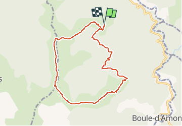
![](/images/other/stat-length.png)
![Tocht Stappen Boule-d'Amont - Serrabonne autour du prieuré - Photo](https://media.geolcdn.com/t/1900/400/24231eed-2f48-4061-8c52-7dd0f6f55a72.jpg&format=pjpeg&maxdim=2)
Serrabonne autour du prieuré
MarieFrancoise
Gebruiker
![Lengte](/images/other/stat-length.png)
![Max. hoogte](https://static1.geolcdn.com/siteimages/upload/files/1508320355ic_sort_altitude_max_24dp.png)
![Positief hoogteverschil](https://static1.geolcdn.com/siteimages/upload/files/1508320355ic_sort_den_pos_24dp.png)
![Km-Effort](/images/other/stat-length.png)
![Min. hoogte](https://static1.geolcdn.com/siteimages/upload/files/1508320355ic_sort_altitude_min_24dp.png)
![Negatief hoogteverschil](https://static1.geolcdn.com/siteimages/upload/files/1508320355ic_sort_den_neg_24dp.png)
![Boucle](https://static1.geolcdn.com/siteimages/upload/files/16400158638029165_repeat_loop_refresh_sync_direction_icon.png)
![Stappen](https://static1.geolcdn.com/sitytour/trail-icons/101.png)
4h27
Moeilijkheid : Medium
![Scan deze QR-code om de tocht te openen in de SityTrail-applicatie](https://capi.geolives.com/qq0zvz2zws4bq2lad0pu/sitytour/trails/2648818/qr.png?size=200)
Gratisgps-wandelapplicatie
Over ons
Tocht Stappen van 9,3 km beschikbaar op Occitanië, Pyrénées-Orientales, Boule-d'Amont. Deze tocht wordt voorgesteld door MarieFrancoise.
Beschrijving
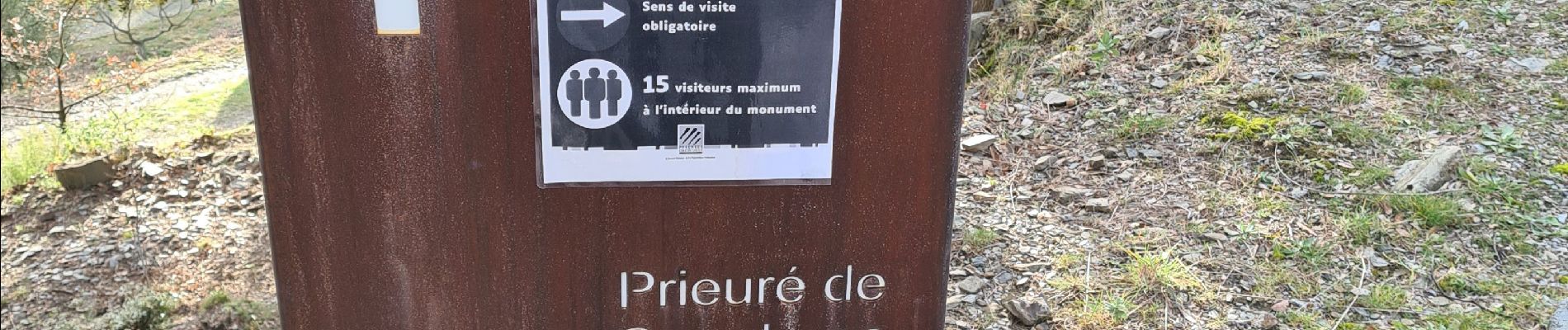
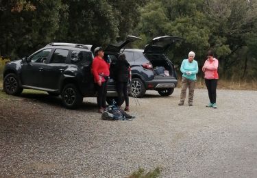
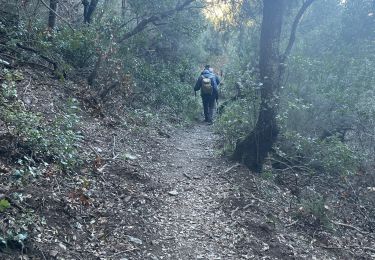
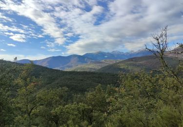
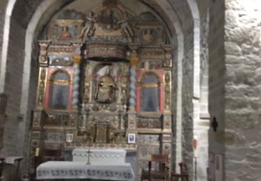
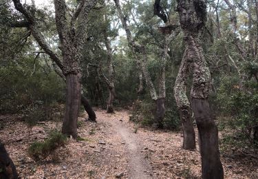
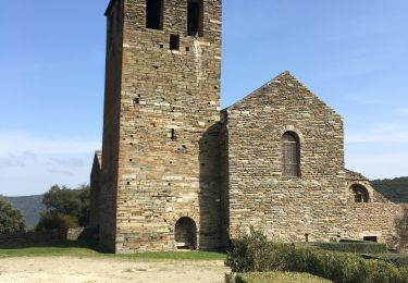
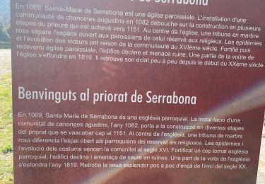
départ du parking du prieuré .En face du prieuré prendre le sentier repéré par un poteau " col de les Arques". montée continue jusqu ' aux crêtes. suivre la clôture jusqu'au col .Magnifiques points de vue à 360°.
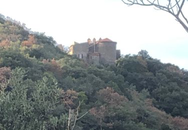
Au col des Arques tourner à gauche en direction de boule d 'Amon. Descendre jusqu ' à l ' épave de la camionnette bleue. suivre direction de Serrabonne ( petit sentier )..retour par le col d 'Aspic .
Très jolie rando sans véritables difficultés avec de magnifiques panoramas ( voir photos )sur le canigou , la mer, la plaine du RRousillon ,les corbières.
Plaatsbepaling
Opmerkingen
Wandeltochten in de omgeving
![Tocht Stappen Caixas - route saint Michel - Photo](https://media.geolcdn.com/t/375/260/13258c1c-2d9b-4954-ba3f-27706acb2c56.jpg&format=jpg&maxdim=2)
![Stappen Stappen](https://static1.geolcdn.com/sitytour/trail-icons/101.png)
Stappen
![](/images/other/stat-length.png)
![](https://static1.geolcdn.com/siteimages/upload/files/16400158638029165_repeat_loop_refresh_sync_direction_icon.png)
![Tocht Stappen Casefabre - Casefabre 66 - Photo](https://media.geolcdn.com/t/375/260/fda5b463-42b5-4e8b-9ebd-458b38a5ec57.jpg&format=jpg&maxdim=2)
![Stappen Stappen](https://static1.geolcdn.com/sitytour/trail-icons/101.png)
Stappen
![](/images/other/stat-length.png)
![](https://static1.geolcdn.com/siteimages/upload/files/16400158638029165_repeat_loop_refresh_sync_direction_icon.png)
![Tocht Stappen Prunet-et-Belpuig - BOULE d'AMONT - La TRINITE - Photo](https://media.geolcdn.com/t/375/260/63148342-eaf9-42f9-af5b-21ab9e845710.jpg&format=jpg&maxdim=2)
![Stappen Stappen](https://static1.geolcdn.com/sitytour/trail-icons/101.png)
Stappen
![](/images/other/stat-length.png)
![](https://static1.geolcdn.com/siteimages/upload/files/16400158638029165_repeat_loop_refresh_sync_direction_icon.png)
![Tocht Stappen Prunet-et-Belpuig - Boule d’amont /Chapelle de la Trinité / Prunet - Photo](https://media.geolcdn.com/t/375/260/68eed7a9-ae13-40d7-8c91-a7b1707b93bf.jpg&format=jpg&maxdim=2)
![Stappen Stappen](https://static1.geolcdn.com/sitytour/trail-icons/101.png)
Stappen
![](/images/other/stat-length.png)
![](https://static1.geolcdn.com/siteimages/upload/files/16400158638029165_repeat_loop_refresh_sync_direction_icon.png)
![Tocht Stappen Boule-d'Amont - 20240104 Tour depuis le prieuré de Serrabonne - Photo](https://media.geolcdn.com/t/375/260/a082747f-89ab-4e46-8caf-fd728589230f.jpg&format=jpg&maxdim=2)
![Stappen Stappen](https://static1.geolcdn.com/sitytour/trail-icons/101.png)
Stappen
![](/images/other/stat-length.png)
![](https://static1.geolcdn.com/siteimages/upload/files/16400158638029165_repeat_loop_refresh_sync_direction_icon.png)
![Tocht Stappen Rodès - 20221222 Rodés - Domanova…. Boucle - Photo](https://media.geolcdn.com/t/375/260/a3e631e7-3bf6-4340-8786-449d4c4dba31.jpg&format=jpg&maxdim=2)
![Stappen Stappen](https://static1.geolcdn.com/sitytour/trail-icons/101.png)
Stappen
![](/images/other/stat-length.png)
![](https://static1.geolcdn.com/siteimages/upload/files/16400158638029165_repeat_loop_refresh_sync_direction_icon.png)
![Tocht Stappen Rodès - 20220217 au départ de Rodes - Photo](https://media.geolcdn.com/t/375/260/d4c22c06-1901-4b1d-a9f2-7a9ffb0df265.jpg&format=jpg&maxdim=2)
![Stappen Stappen](https://static1.geolcdn.com/sitytour/trail-icons/101.png)
Stappen
![](/images/other/stat-length.png)
![](https://static1.geolcdn.com/siteimages/upload/files/16400158638029165_repeat_loop_refresh_sync_direction_icon.png)
![Tocht Stappen Boule-d'Amont - Serrabone /le roc rouge(le rocher du dragon):itinéraire 2 - Photo](https://media.geolcdn.com/t/375/260/26b43676-9e75-4b0d-befc-d44645d8fbe1.jpg&format=jpg&maxdim=2)
![Stappen Stappen](https://static1.geolcdn.com/sitytour/trail-icons/101.png)
Stappen
![](/images/other/stat-length.png)
![](https://static1.geolcdn.com/siteimages/upload/files/16400158638029165_repeat_loop_refresh_sync_direction_icon.png)
![Tocht Stappen Boule-d'Amont - Serra une - Photo](https://media.geolcdn.com/t/375/260/40936afc-9b58-415d-9be4-e3356895329e.jpg&format=jpg&maxdim=2)
![Stappen Stappen](https://static1.geolcdn.com/sitytour/trail-icons/101.png)
Stappen
![](/images/other/stat-length.png)
![](https://static1.geolcdn.com/siteimages/upload/files/16400158638029165_repeat_loop_refresh_sync_direction_icon.png)