


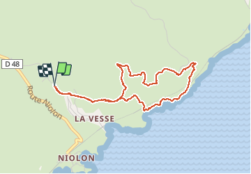

5,7 km | 8,3 km-effort

Gebruiker


Gratisgps-wandelapplicatie
 SityTrail
IGN / Geografische instituten
SityTrail World
De wereld gaat voor u open
Tocht Stappen van 4,5 km beschikbaar op Provence-Alpes-Côte d'Azur, Bouches-du-Rhône, Le Rove. Deze tocht wordt voorgesteld door fhascoet.
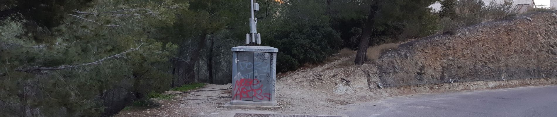
Sur la route de la Vesse, prendre le chemin caché derrière le coffret électrique (voir photo)
Très belle vues sur la rade de Marseille
Sur le chemin le long de la côte, quelques passages qui nécessite d'utiliser les mains ( tout public)


Stappen
Stappen

Stappen

Te voet

Te voet

Stappen

Stappen

Stappen

Stappen