

Saint Blimont

roselinemazeyrat
Gebruiker

Lengte
10,5 km

Max. hoogte
58 m

Positief hoogteverschil
101 m

Km-Effort
11,9 km

Min. hoogte
17 m

Negatief hoogteverschil
101 m
Boucle
Ja
Datum van aanmaak :
2020-12-06 07:57:52.0
Laatste wijziging :
2020-12-09 14:20:53.989
2h16
Moeilijkheid : Onbekend

Gratisgps-wandelapplicatie
Over ons
Tocht Noords wandelen van 10,5 km beschikbaar op Hauts-de-France, Somme, Saint-Blimont. Deze tocht wordt voorgesteld door roselinemazeyrat.
Beschrijving
Balade dans la campagne, par champs et bois. Vue sur le château d’Elincourt.
Plaatsbepaling
Land:
France
Regio :
Hauts-de-France
Departement/Provincie :
Somme
Gemeente :
Saint-Blimont
Locatie:
Unknown
Vertrek:(Dec)
Vertrek:(UTM)
397624 ; 5552977 (31U) N.
Opmerkingen
Wandeltochten in de omgeving

Circuit de Drancourt


Stappen
Medium
(2)
Estrébœuf,
Hauts-de-France,
Somme,
France

6,6 km | 7,4 km-effort
2h 15min
Ja
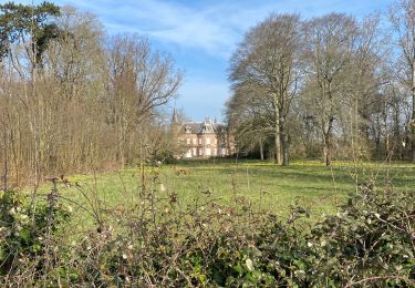
Pendé estreboeuf Tilloy


Stappen
Moeilijk
Pendé,
Hauts-de-France,
Somme,
France

12,7 km | 13,8 km-effort
3h 7min
Ja

Nibas au printemps


Noords wandelen
Medium
Nibas,
Hauts-de-France,
Somme,
France

13,9 km | 15,7 km-effort
2h 34min
Ja
Rando VTT du bord de mer - Cayeux sur Mer


Mountainbike
Medium
Saint-Blimont,
Hauts-de-France,
Somme,
France

31 km | 33 km-effort
2h 0min
Neen
Sur les traces d'Eole - Friville Escarbotin


Mountainbike
Medium
Friville-Escarbotin,
Hauts-de-France,
Somme,
France

55 km | 62 km-effort
3h 15min
Ja
Les étangs de la Vallée de la Bresle - Friville Escarbotin


Mountainbike
Medium
Friville-Escarbotin,
Hauts-de-France,
Somme,
France

45 km | 51 km-effort
2h 40min
Ja
La forêt d'Eu - Friville Escarbotin


Mountainbike
Moeilijk
Friville-Escarbotin,
Hauts-de-France,
Somme,
France

47 km | 56 km-effort
3h 4min
Ja
Le marais du hâble d'Ault - Frivillle Escarbotin


Mountainbike
Medium
Friville-Escarbotin,
Hauts-de-France,
Somme,
France

41 km | 44 km-effort
2h 10min
Ja
Le sud de la côte Picarde - Friville Escarbotin


Mountainbike
Medium
(1)
Friville-Escarbotin,
Hauts-de-France,
Somme,
France

35 km | 40 km-effort
2h 0min
Ja


 SityTrail


