


3,5 km | 4,4 km-effort


Gebruiker


Gratisgps-wandelapplicatie
 SityTrail
IGN / Geografische instituten
SityTrail World
De wereld gaat voor u open
Tocht Stappen van 1 km beschikbaar op Auvergne-Rhône-Alpes, Ain, Chevry. Deze tocht wordt voorgesteld door Echenevex.
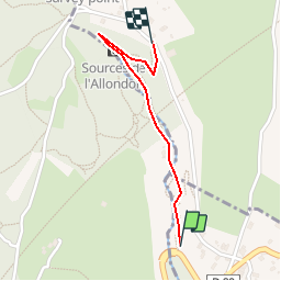
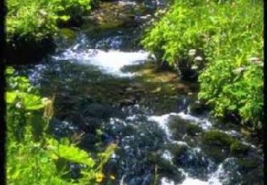
Deux itinéraires permettent d''accéder aux sources de l''Allondon.
Départ 1) itinéraire Sud : parking au niveau du pont de l''Allondon, sur la D89 à Naz-Dessous.
Prenez le chemin qui suit la rivière en passant par les ponts et passerelles avant d''atteindre les sources de l''Allondon (3).
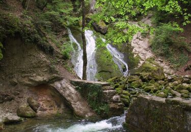
Le parcours est aménagé de tables de lecture. Vous découvrirez les vestiges d''anciens moulins et le rôle que jouaient jadis les cours d''eau comme force hydraulique principale.
Parcours ombragé pour l''essentiel, avec aire de pique-nique et foyer pour barbecue.
Départ (2) itinéraire Nord : départ de Naz Dessus (parking sur la droite en descendant la route principale).
Suivez le panneau "sources de l''Allondon". Le sentier descend jusqu''au niveau de la rivière. Attention: chemin raide et glissant qui rejoint l''itinéraire précédent 200 mètres avant les sources de l''Allondon.
Stappen
Fiets
Fiets
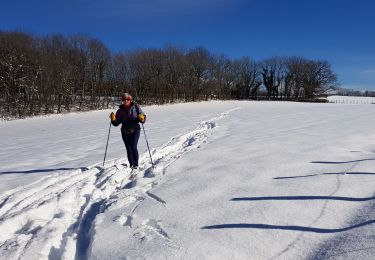
Langlaufen
Mountainbike

Stappen

Stappen
Stappen
Stappen