![](/images/other/stat-length.png)
![Tocht Stappen Diepenbeek - Diepenbeek - Photo](https://media.geolcdn.com/t/1900/400/3d529861-d153-4f9d-8730-81a882934229.jpg&format=pjpeg&maxdim=2)
Diepenbeek
mumu.larandonneuse
Gebruiker GUIDE
![Lengte](/images/other/stat-length.png)
![Max. hoogte](https://static1.geolcdn.com/siteimages/upload/files/1508320355ic_sort_altitude_max_24dp.png)
![Positief hoogteverschil](https://static1.geolcdn.com/siteimages/upload/files/1508320355ic_sort_den_pos_24dp.png)
![Km-Effort](/images/other/stat-length.png)
![Min. hoogte](https://static1.geolcdn.com/siteimages/upload/files/1508320355ic_sort_altitude_min_24dp.png)
![Negatief hoogteverschil](https://static1.geolcdn.com/siteimages/upload/files/1508320355ic_sort_den_neg_24dp.png)
![Boucle](https://static1.geolcdn.com/siteimages/upload/files/16400158638029165_repeat_loop_refresh_sync_direction_icon.png)
![Stappen](https://static1.geolcdn.com/sitytour/trail-icons/101.png)
2h44
Moeilijkheid : Heel gemakkelijk
![Scan deze QR-code om de tocht te openen in de SityTrail-applicatie](https://capi.geolives.com/qq0zvz2zws4bq2lad0pu/sitytour/trails/2587361/qr.png?size=200)
Gratisgps-wandelapplicatie
Over ons
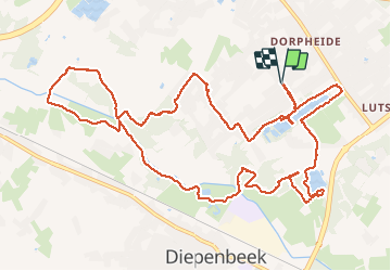
Tocht Stappen van 13,2 km beschikbaar op Vlaanderen, Limburg, Diepenbeek. Deze tocht wordt voorgesteld door mumu.larandonneuse.
Beschrijving
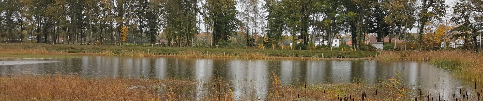
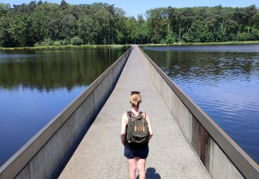
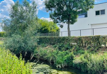
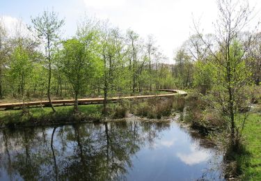
Beau parcours facile passant par plusieurs étangs dont le Pomperikvijver et 3 ruisseaux (le Stiekemerbeek, le Coetsbeek et le Demer).
📌Gasthof Lederhose, Heidstraat 55 ➡️
possibilité de parking Heidestraat (rue en cul-de-sac)
⚠️ 3 petits A/R à ne pas faire (erreurs de ma part)
Plaatsbepaling
Opmerkingen
Wandeltochten in de omgeving
![Tocht Stappen Hasselt - Domaine Kiewit &](https://media.geolcdn.com/t/375/260/24e338e2-ab75-48fb-ae32-0abbc38a1902.jpg&format=jpg&maxdim=2)
![Stappen Stappen](https://static1.geolcdn.com/sitytour/trail-icons/101.png)
Stappen
![](/images/other/stat-length.png)
![](https://static1.geolcdn.com/siteimages/upload/files/16400158638029165_repeat_loop_refresh_sync_direction_icon.png)
![Tocht Stappen Genk - Promenade vers la piste dans l'eau, dans le magnifique domaine de Bokrijk - Photo](https://media.geolcdn.com/t/375/260/45cc0ed2-db94-4d5d-a7c6-1096a930a2ab.jpg&format=jpg&maxdim=2)
![Stappen Stappen](https://static1.geolcdn.com/sitytour/trail-icons/101.png)
Stappen
![](/images/other/stat-length.png)
![](https://static1.geolcdn.com/siteimages/upload/files/16400158638029165_repeat_loop_refresh_sync_direction_icon.png)
![Tocht Stappen Diepenbeek - La vallée du Démer - La réserve naturelle Dorpsbemden à Diepenbeek - Photo](https://media.geolcdn.com/t/375/260/831c90b3-6b69-4442-bd2d-357552ece2e5.jpeg&format=jpg&maxdim=2)
![Stappen Stappen](https://static1.geolcdn.com/sitytour/trail-icons/101.png)
Stappen
![](/images/other/stat-length.png)
![](https://static1.geolcdn.com/siteimages/upload/files/16400158638029165_repeat_loop_refresh_sync_direction_icon.png)
![Tocht Stappen Diepenbeek - La vallée du Démer - Le ruisseau Dauten et les Dautewijers à Diepenbeek - Photo](https://media.geolcdn.com/t/375/260/ff431e14-a2e4-4401-9193-e96799f79a9a.jpeg&format=jpg&maxdim=2)
![Stappen Stappen](https://static1.geolcdn.com/sitytour/trail-icons/101.png)
Stappen
![](/images/other/stat-length.png)
![](https://static1.geolcdn.com/siteimages/upload/files/16400158638029165_repeat_loop_refresh_sync_direction_icon.png)
![Tocht Te voet Diepenbeek - Lange afstandstocht - Photo](https://media.geolcdn.com/t/375/260/c0f28296-bcff-4fe2-9db4-902c2464ce24.jpeg&format=jpg&maxdim=2)
![Te voet Te voet](https://static1.geolcdn.com/sitytour/trail-icons/100.png)
Te voet
![](/images/other/stat-length.png)
![](https://static1.geolcdn.com/siteimages/upload/files/16400158638029165_repeat_loop_refresh_sync_direction_icon.png)
![Tocht Te voet Genk - De Maten oranje - Photo](https://media.geolcdn.com/t/375/260/5daa36df-5a45-46f0-9e87-234b3c303469.jpeg&format=jpg&maxdim=2)
![Te voet Te voet](https://static1.geolcdn.com/sitytour/trail-icons/100.png)
Te voet
![](/images/other/stat-length.png)
![](https://static1.geolcdn.com/siteimages/upload/files/16400158638029165_repeat_loop_refresh_sync_direction_icon.png)
![Tocht Te voet Genk - Bokrijk Gele zeshoek (voor rolstoel/buggy) - Photo](https://media.geolcdn.com/t/375/260/abfb207d-dc7b-4a70-b673-1e7d6075a286.jpeg&format=jpg&maxdim=2)
![Te voet Te voet](https://static1.geolcdn.com/sitytour/trail-icons/100.png)
Te voet
![](/images/other/stat-length.png)
![](https://static1.geolcdn.com/siteimages/upload/files/16400158638029165_repeat_loop_refresh_sync_direction_icon.png)
![Tocht Te voet Hasselt - Kiewit Wildernis route - Photo](https://media.geolcdn.com/t/375/260/3dbc744d-9453-4105-ac17-d803e722e0e9.jpeg&format=jpg&maxdim=2)
![Te voet Te voet](https://static1.geolcdn.com/sitytour/trail-icons/100.png)
Te voet
![](/images/other/stat-length.png)
![](https://static1.geolcdn.com/siteimages/upload/files/16400158638029165_repeat_loop_refresh_sync_direction_icon.png)
![Tocht Te voet Hasselt - Kiewit Wijer route - Photo](https://media.geolcdn.com/t/375/260/3dbc744d-9453-4105-ac17-d803e722e0e9.jpeg&format=jpg&maxdim=2)
![Te voet Te voet](https://static1.geolcdn.com/sitytour/trail-icons/100.png)
Te voet
![](/images/other/stat-length.png)
![](https://static1.geolcdn.com/siteimages/upload/files/16400158638029165_repeat_loop_refresh_sync_direction_icon.png)