![](/images/other/stat-length.png)
![Tocht Stappen Saint-Maurice-sur-Moselle - la tête des Révoles depuis l Lait - Photo](https://media.geolcdn.com/t/1900/400/ext.pjpeg?maxdim=2&url=https%3A%2F%2Fstatic1.geolcdn.com%2Fsiteimages%2Fupload%2Ffiles%2F1553511878bg_sport_marche.png)
la tête des Révoles depuis l Lait
margotte
Gebruiker
![Lengte](/images/other/stat-length.png)
Lengte
11,5 km
![Max. hoogte](https://static1.geolcdn.com/siteimages/upload/files/1508320355ic_sort_altitude_max_24dp.png)
Max. hoogte
973 m
![Positief hoogteverschil](https://static1.geolcdn.com/siteimages/upload/files/1508320355ic_sort_den_pos_24dp.png)
Positief hoogteverschil
568 m
![Km-Effort](/images/other/stat-length.png)
Km-Effort
19,1 km
![Min. hoogte](https://static1.geolcdn.com/siteimages/upload/files/1508320355ic_sort_altitude_min_24dp.png)
Min. hoogte
617 m
![Negatief hoogteverschil](https://static1.geolcdn.com/siteimages/upload/files/1508320355ic_sort_den_neg_24dp.png)
Negatief hoogteverschil
564 m
![Boucle](https://static1.geolcdn.com/siteimages/upload/files/16400158638029165_repeat_loop_refresh_sync_direction_icon.png)
Boucle
Ja
Datum van aanmaak :
2020-10-18 08:53:12.526
Laatste wijziging :
2020-10-27 17:40:22.903
![Stappen](https://static1.geolcdn.com/sitytour/trail-icons/101.png)
2h41
Moeilijkheid : Medium
![Scan deze QR-code om de tocht te openen in de SityTrail-applicatie](https://capi.geolives.com/qq0zvz2zws4bq2lad0pu/sitytour/trails/2581369/qr.png?size=200)
Gratisgps-wandelapplicatie
Over ons
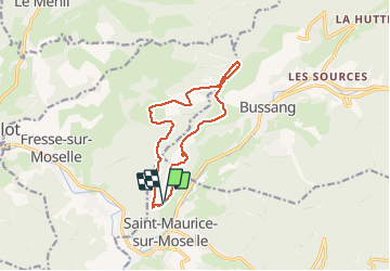
Tocht Stappen van 11,5 km beschikbaar op Grand Est, Vogezen, Saint-Maurice-sur-Moselle. Deze tocht wordt voorgesteld door margotte.
Beschrijving
un parcours de moyenne montagne très agréable dans un milieu très ouvert avec une vue sur les 3 Ballons, Servance, Alsace et Guebwiller.
Plaatsbepaling
Land:
France
Regio :
Grand Est
Departement/Provincie :
Vogezen
Gemeente :
Saint-Maurice-sur-Moselle
Locatie:
Unknown
Vertrek:(Dec)
Vertrek:(UTM)
337157 ; 5303578 (32T) N.
Opmerkingen
Wandeltochten in de omgeving
![Tocht Stappen Le Ménil - Boucle au départ des chalets de la](https://media.geolcdn.com/t/375/260/a828a9f3-0482-4d5b-86c2-c919e4b59d9f.jpg&format=jpg&maxdim=2)
![Stappen Stappen](https://static1.geolcdn.com/sitytour/trail-icons/101.png)
Boucle au départ des chalets de la "Vosges Attitude"
Stappen
Gemakkelijk
(3)
Le Ménil,
Grand Est,
Vogezen,
France
![](/images/other/stat-length.png)
10 km | 14,1 km-effort
3h 0min
![](https://static1.geolcdn.com/siteimages/upload/files/16400158638029165_repeat_loop_refresh_sync_direction_icon.png)
Ja
![Tocht Stappen Saint-Maurice-sur-Moselle - Tour du Ballon d'Alsace - Photo](https://media.geolcdn.com/t/375/260/ext.jpg?maxdim=2&url=https%3A%2F%2Fservices.sitytrail.com%2FGeolivesWS%2FDownloadMedia.ashx%3FTrailID%3D450011%26Media%3Dfix__20150716161020.jpg)
![Stappen Stappen](https://static1.geolcdn.com/sitytour/trail-icons/101.png)
Tour du Ballon d'Alsace
Stappen
Moeilijk
(1)
Saint-Maurice-sur-Moselle,
Grand Est,
Vogezen,
France
![](/images/other/stat-length.png)
10,5 km | 17,7 km-effort
5h 25min
![](https://static1.geolcdn.com/siteimages/upload/files/16400158638029165_repeat_loop_refresh_sync_direction_icon.png)
Ja
![Tocht Sneeuwschoenen Bussang - Circuit de raquette de Bussang - Photo](https://media.geolcdn.com/t/375/260/ext.jpg?maxdim=2&url=https%3A%2F%2Fservices.sitytrail.com%2FGeolivesWS%2FDownloadMedia.ashx%3FTrailID%3D111638%26Media%3D7873_6.jpg)
![Sneeuwschoenen Sneeuwschoenen](https://static1.geolcdn.com/sitytour/trail-icons/504.png)
Circuit de raquette de Bussang
Sneeuwschoenen
Moeilijk
(1)
Bussang,
Grand Est,
Vogezen,
France
![](/images/other/stat-length.png)
7,7 km | 11,2 km-effort
3h 0min
![](https://static1.geolcdn.com/siteimages/upload/files/16400158638029165_repeat_loop_refresh_sync_direction_icon.png)
Ja
![Mountainbike Mountainbike](https://static1.geolcdn.com/sitytour/trail-icons/202.png)
SityTrail - 3248441 - documentxix745004916x3256137
Mountainbike
Medium
Saint-Maurice-sur-Moselle,
Grand Est,
Vogezen,
France
![](/images/other/stat-length.png)
21 km | 30 km-effort
2h 3min
![](https://static1.geolcdn.com/siteimages/upload/files/16400158638029165_repeat_loop_refresh_sync_direction_icon.png)
Ja
![Mountainbike Mountainbike](https://static1.geolcdn.com/sitytour/trail-icons/202.png)
activity_9407679223
Mountainbike
Medium
Bussang,
Grand Est,
Vogezen,
France
![](/images/other/stat-length.png)
21 km | 30 km-effort
2h 2min
![](https://static1.geolcdn.com/siteimages/upload/files/16400158638029165_repeat_loop_refresh_sync_direction_icon.png)
Ja
![Tocht Te voet Fresse-sur-Moselle - Les ballons à l’horizon - Photo](https://media.geolcdn.com/t/375/260/30df9189-1183-47e3-a585-be073639a450.jpeg&format=jpg&maxdim=2)
![Te voet Te voet](https://static1.geolcdn.com/sitytour/trail-icons/100.png)
Les ballons à l’horizon
Te voet
Gemakkelijk
Fresse-sur-Moselle,
Grand Est,
Vogezen,
France
![](/images/other/stat-length.png)
7,7 km | 12,6 km-effort
2h 51min
![](https://static1.geolcdn.com/siteimages/upload/files/16400158638029165_repeat_loop_refresh_sync_direction_icon.png)
Ja
![Mountainbike Mountainbike](https://static1.geolcdn.com/sitytour/trail-icons/202.png)
Bussang_20210918_101006
Mountainbike
Heel gemakkelijk
Bussang,
Grand Est,
Vogezen,
France
![](/images/other/stat-length.png)
30 km | 43 km-effort
Onbekend
![](https://static1.geolcdn.com/siteimages/upload/files/16400158638029165_repeat_loop_refresh_sync_direction_icon.png)
Neen
![Mountainbike Mountainbike](https://static1.geolcdn.com/sitytour/trail-icons/202.png)
Bussang_20210821_100939 (1)
Mountainbike
Heel gemakkelijk
Bussang,
Grand Est,
Vogezen,
France
![](/images/other/stat-length.png)
31 km | 42 km-effort
Onbekend
![](https://static1.geolcdn.com/siteimages/upload/files/16400158638029165_repeat_loop_refresh_sync_direction_icon.png)
Neen
![Mountainbike Mountainbike](https://static1.geolcdn.com/sitytour/trail-icons/202.png)
Bussang_20210717_101651
Mountainbike
Heel gemakkelijk
Bussang,
Grand Est,
Vogezen,
France
![](/images/other/stat-length.png)
32 km | 44 km-effort
Onbekend
![](https://static1.geolcdn.com/siteimages/upload/files/16400158638029165_repeat_loop_refresh_sync_direction_icon.png)
Ja
Tip top 👌