![](/images/other/stat-length.png)
![Tocht Stappen Camps-sur-l'Agly - Pech de Bugarach (départ de la Bastide - Camps-sur-l'Agly) - Photo](https://media.geolcdn.com/t/1900/400/8fe478a1-aac1-4e62-9fee-db7a2d6e2489.jpg&format=pjpeg&maxdim=2)
Pech de Bugarach (départ de la Bastide - Camps-sur-l'Agly)
PiloudeBamako
Gebruiker
![Lengte](/images/other/stat-length.png)
![Max. hoogte](https://static1.geolcdn.com/siteimages/upload/files/1508320355ic_sort_altitude_max_24dp.png)
![Positief hoogteverschil](https://static1.geolcdn.com/siteimages/upload/files/1508320355ic_sort_den_pos_24dp.png)
![Km-Effort](/images/other/stat-length.png)
![Min. hoogte](https://static1.geolcdn.com/siteimages/upload/files/1508320355ic_sort_altitude_min_24dp.png)
![Negatief hoogteverschil](https://static1.geolcdn.com/siteimages/upload/files/1508320355ic_sort_den_neg_24dp.png)
![Boucle](https://static1.geolcdn.com/siteimages/upload/files/16400158638029165_repeat_loop_refresh_sync_direction_icon.png)
![Stappen](https://static1.geolcdn.com/sitytour/trail-icons/101.png)
6h17
Moeilijkheid : Moeilijk
![Scan deze QR-code om de tocht te openen in de SityTrail-applicatie](https://capi.geolives.com/qq0zvz2zws4bq2lad0pu/sitytour/trails/2572015/qr.png?size=200)
Gratisgps-wandelapplicatie
Over ons
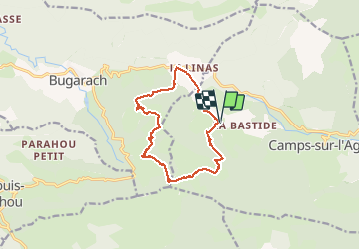
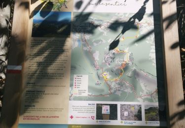
Tocht Stappen van 12,7 km beschikbaar op Occitanië, Aude, Camps-sur-l'Agly. Deze tocht wordt voorgesteld door PiloudeBamako.
Beschrijving
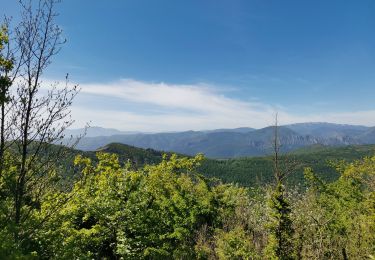
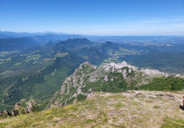
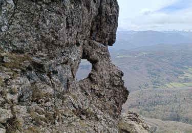
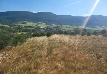
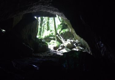
Contournement du Pech par le Sud (GR 367) au départ du hameau de la Bastide (commune de Camps-sur-l'Agly). Ascension par le GR 36 et "la fenêtre".
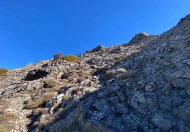
Descente (pente forte et glissante par temps humide) par le Nord du Pech vers le col de Linas.
A mon avis, l'ascension doit se faire dans ce sens car la descente du Pech par "la fenêtre" est très escarpée et impressionnante face au vide, alors que la montée est assez facile dos au vide.
Plaatsbepaling
Opmerkingen
Wandeltochten in de omgeving
![Tocht Stappen Bugarach - Le Pech de Bugarach - Photo](https://media.geolcdn.com/t/375/260/ext.jpg?maxdim=2&url=https%3A%2F%2Fservices.sitytrail.com%2FGeolivesWS%2FDownloadMedia.ashx%3FTrailID%3D103373%26Media%3D5434_4.jpg)
![Stappen Stappen](https://static1.geolcdn.com/sitytour/trail-icons/101.png)
Stappen
![](/images/other/stat-length.png)
![](https://static1.geolcdn.com/siteimages/upload/files/16400158638029165_repeat_loop_refresh_sync_direction_icon.png)
![Tocht Stappen Bugarach - Le Pech de Bugarach 1230 m, depuis le Col du Linas - Photo](https://media.geolcdn.com/t/375/260/ext.jpg?maxdim=2&url=https%3A%2F%2Fservices.sitytrail.com%2FGeolivesWS%2FDownloadMedia.ashx%3FTrailID%3D191665%26Media%3D15324_1.jpg)
![Stappen Stappen](https://static1.geolcdn.com/sitytour/trail-icons/101.png)
Stappen
![](/images/other/stat-length.png)
![](https://static1.geolcdn.com/siteimages/upload/files/16400158638029165_repeat_loop_refresh_sync_direction_icon.png)
![Tocht Stappen Bugarach - Bugarach par la fenêtre - Photo](https://media.geolcdn.com/t/375/260/f61c8120-4edd-4c37-b8d1-8f8539bc9df7.jpg&format=jpg&maxdim=2)
![Stappen Stappen](https://static1.geolcdn.com/sitytour/trail-icons/101.png)
Stappen
![](/images/other/stat-length.png)
![](https://static1.geolcdn.com/siteimages/upload/files/16400158638029165_repeat_loop_refresh_sync_direction_icon.png)
![Tocht Stappen Bugarach - pic du Bugarach - Photo](https://media.geolcdn.com/t/375/260/0be0b540-d788-4840-b942-68a2805d5a8a.jpg&format=jpg&maxdim=2)
![Stappen Stappen](https://static1.geolcdn.com/sitytour/trail-icons/101.png)
Stappen
![](/images/other/stat-length.png)
![](https://static1.geolcdn.com/siteimages/upload/files/16400158638029165_repeat_loop_refresh_sync_direction_icon.png)
![Tocht Stappen Bugarach - le Pech de Bugarach - Lac de La vène - Photo](https://media.geolcdn.com/t/375/260/d1455a7d-4be7-4620-998d-a60e0cfc8767.jpg&format=jpg&maxdim=2)
![Stappen Stappen](https://static1.geolcdn.com/sitytour/trail-icons/101.png)
Stappen
![](/images/other/stat-length.png)
![](https://static1.geolcdn.com/siteimages/upload/files/16400158638029165_repeat_loop_refresh_sync_direction_icon.png)
![Tocht Stappen Sougraigne - Sougraigne bugarach pont romain - Photo](https://media.geolcdn.com/t/375/260/ad5479a5-b384-460d-9d60-d556ca1f7a71.jpg&format=jpg&maxdim=2)
![Stappen Stappen](https://static1.geolcdn.com/sitytour/trail-icons/101.png)
Stappen
![](/images/other/stat-length.png)
![](https://static1.geolcdn.com/siteimages/upload/files/16400158638029165_repeat_loop_refresh_sync_direction_icon.png)
![Tocht Stappen Prugnanes - roc paradet - Photo](https://media.geolcdn.com/t/375/260/f4e6fd12-f0ab-4601-9b76-44d15e72f3de.jpg&format=jpg&maxdim=2)
![Stappen Stappen](https://static1.geolcdn.com/sitytour/trail-icons/101.png)
Stappen
![](/images/other/stat-length.png)
![](https://static1.geolcdn.com/siteimages/upload/files/16400158638029165_repeat_loop_refresh_sync_direction_icon.png)
![Tocht Stappen Bugarach - Tour Bugarach - Photo](https://media.geolcdn.com/t/375/260/8fec2c3e-ab59-425a-8e19-942b2c7606b2.jpg&format=jpg&maxdim=2)
![Stappen Stappen](https://static1.geolcdn.com/sitytour/trail-icons/101.png)
![Tocht Stappen Bugarach - Col du Linas-Pech de Bugarach-La fenêtre - Photo](https://media.geolcdn.com/t/375/260/45453090-280d-427b-b6e8-17db17de82e5.jpg&format=jpg&maxdim=2)
![Stappen Stappen](https://static1.geolcdn.com/sitytour/trail-icons/101.png)
Stappen
![](/images/other/stat-length.png)
![](https://static1.geolcdn.com/siteimages/upload/files/16400158638029165_repeat_loop_refresh_sync_direction_icon.png)