![](/images/other/stat-length.png)
![Tocht Stappen Laguiole - Laguiole - Station de ski - Photo](https://media.geolcdn.com/t/1900/400/ext.pjpeg?maxdim=2&url=https%3A%2F%2Fstatic1.geolcdn.com%2Fsiteimages%2Fupload%2Ffiles%2F1553511878bg_sport_marche.png)
Laguiole - Station de ski
neitag61
Gebruiker
![Lengte](/images/other/stat-length.png)
Lengte
7,1 km
![Max. hoogte](https://static1.geolcdn.com/siteimages/upload/files/1508320355ic_sort_altitude_max_24dp.png)
Max. hoogte
1326 m
![Positief hoogteverschil](https://static1.geolcdn.com/siteimages/upload/files/1508320355ic_sort_den_pos_24dp.png)
Positief hoogteverschil
179 m
![Km-Effort](/images/other/stat-length.png)
Km-Effort
9,5 km
![Min. hoogte](https://static1.geolcdn.com/siteimages/upload/files/1508320355ic_sort_altitude_min_24dp.png)
Min. hoogte
1182 m
![Negatief hoogteverschil](https://static1.geolcdn.com/siteimages/upload/files/1508320355ic_sort_den_neg_24dp.png)
Negatief hoogteverschil
184 m
![Boucle](https://static1.geolcdn.com/siteimages/upload/files/16400158638029165_repeat_loop_refresh_sync_direction_icon.png)
Boucle
Ja
Datum van aanmaak :
2020-09-25 20:16:12.42
Laatste wijziging :
2020-10-09 08:04:30.047
![Stappen](https://static1.geolcdn.com/sitytour/trail-icons/101.png)
1h50
Moeilijkheid : Medium
![Scan deze QR-code om de tocht te openen in de SityTrail-applicatie](https://capi.geolives.com/qq0zvz2zws4bq2lad0pu/sitytour/trails/2561616/qr.png?size=200)
Gratisgps-wandelapplicatie
Over ons
Tocht Stappen van 7,1 km beschikbaar op Occitanië, Aveyron, Laguiole. Deze tocht wordt voorgesteld door neitag61.
Beschrijving
Passage impossible du ruisseau au Km 6 en période humide
possibilité de descendre par les pistes au km 4.5 pour rejoindre le départ
Plaatsbepaling
Land:
France
Regio :
Occitanië
Departement/Provincie :
Aveyron
Gemeente :
Laguiole
Locatie:
Unknown
Vertrek:(Dec)
Vertrek:(UTM)
493064 ; 4946794 (31T) N.
Opmerkingen
Wandeltochten in de omgeving
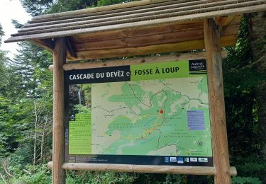
![Tocht Stappen Curières - Le Devez cascade et forêts - Photo](https://media.geolcdn.com/t/375/260/7d8f35a5-9c7c-4d32-ad85-47f2399701b0.jpg&format=jpg&maxdim=2)
![Stappen Stappen](https://static1.geolcdn.com/sitytour/trail-icons/101.png)
Le Devez cascade et forêts
Stappen
Gemakkelijk
(1)
Curières,
Occitanië,
Aveyron,
France
![](/images/other/stat-length.png)
11 km | 15,4 km-effort
3h 22min
![](https://static1.geolcdn.com/siteimages/upload/files/16400158638029165_repeat_loop_refresh_sync_direction_icon.png)
Ja
![Tocht Stappen Laguiole - Vergne noire - Photo](https://media.geolcdn.com/t/375/260/ebee8db9-1cc9-4612-8f14-009829a2d48d.jpg&format=jpg&maxdim=2)
![Stappen Stappen](https://static1.geolcdn.com/sitytour/trail-icons/101.png)
Vergne noire
Stappen
Heel gemakkelijk
Laguiole,
Occitanië,
Aveyron,
France
![](/images/other/stat-length.png)
8,6 km | 10,7 km-effort
2h 19min
![](https://static1.geolcdn.com/siteimages/upload/files/16400158638029165_repeat_loop_refresh_sync_direction_icon.png)
Ja
![Tocht Stappen Curières - Truques d’Aubrac Pas de Mathieu - Photo](https://media.geolcdn.com/t/375/260/943ba7fb-dc01-4617-b5be-555fb9d2d35b.jpg&format=jpg&maxdim=2)
![Stappen Stappen](https://static1.geolcdn.com/sitytour/trail-icons/101.png)
Truques d’Aubrac Pas de Mathieu
Stappen
Heel gemakkelijk
Curières,
Occitanië,
Aveyron,
France
![](/images/other/stat-length.png)
9,6 km | 12,2 km-effort
2h 44min
![](https://static1.geolcdn.com/siteimages/upload/files/16400158638029165_repeat_loop_refresh_sync_direction_icon.png)
Ja
![Tocht Stappen Curières - hier - Photo](https://media.geolcdn.com/t/375/260/9490aa44-9d58-4d6b-baaf-b8514dbcec92.jpg&format=jpg&maxdim=2)
![Stappen Stappen](https://static1.geolcdn.com/sitytour/trail-icons/101.png)
![Tocht Stappen Curières - Cascade du devèz et fosse à loup - Photo](https://media.geolcdn.com/t/375/260/6f1db11d-391b-45c8-a150-eff730661c36.jpg&format=jpg&maxdim=2)
![Stappen Stappen](https://static1.geolcdn.com/sitytour/trail-icons/101.png)
Cascade du devèz et fosse à loup
Stappen
Moeilijk
Curières,
Occitanië,
Aveyron,
France
![](/images/other/stat-length.png)
10,8 km | 15 km-effort
4h 7min
![](https://static1.geolcdn.com/siteimages/upload/files/16400158638029165_repeat_loop_refresh_sync_direction_icon.png)
Ja
![Tocht Stappen Curières - AVEYRON LAGUIOLE . TROU DU LOUP . CASCADE DE DEVEZ . O - Photo](https://media.geolcdn.com/t/375/260/ff326478-3f0b-424b-9b6b-69613fc3b420.jpg&format=jpg&maxdim=2)
![Stappen Stappen](https://static1.geolcdn.com/sitytour/trail-icons/101.png)
AVEYRON LAGUIOLE . TROU DU LOUP . CASCADE DE DEVEZ . O
Stappen
Medium
Curières,
Occitanië,
Aveyron,
France
![](/images/other/stat-length.png)
14,2 km | 19,6 km-effort
4h 6min
![](https://static1.geolcdn.com/siteimages/upload/files/16400158638029165_repeat_loop_refresh_sync_direction_icon.png)
Ja
![Tocht Stappen Laguiole - Bouyssou sous la neige - Photo](https://media.geolcdn.com/t/375/260/de2a5102-e9b2-4025-9659-880922f9a478.jpg&format=jpg&maxdim=2)
![Stappen Stappen](https://static1.geolcdn.com/sitytour/trail-icons/101.png)
Bouyssou sous la neige
Stappen
Heel gemakkelijk
Laguiole,
Occitanië,
Aveyron,
France
![](/images/other/stat-length.png)
6,3 km | 7,5 km-effort
2h 2min
![](https://static1.geolcdn.com/siteimages/upload/files/16400158638029165_repeat_loop_refresh_sync_direction_icon.png)
Ja
![Tocht Stappen Saint-Urcize - Pas de Mathieu Aubrac - Photo](https://media.geolcdn.com/t/375/260/53d9d56f-b9b6-4615-8ae1-0d54f2ee7484.jpg&format=jpg&maxdim=2)
![Stappen Stappen](https://static1.geolcdn.com/sitytour/trail-icons/101.png)
Pas de Mathieu Aubrac
Stappen
Gemakkelijk
Saint-Urcize,
Auvergne-Rhône-Alpes,
Cantal,
France
![](/images/other/stat-length.png)
14,4 km | 19 km-effort
4h 45min
![](https://static1.geolcdn.com/siteimages/upload/files/16400158638029165_repeat_loop_refresh_sync_direction_icon.png)
Ja
![Tocht Stappen Laguiole - Laguiole Pigasse - Photo](https://media.geolcdn.com/t/375/260/a4af4d41-c2d4-4b57-b319-c0c46e5ff3e0.jpg&format=jpg&maxdim=2)
![Stappen Stappen](https://static1.geolcdn.com/sitytour/trail-icons/101.png)
Laguiole Pigasse
Stappen
Gemakkelijk
Laguiole,
Occitanië,
Aveyron,
France
![](/images/other/stat-length.png)
6,2 km | 8,4 km-effort
1h 47min
![](https://static1.geolcdn.com/siteimages/upload/files/16400158638029165_repeat_loop_refresh_sync_direction_icon.png)
Ja
uniquement en été