![](/images/other/stat-length.png)
![Tocht Stappen Mannevillette - Manevillette - Photo](https://media.geolcdn.com/t/1900/400/ac876953-8dc4-43c6-b79b-f344f5908c23.jpg&format=pjpeg&maxdim=2)
Manevillette
MarcherEnsemble
Gebruiker
![Lengte](/images/other/stat-length.png)
Lengte
9,9 km
![Max. hoogte](https://static1.geolcdn.com/siteimages/upload/files/1508320355ic_sort_altitude_max_24dp.png)
Max. hoogte
106 m
![Positief hoogteverschil](https://static1.geolcdn.com/siteimages/upload/files/1508320355ic_sort_den_pos_24dp.png)
Positief hoogteverschil
58 m
![Km-Effort](/images/other/stat-length.png)
Km-Effort
10,7 km
![Min. hoogte](https://static1.geolcdn.com/siteimages/upload/files/1508320355ic_sort_altitude_min_24dp.png)
Min. hoogte
88 m
![Negatief hoogteverschil](https://static1.geolcdn.com/siteimages/upload/files/1508320355ic_sort_den_neg_24dp.png)
Negatief hoogteverschil
59 m
![Boucle](https://static1.geolcdn.com/siteimages/upload/files/16400158638029165_repeat_loop_refresh_sync_direction_icon.png)
Boucle
Ja
Datum van aanmaak :
2020-09-21 07:23:05.517
Laatste wijziging :
2020-09-21 12:16:55.393
![Stappen](https://static1.geolcdn.com/sitytour/trail-icons/101.png)
2h28
Moeilijkheid : Heel gemakkelijk
![Lopen](https://static1.geolcdn.com/sitytour/trail-icons/103.png)
--
Moeilijkheid : Heel gemakkelijk
![Mountainbike](https://static1.geolcdn.com/sitytour/trail-icons/202.png)
43m
Moeilijkheid : Gemakkelijk
![Scan deze QR-code om de tocht te openen in de SityTrail-applicatie](https://capi.geolives.com/qq0zvz2zws4bq2lad0pu/sitytour/trails/2557701/qr.png?size=200)
Gratisgps-wandelapplicatie
Over ons
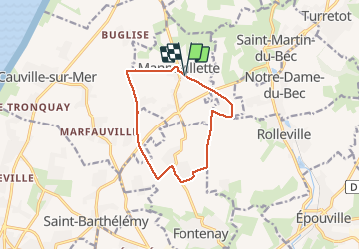
Tocht Stappen van 9,9 km beschikbaar op Normandië, Seine-Maritime, Mannevillette. Deze tocht wordt voorgesteld door MarcherEnsemble.
Beschrijving
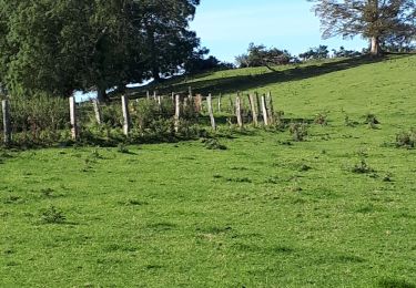
Départ du parking des tennis du charmant village de Mannevillette.
Rue des Tennis.
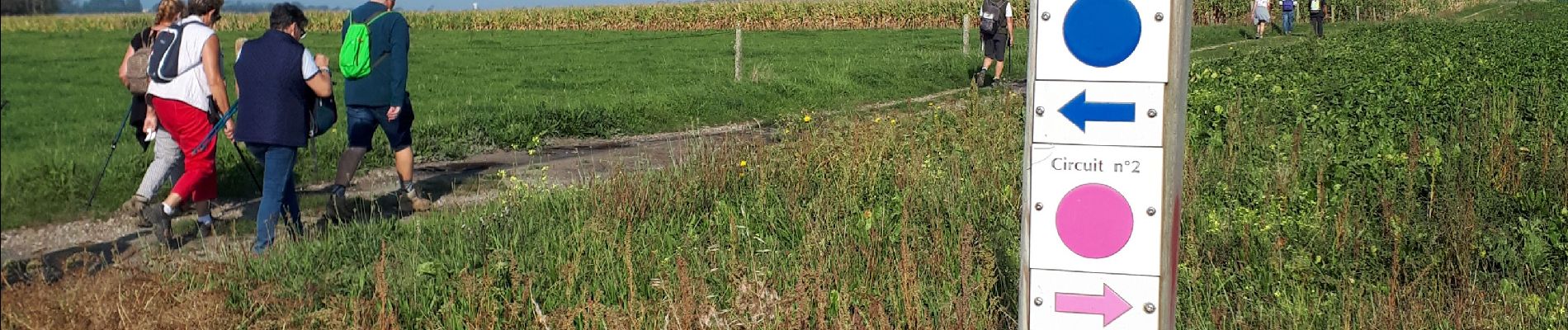
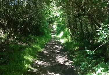
Goudron et chemins herbeux entre les champs.
Plaatsbepaling
Land:
France
Regio :
Normandië
Departement/Provincie :
Seine-Maritime
Gemeente :
Mannevillette
Locatie:
Unknown
Vertrek:(Dec)
Vertrek:(UTM)
296113 ; 5497449 (31U) N.
Opmerkingen
Wandeltochten in de omgeving
![Tocht Stappen Saint-Jouin-Bruneval - saint jouin - Photo](https://media.geolcdn.com/t/375/260/ext.jpg?maxdim=2&url=https%3A%2F%2Fservices.sitytrail.com%2FGeolivesWS%2FDownloadMedia.ashx%3FTrailID%3D195403%26Media%3D20130601165433.jpg)
![Stappen Stappen](https://static1.geolcdn.com/sitytour/trail-icons/101.png)
saint jouin
Stappen
Heel gemakkelijk
(2)
Saint-Jouin-Bruneval,
Normandië,
Seine-Maritime,
France
![](/images/other/stat-length.png)
15,4 km | 18,3 km-effort
4h 4min
![](https://static1.geolcdn.com/siteimages/upload/files/16400158638029165_repeat_loop_refresh_sync_direction_icon.png)
Ja
![Tocht Stappen Épouville - epouville 7,8 - Photo](https://media.geolcdn.com/t/375/260/ext.jpg?maxdim=2&url=https%3A%2F%2Fstatic1.geolcdn.com%2Fsiteimages%2Fupload%2Ffiles%2F1553511878bg_sport_marche.png)
![Stappen Stappen](https://static1.geolcdn.com/sitytour/trail-icons/101.png)
epouville 7,8
Stappen
Medium
(1)
Épouville,
Normandië,
Seine-Maritime,
France
![](/images/other/stat-length.png)
7,8 km | 9,3 km-effort
2h 6min
![](https://static1.geolcdn.com/siteimages/upload/files/16400158638029165_repeat_loop_refresh_sync_direction_icon.png)
Ja
![Tocht Stappen Épouville - Epouville / Le Gray / La Lézarde /Epouville - Photo](https://media.geolcdn.com/t/375/260/ext.jpg?maxdim=2&url=https%3A%2F%2Fstatic1.geolcdn.com%2Fsiteimages%2Fupload%2Ffiles%2F1553511878bg_sport_marche.png)
![Stappen Stappen](https://static1.geolcdn.com/sitytour/trail-icons/101.png)
Epouville / Le Gray / La Lézarde /Epouville
Stappen
Medium
(1)
Épouville,
Normandië,
Seine-Maritime,
France
![](/images/other/stat-length.png)
8,6 km | 10,3 km-effort
2h 20min
![](https://static1.geolcdn.com/siteimages/upload/files/16400158638029165_repeat_loop_refresh_sync_direction_icon.png)
Ja
![Tocht Stappen Rolleville - 76-Rolleville - Photo](https://media.geolcdn.com/t/375/260/c4a01121-b546-41d9-85a0-a5074e485afa.jpg&format=jpg&maxdim=2)
![Stappen Stappen](https://static1.geolcdn.com/sitytour/trail-icons/101.png)
76-Rolleville
Stappen
Gemakkelijk
Rolleville,
Normandië,
Seine-Maritime,
France
![](/images/other/stat-length.png)
13,2 km | 15,5 km-effort
3h 1min
![](https://static1.geolcdn.com/siteimages/upload/files/16400158638029165_repeat_loop_refresh_sync_direction_icon.png)
Ja
![Tocht Stappen Fontenay - Le Fontenay - 10-07-23 - Circuit court - Photo](https://media.geolcdn.com/t/375/260/ext.jpg?maxdim=2&url=https%3A%2F%2Fstatic1.geolcdn.com%2Fsiteimages%2Fupload%2Ffiles%2F1553511878bg_sport_marche.png)
![Stappen Stappen](https://static1.geolcdn.com/sitytour/trail-icons/101.png)
Le Fontenay - 10-07-23 - Circuit court
Stappen
Medium
(1)
Fontenay,
Normandië,
Seine-Maritime,
France
![](/images/other/stat-length.png)
7,1 km | 8,3 km-effort
1h 53min
![](https://static1.geolcdn.com/siteimages/upload/files/16400158638029165_repeat_loop_refresh_sync_direction_icon.png)
Ja
![Tocht Stappen Fontenay - Le Fontenay - 10-07-23 - Photo](https://media.geolcdn.com/t/375/260/ext.jpg?maxdim=2&url=https%3A%2F%2Fstatic1.geolcdn.com%2Fsiteimages%2Fupload%2Ffiles%2F1553511878bg_sport_marche.png)
![Stappen Stappen](https://static1.geolcdn.com/sitytour/trail-icons/101.png)
Le Fontenay - 10-07-23
Stappen
Medium
(1)
Fontenay,
Normandië,
Seine-Maritime,
France
![](/images/other/stat-length.png)
9,7 km | 11,1 km-effort
2h 31min
![](https://static1.geolcdn.com/siteimages/upload/files/16400158638029165_repeat_loop_refresh_sync_direction_icon.png)
Ja
![Tocht Te voet Cauville-sur-Mer - A la découverte du littoral cauvillais - Photo](https://media.geolcdn.com/t/375/260/83ff3eae-7c19-4876-8e6a-650be866268a.jpeg&format=jpg&maxdim=2)
![Te voet Te voet](https://static1.geolcdn.com/sitytour/trail-icons/100.png)
A la découverte du littoral cauvillais
Te voet
Gemakkelijk
Cauville-sur-Mer,
Normandië,
Seine-Maritime,
France
![](/images/other/stat-length.png)
14,9 km | 16,4 km-effort
3h 43min
![](https://static1.geolcdn.com/siteimages/upload/files/16400158638029165_repeat_loop_refresh_sync_direction_icon.png)
Neen
![Tocht Stappen Rolleville - rolleville - Photo](https://media.geolcdn.com/t/375/260/ext.jpg?maxdim=2&url=https%3A%2F%2Fstatic1.geolcdn.com%2Fsiteimages%2Fupload%2Ffiles%2F1553511878bg_sport_marche.png)
![Stappen Stappen](https://static1.geolcdn.com/sitytour/trail-icons/101.png)
rolleville
Stappen
Heel gemakkelijk
(1)
Rolleville,
Normandië,
Seine-Maritime,
France
![](/images/other/stat-length.png)
12 km | 14 km-effort
2h 43min
![](https://static1.geolcdn.com/siteimages/upload/files/16400158638029165_repeat_loop_refresh_sync_direction_icon.png)
Ja
![Tocht Stappen Gonneville-la-Mallet - Gonneville la Malllet / Villainville / Gonneville la Mallet varioante N°1 - Photo](https://media.geolcdn.com/t/375/260/dd9ccd95-ec42-423e-a194-0da90bbfd3d7.jpg&format=jpg&maxdim=2)
![Stappen Stappen](https://static1.geolcdn.com/sitytour/trail-icons/101.png)
Gonneville la Malllet / Villainville / Gonneville la Mallet varioante N°1
Stappen
Heel gemakkelijk
Gonneville-la-Mallet,
Normandië,
Seine-Maritime,
France
![](/images/other/stat-length.png)
9,4 km | 10,6 km-effort
2h 25min
![](https://static1.geolcdn.com/siteimages/upload/files/16400158638029165_repeat_loop_refresh_sync_direction_icon.png)
Ja